-
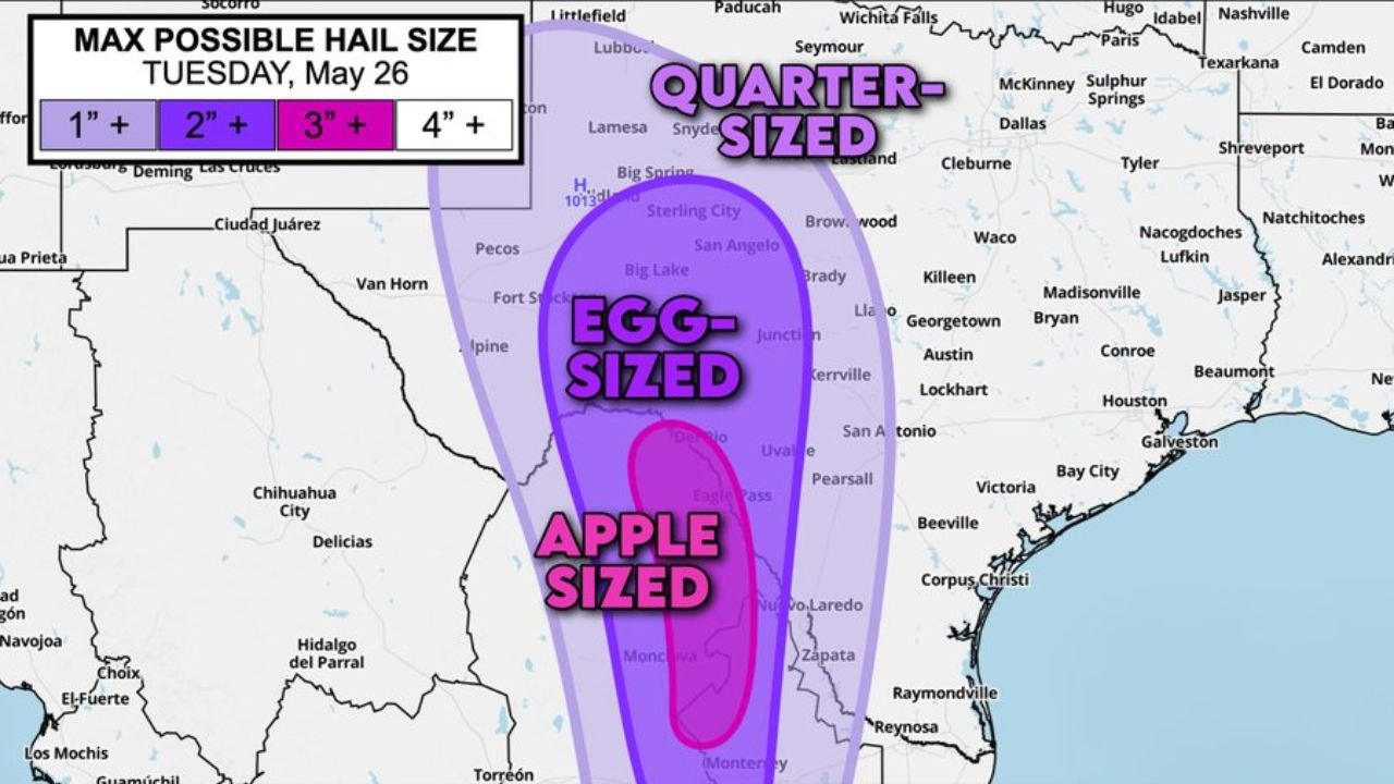
Baseball to Apple Sized Hail Possible Near Del Rio and Eagle Pass as Supercells Cross Into Texas From Mexico Today May 26
DEL RIO, TEXAS — An extremely dangerous hail threat is developing across Southwest Texas today Tuesday May 26, 2026, with forecasters warning that storms near Del Rio and Eagle Pass could produce damaging hail up to baseball size if they…
-
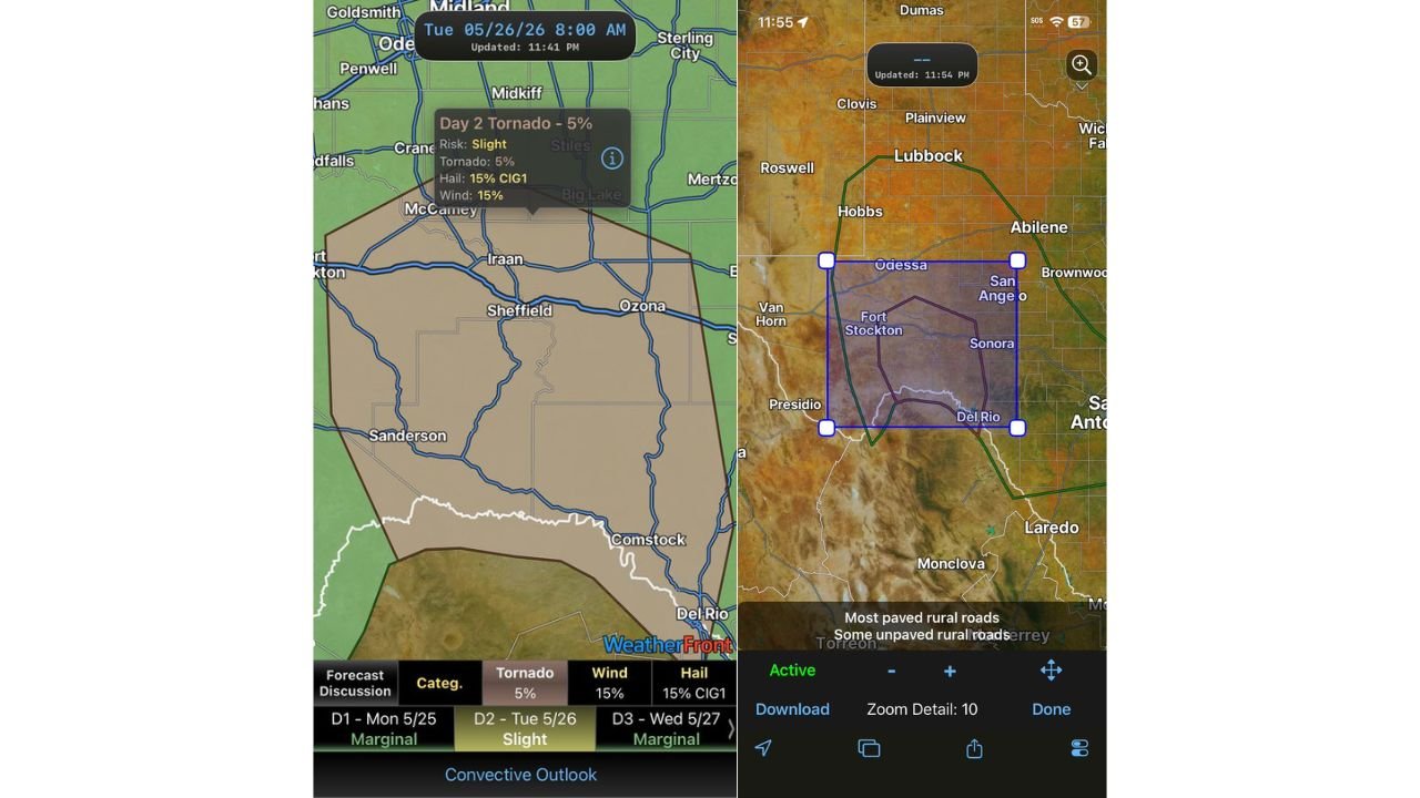
5% Tornado Risk With Slight Risk Active Across West Texas Including Midland, Sheffield and Del Rio Today May 26
MIDLAND, TEXAS — A Slight Risk of severe weather with a 5 percent tornado probability is in place across a large stretch of West Texas today Tuesday May 26, 2026, covering a remote and sparsely connected region where road networks…
-
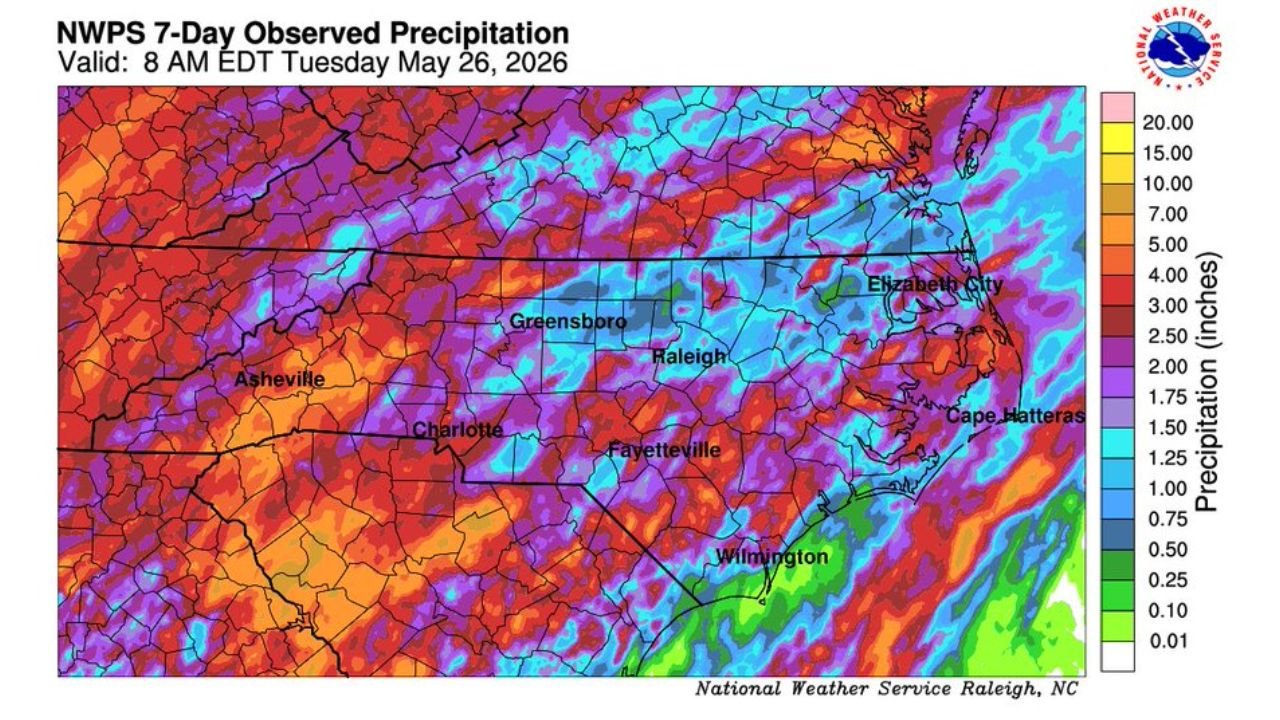
Nearly 6 Inches of Rain Drenches Clinton as North Carolina Records Up to 4 Inches Statewide Since Thursday
RALEIGH, NORTH CAROLINA — Radar-estimated precipitation data across North Carolina is revealing a significant multi-day rainfall event that has been unfolding since Thursday, with the National Weather Service Raleigh office releasing a 7-Day Observed Precipitation map valid at 8 AM…
-
Slight Risk of Severe Weather Targets South Texas With Very Large Hail, Damaging Winds and Tornadoes Possible Tomorrow May 26
SAN ANTONIO, TEXAS — A Slight Risk of severe weather has been placed over south Texas for tomorrow Tuesday May 26, 2026, with very large hail, damaging winds, and a tornado or two all listed as possible hazards as storm…
-
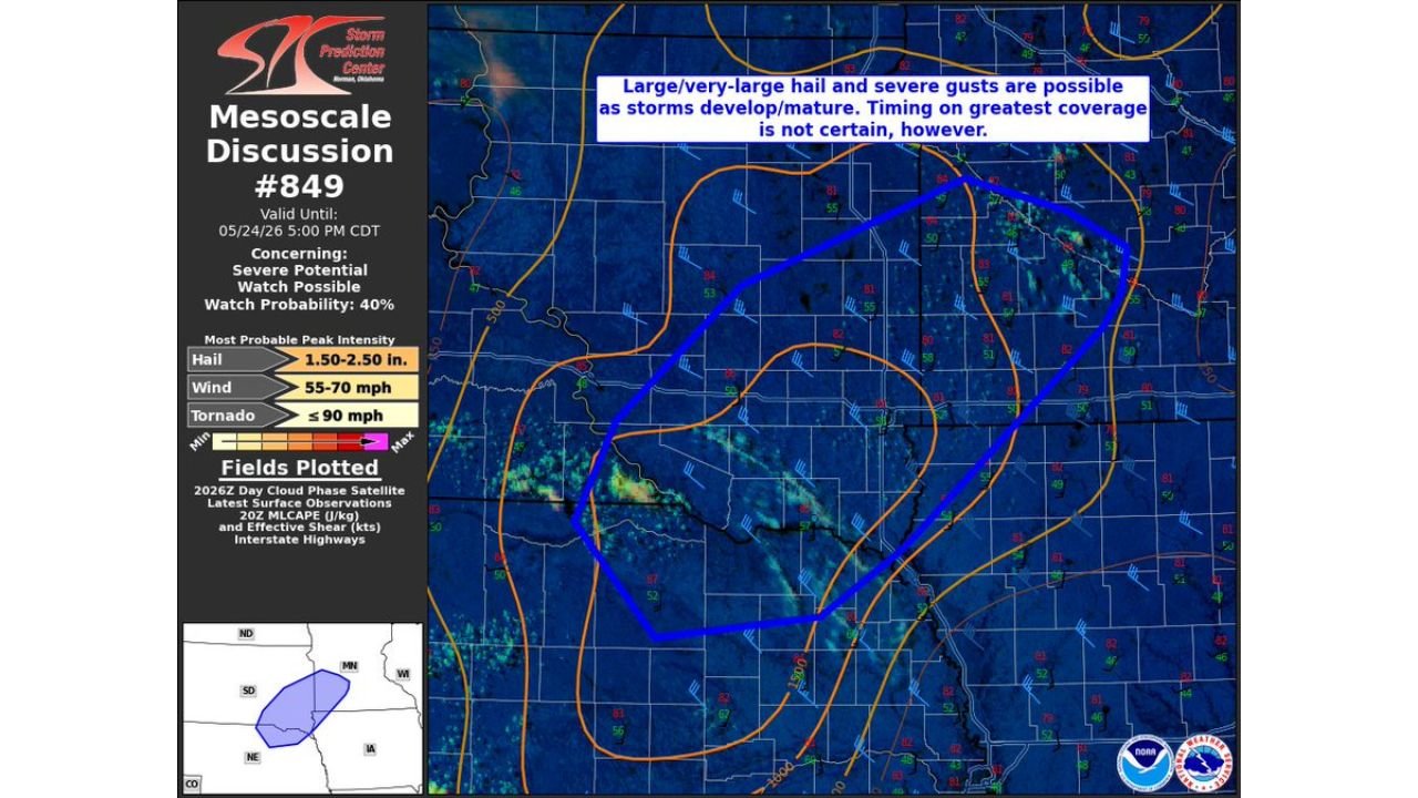
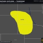
Large to Very Large Hail Up to 2.50 Inches and 70 MPH Winds Threatening Northeast Nebraska and Southwest Minnesota This Afternoon
LINCOLN, NEBRASKA — The Storm Prediction Center has issued Mesoscale Discussion 849 at 3:36 PM CDT on May 24, 2026, flagging a significant severe weather threat across northeast Nebraska and southwest Minnesota as storms develop and mature through the afternoon,…
-
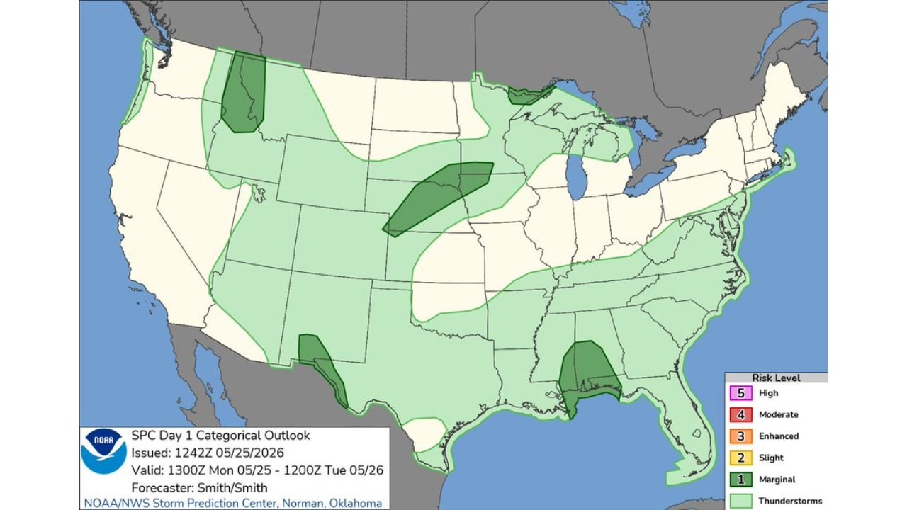
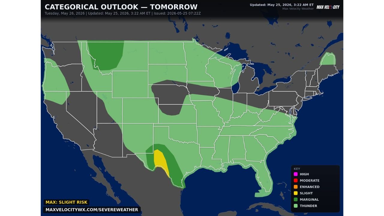
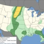
SPC Day 1 Marginal Risk Issued Across Gulf Coast, Far West Texas, Nebraska and Northern Rockies Today May 25
NORMAN, OKLAHOMA — The Storm Prediction Center has issued its Day 1 Categorical Outlook at 1242Z on May 25, 2026, placing a Marginal Risk of severe weather across several distinct zones of the country including parts of the central Gulf…
-
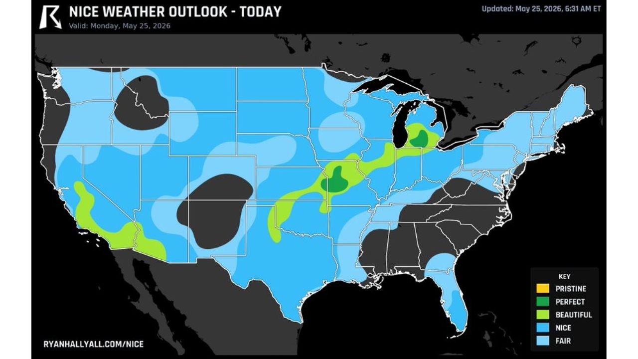
Best Weather in the USA Today Runs From Olathe Kansas Through Kalamazoo and Lansing Michigan This Monday May 25
OLATHE, KANSAS — The finest weather in the entire country today is concentrated along a beautiful corridor stretching from Olathe, Kansas northeastward through Kalamazoo, Michigan and up to Lansing, Michigan, according to the Ryan Hall Y’all Nice Weather Outlook updated…
-
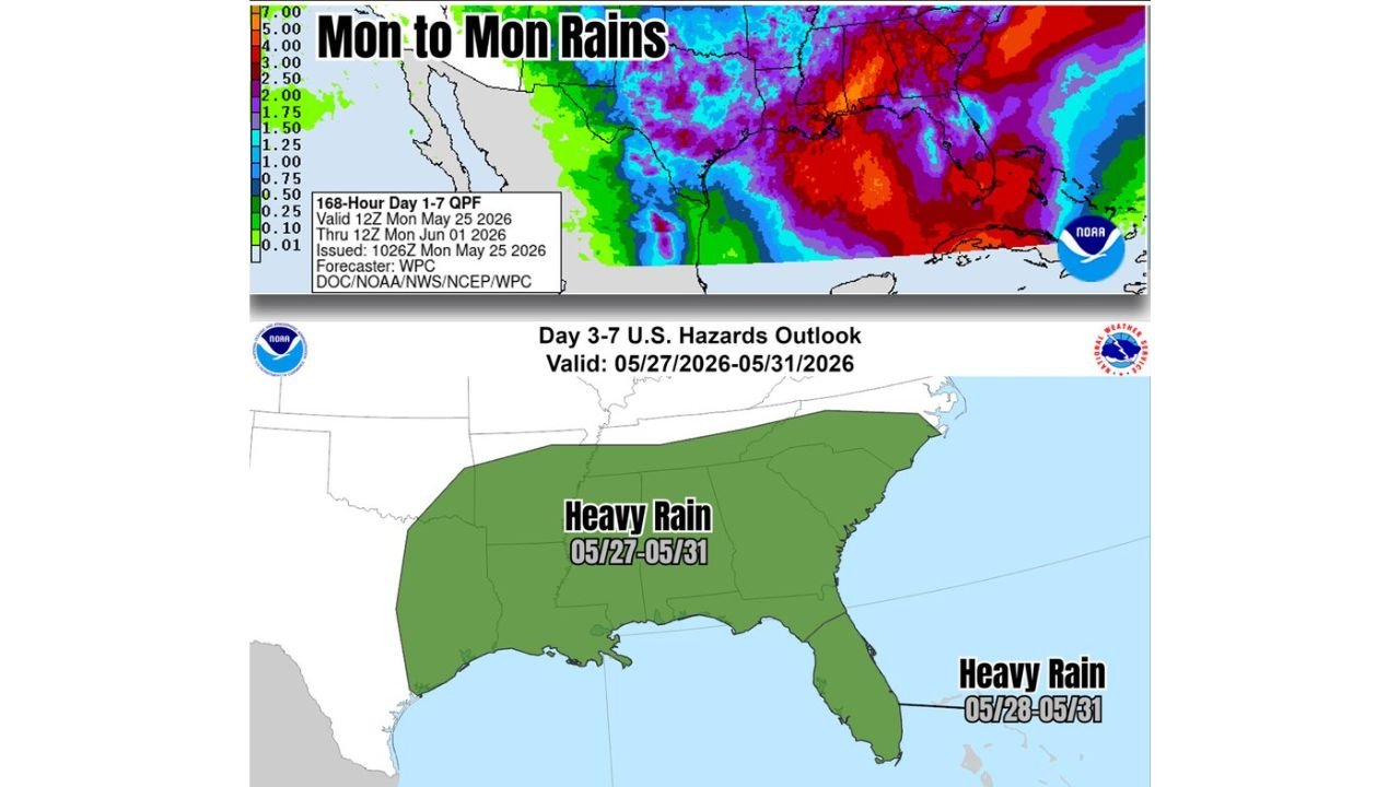
Tropical Juice Flowing From Caribbean Brings Heavy Rain Hazard Across the South and Southeast From May 27 Through May 31
NEW ORLEANS, LOUISIANA — Tropical moisture is set to surge northward from the Caribbean into the southern and eastern United States over the next week, with NOAA forecasts showing widespread heavy rain developing across the South and Southeast as the…

Gordon Ramsay
Founder & Author
Hi there! I’m Gordon Ramsay, a journalist at heart and a storyteller by passion. Gordon Ramsay Club is my digital newsroom where I share breaking updates, sharp commentary, and stories that matter—covering trends, headlines, and conversations shaping today’s world.
Latest Posts
-
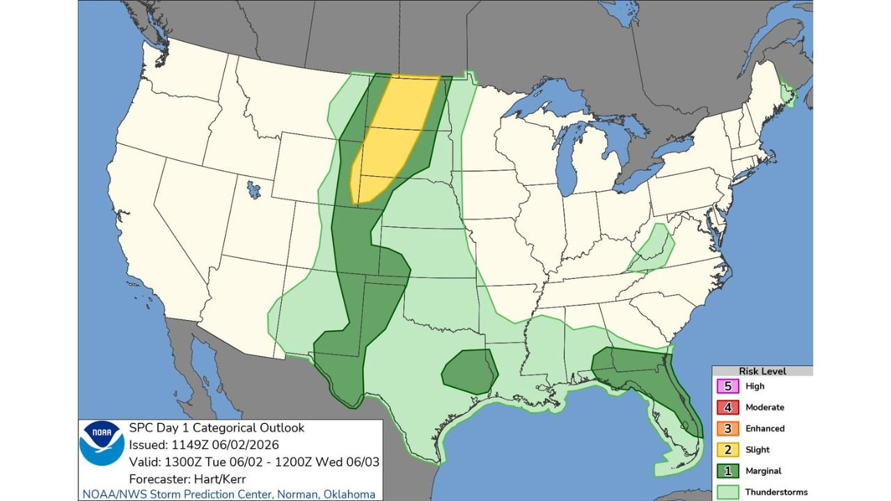
Northern Plains, High Plains, Southern Georgia, and Northern Florida Facing Large Hail, Severe Winds, and Tornadoes as SPC Issues Slight Risk Tuesday June 2
-
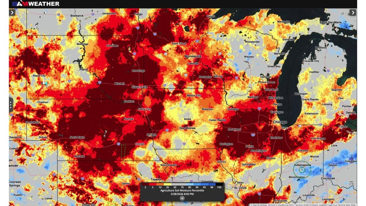
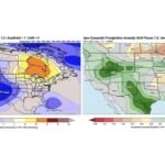
Central Plains, Midwest, and Upper Midwest Including Minnesota, Iowa, and Nebraska Showing Critically Low Soil Moisture as NASA and USDA Data Reveal Alarming Drought Conditions

-
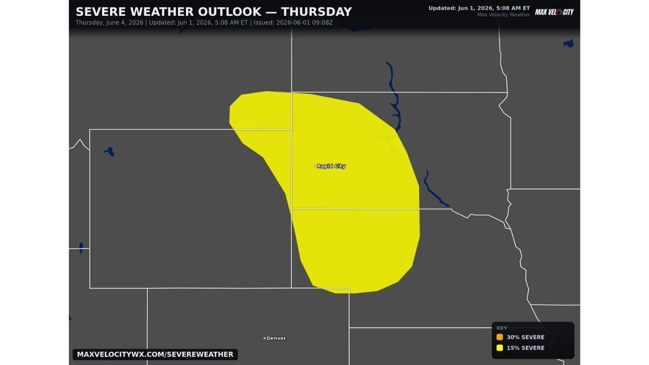
Central and Northern Plains Including Rapid City Under First Day 4 Slight Risk in a While with Damaging Winds, Large Hail, and Tornado Threat Thursday June 4
-
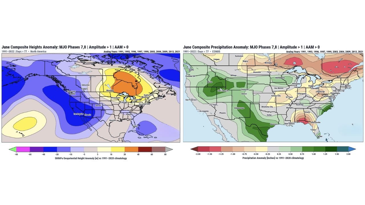
Eastern Grain Belt and Great Lakes Facing Drier Than Normal June as MJO Phases 7 and 8 Favor Hudson Bay Ridge Signal
-
Northern High Plains Including North Dakota, South Dakota, and Wyoming Facing Tornado Potential as Strong Winds and High Instability Combine Tuesday June 2