-
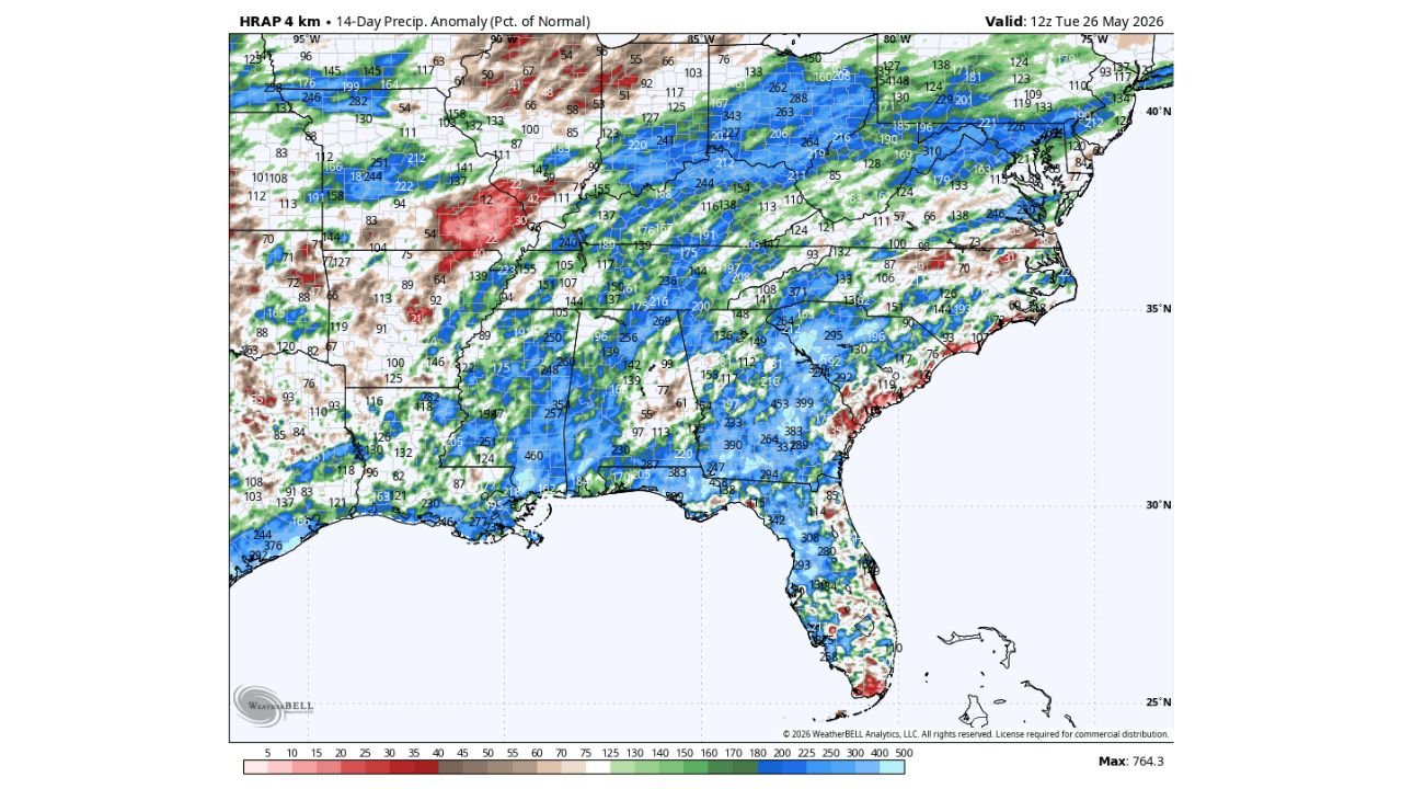
Beneficial Rain Making Dent in Drought Across the Southeast but 6 to 18 More Inches Needed as Wet Pattern Continues 10 to 15 Days
ATLANTA, GEORGIA — Most of the Southeast United States has received beneficial rainfall over the past couple of weeks, with the HRAP 4km 14-Day Precipitation Anomaly map valid at 12z Tuesday May 26, 2026 showing widespread above-normal precipitation percentages across…
-
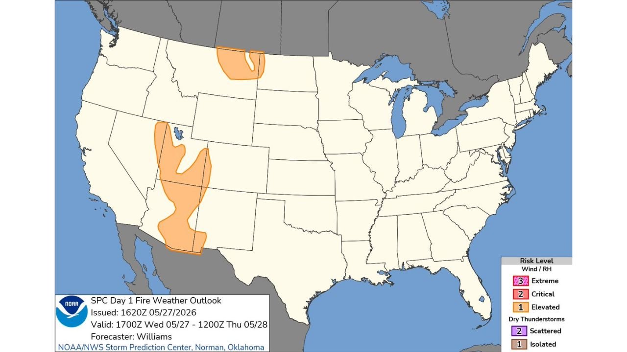
Elevated Fire Weather Risk Active Across Nevada, Utah and Northern Montana Through Thursday May 28
RENO, NEVADA — The Storm Prediction Center has issued its Day 1 Fire Weather Outlook at 1620Z on May 27, 2026, placing Elevated fire weather risk zones across two distinct regions of the western United States — a large swath…
-
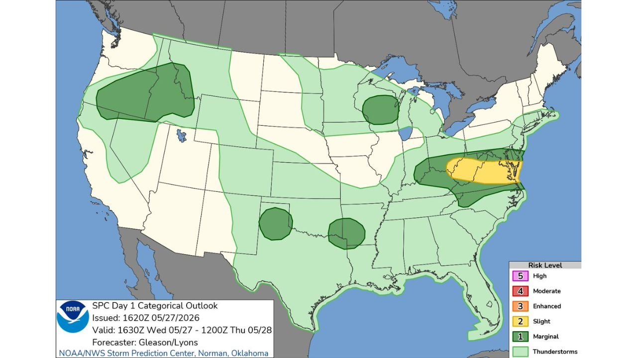
SPC Day 1 Slight Risk Issued Across Ohio Valley Into Virginia and Maryland Mid-Atlantic Corridor Today May 27
NORMAN, OKLAHOMA — The Storm Prediction Center has issued an updated Day 1 Categorical Outlook at 1620Z on May 27, 2026, placing a Slight Risk of severe weather across a corridor stretching from the Ohio Valley into the Mid-Atlantic region,…
-
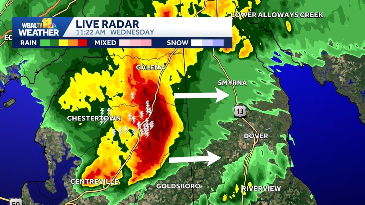
Severe Thunderstorm Warning With 60 MPH Gusts and Hail Hits Chestertown and Eastern Shore Maryland Until Noon Wednesday
CHESTERTOWN, MARYLAND — A Severe Thunderstorm Warning is in effect until Noon on Wednesday May 27, 2026 for a powerful storm system moving across parts of the Eastern Shore of Maryland, with WBAL TV 11 Live Radar captured at 11:22…
-
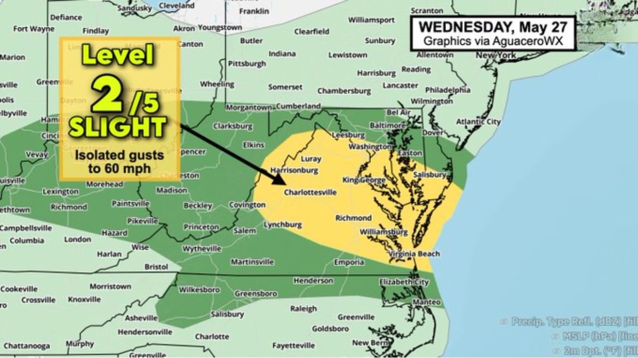
Flood Watch and 60 MPH Gusts Threatening Maryland, Washington DC and Virginia as Frontal Boundary Taps Humid Air Mass Today May 27
WASHINGTON, D.C. — A potentially impactful weather setup is unfolding across the Mid-Atlantic region today Wednesday May 27, 2026, as a frontal boundary sagging southward encounters a humid and juiced-up air mass, producing a multi-hazard threat across Maryland, Washington D.C.,…
-
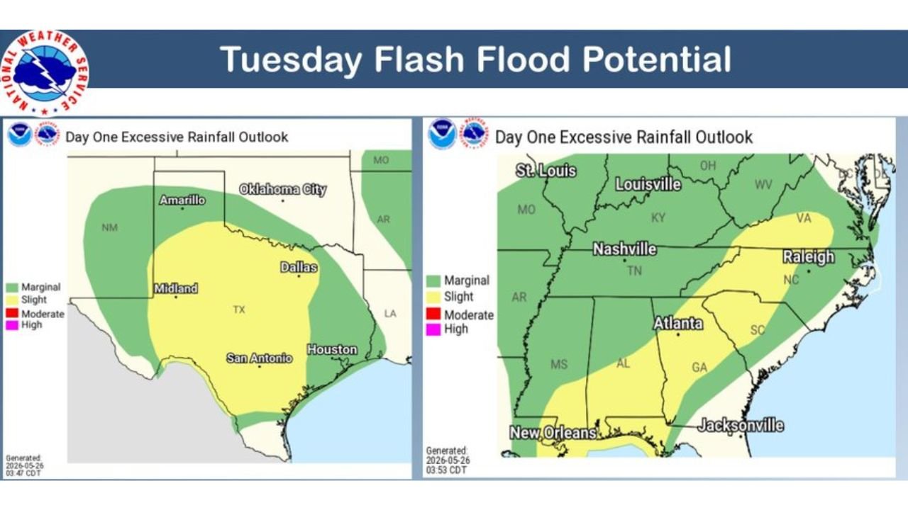
Flash Flood Potential Covers Texas Hill Country, Nashville and Raleigh as Slight Risk Zones Active Today May 26
SAN ANTONIO, TEXAS — The National Weather Service Weather Prediction Center has issued its Tuesday Flash Flood Potential outlook at 5:03 AM EDT on May 26, 2026, placing Slight Risk zones across two separate and significant regions of the country…
-
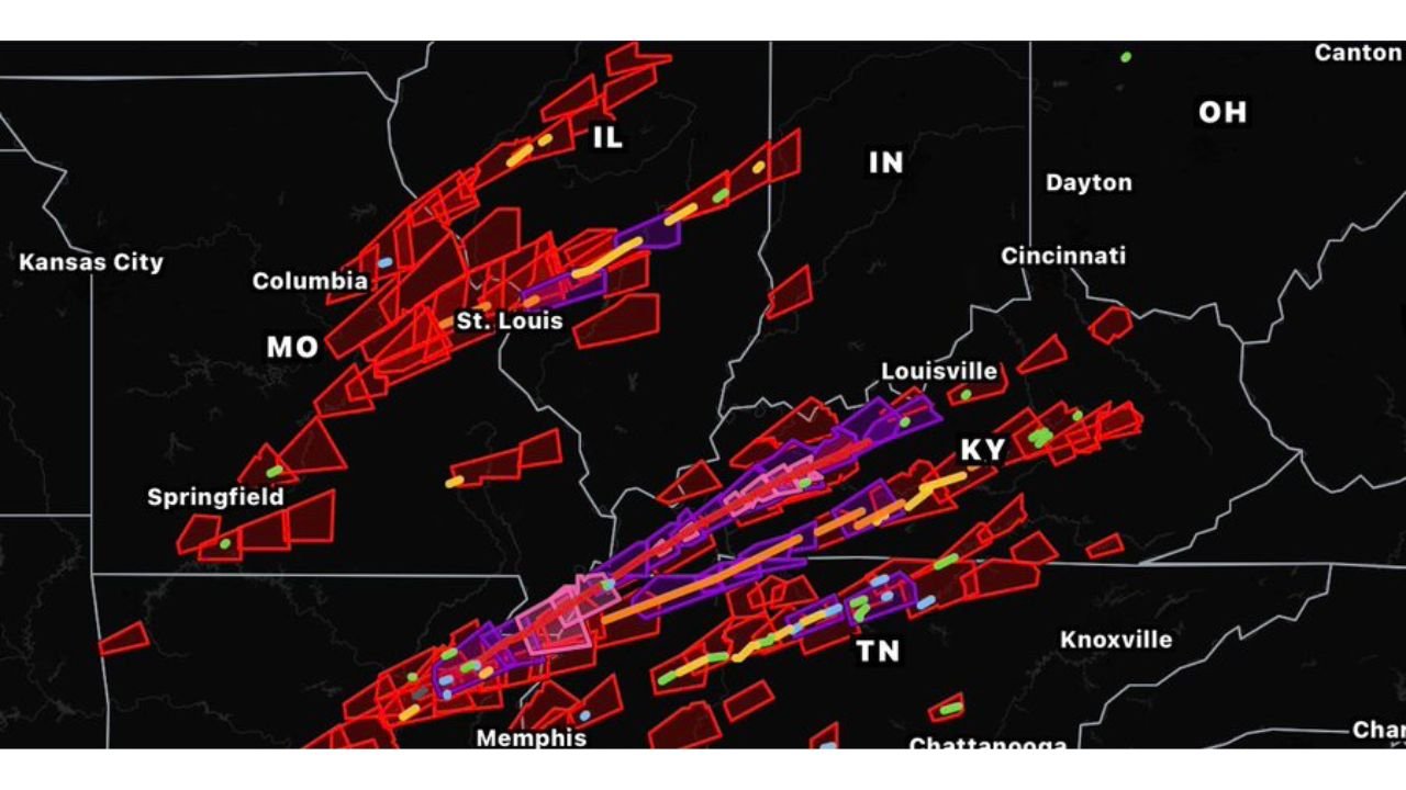
Refined NWS Damage Assessment Toolkit Now Live Mapping Storm Tracks Across Missouri, Kentucky and Tennessee
ST. LOUIS, MISSOURI — A newly developed and highly anticipated weather tool has gone live, with Stupercell releasing the Refined NWS Damage Assessment Toolkit, an independently created platform that is already drawing significant attention from the meteorological and storm chasing…
-
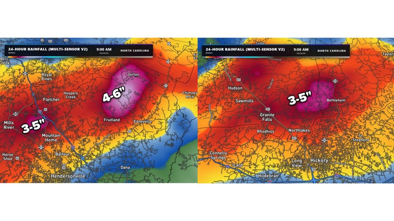
Flash Flooding Hits Granite Falls, Hendersonville and Western North Carolina With Up to 6 Inches of Rain in 24 Hours
GRANITE FALLS, NORTH CAROLINA — Flash flooding has struck multiple communities across western North Carolina over the past 24 hours, with Multi-Sensor radar estimates valid at 9:00 AM on May 26, 2026 showing rainfall totals of 3 to 6 inches…

Gordon Ramsay
Founder & Author
Hi there! I’m Gordon Ramsay, a journalist at heart and a storyteller by passion. Gordon Ramsay Club is my digital newsroom where I share breaking updates, sharp commentary, and stories that matter—covering trends, headlines, and conversations shaping today’s world.
Latest Posts
-
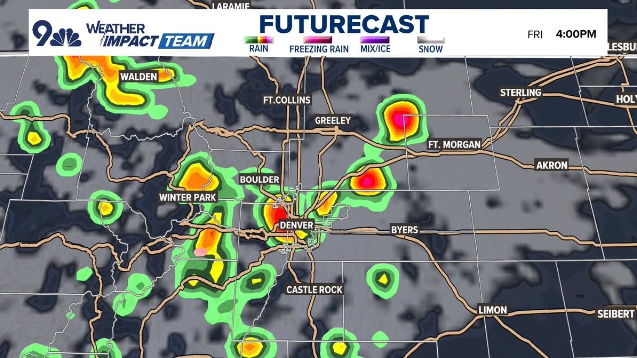
Stronger PM Storms Possible Across Denver, Boulder and Fort Collins Between 1 and 5 PM Friday With Low 80s Highs

-
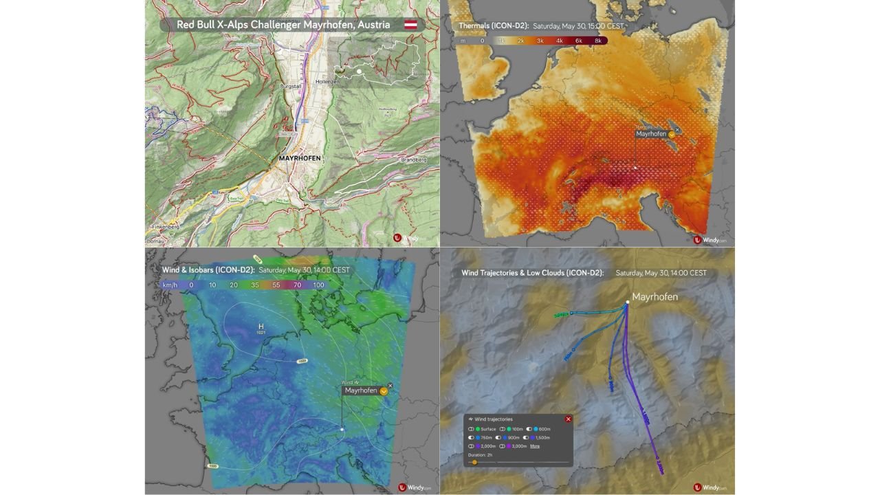
Red Bull X-Alps Challenger Mayrhofen Faces Flyable Morning With Afternoon Thunderstorm Risk in Zillertal Valley Austria This Saturday

-
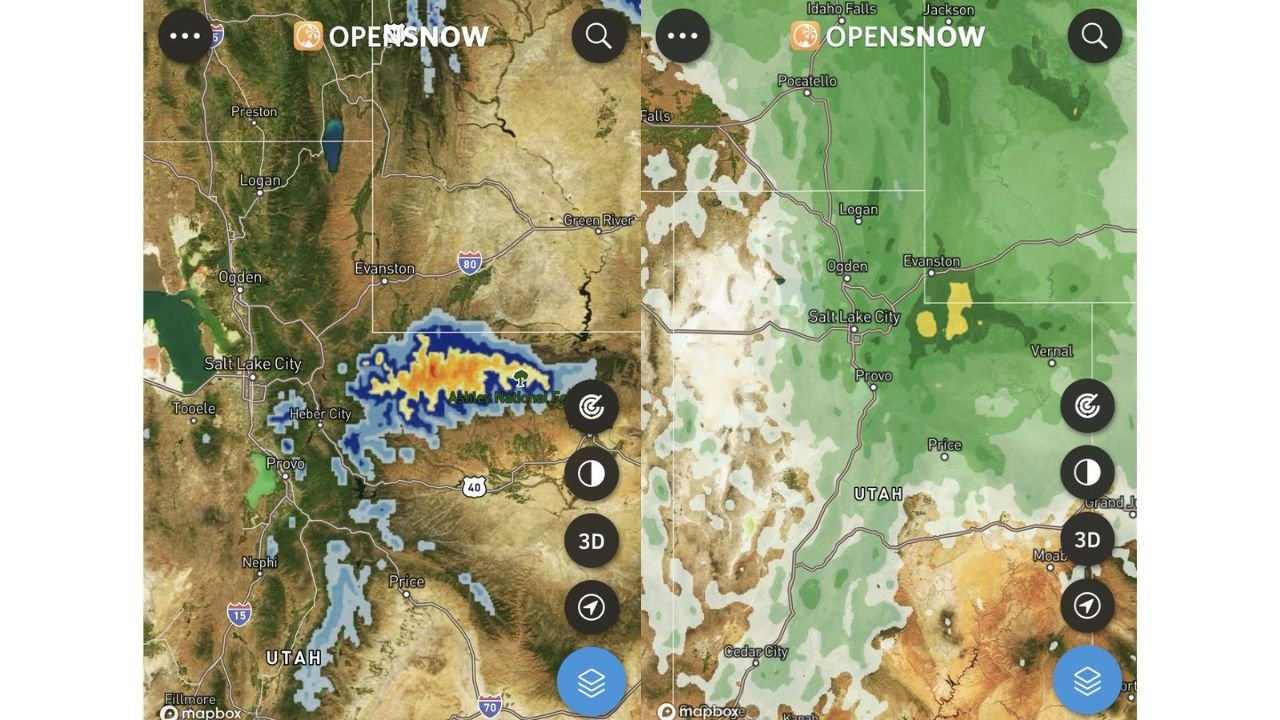
Up to a Foot of Late May Snow Possible on High Uinta Mountains as Closed Low Targets Wasatch and Utah Highlands Tonight

-
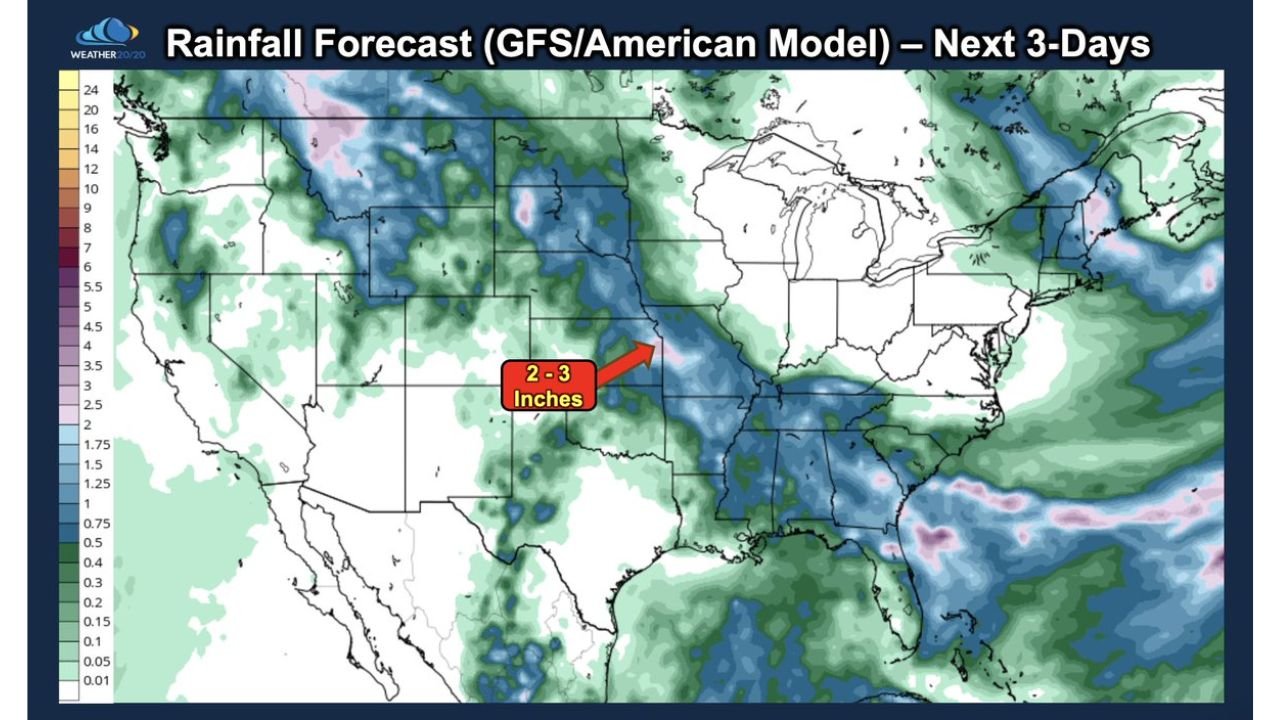
2 to 4 Inches of Rain Forecast for Kansas City This Weekend With July Heat Waves Already Predicted Months in Advance by LRC
-
Cold Air Funnel Clouds and Brief Landspout Tornado Possible Across Northwest Oklahoma and Southwest Kansas Between 3 and 7 PM Friday