-
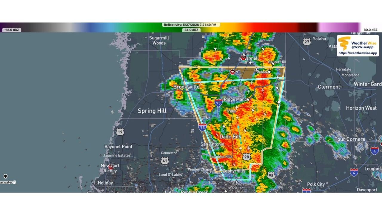
Severe Thunderstorm Warning Issued for Sumter, Pasco and Hernando Counties Including Brooksville and Dade City Until 7:30 PM
BROOKSVILLE, FLORIDA — The National Weather Service in Ruskin has issued an Immediate Broadcast Severe Thunderstorm Warning at 7:06 PM EDT on Wednesday May 27, 2026, covering Southern Sumter County in central Florida, Eastern Pasco County in west central Florida,…
-
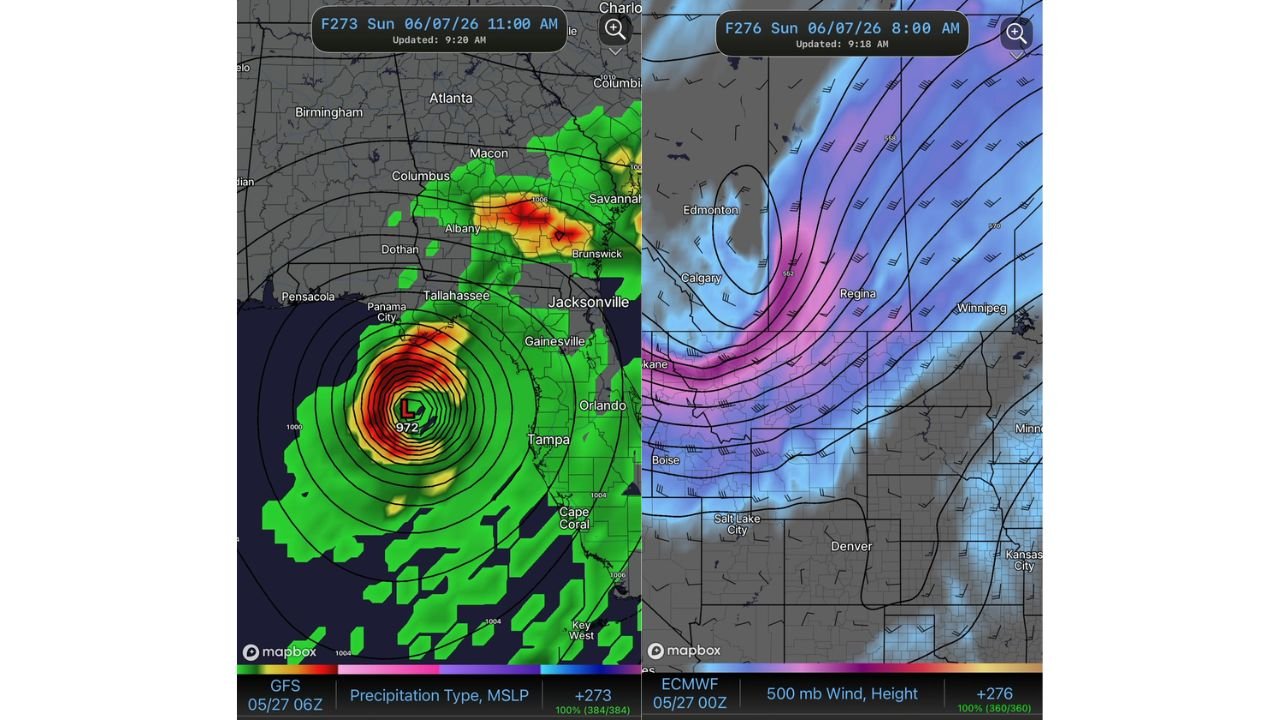
GFS Model Showing 972 MB Gulf System Threatening Panama City and Tallahassee Area Around June 7 Still an Outlier Signal
TALLAHASSEE, FLORIDA — The GFS model initialized at 06z May 27, 2026 is depicting a significant and tightly wound low pressure system with a 972 mb central pressure in the Gulf of Mexico in its F273 forecast frame valid Sunday…
-
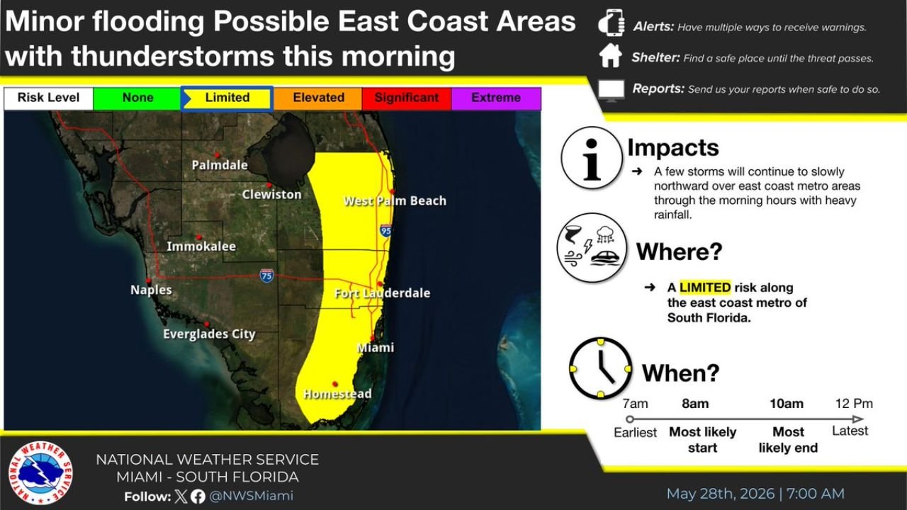
Minor Flooding Possible From Slow Moving Thunderstorms Across Miami, Fort Lauderdale and West Palm Beach This Morning May 28
MIAMI, FLORIDA — The National Weather Service Miami has issued a Minor Flooding Possible outlook for east coast metro areas of South Florida this Thursday morning May 28, 2026, with slow-moving thunderstorms tracking northward along the coast carrying heavy rainfall…
-
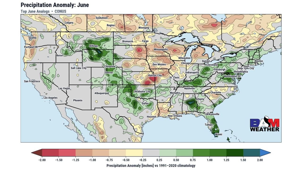
June Analog Forecast Points to Drier Than Normal Pattern for Upper Midwest and Great Plains With Wetter Signal for the South
KANSAS CITY, MISSOURI — Top historical analogs for June 2026 are painting a clear and divided precipitation picture across the United States, with BAM Weather’s June Precipitation Anomaly map based on top June analogs showing a continued drier than normal…
-
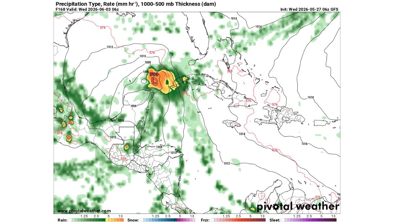
GFS Model Shows Outlier Tropical System Near Yucatan and Gulf of Mexico as an Outlier Signal for June 3
MIAMI, FLORIDA — The GFS model initialized at 06z Wednesday May 27, 2026 is depicting a low pressure system with a 999 mb central pressure in its F168 forecast frame valid at 06z Wednesday June 3, 2026, placing a potentially…
-
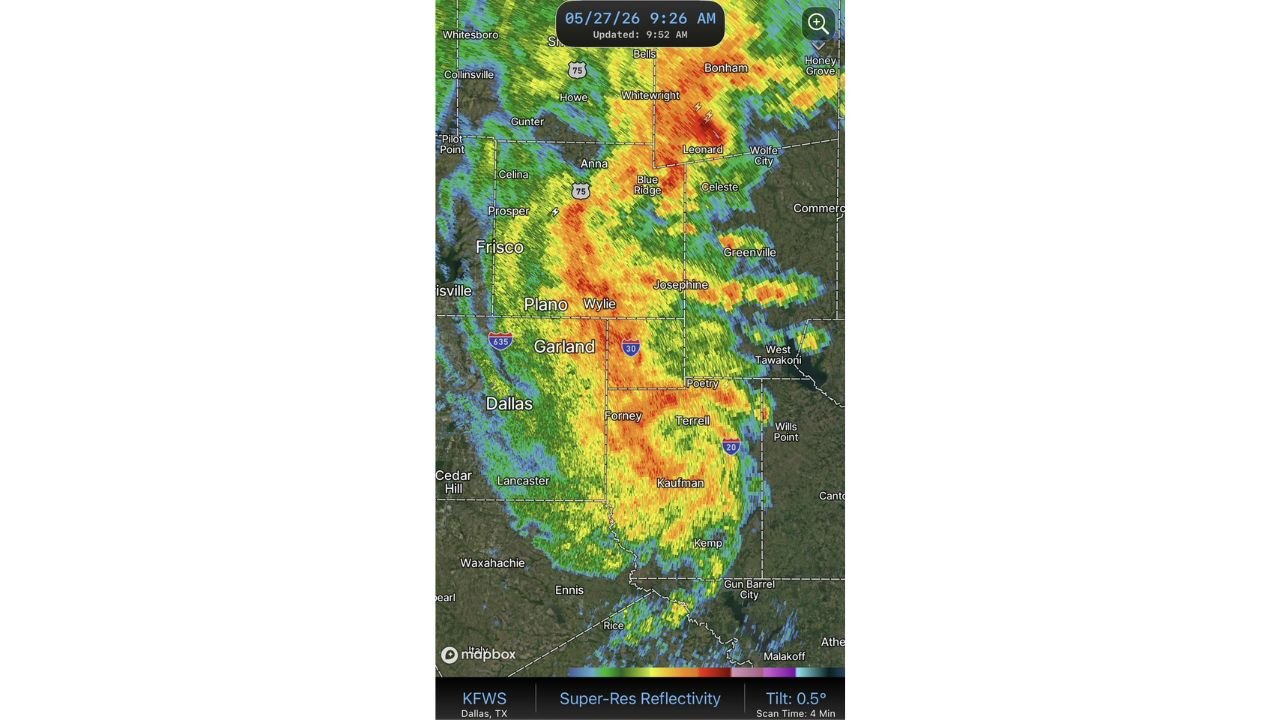
Highly Organized MCV Sweeping Through Dallas, Garland and Plano With Intense Radar Returns This Morning May 27
DALLAS, TEXAS — A remarkably well-organized Mesoscale Convective Vortex is sweeping through the Dallas metro and surrounding north Texas communities this Wednesday morning May 27, 2026, with KFWS Dallas Super-Resolution Reflectivity radar captured at 9:26 AM showing a tightly structured…
-
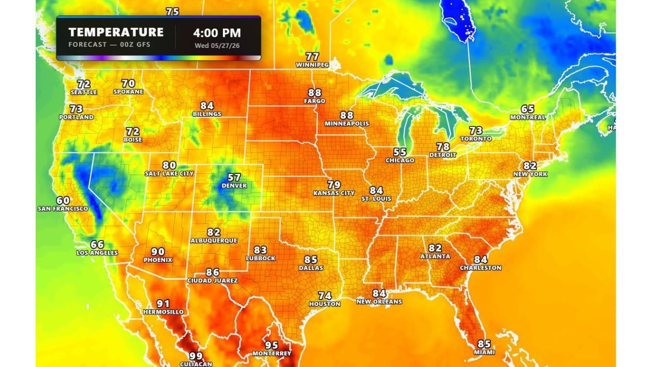
Temperatures in the 70s and 80s Blanket Nearly Every State From Seattle to New York and Dallas This Wednesday May 27
KANSAS CITY, MISSOURI — An outstanding and broadly pleasant temperature pattern is set up across nearly the entire United States today Wednesday May 27, 2026, with the GFS 00Z temperature forecast valid at 4:00 PM showing comfortable 70s and 80s…
-
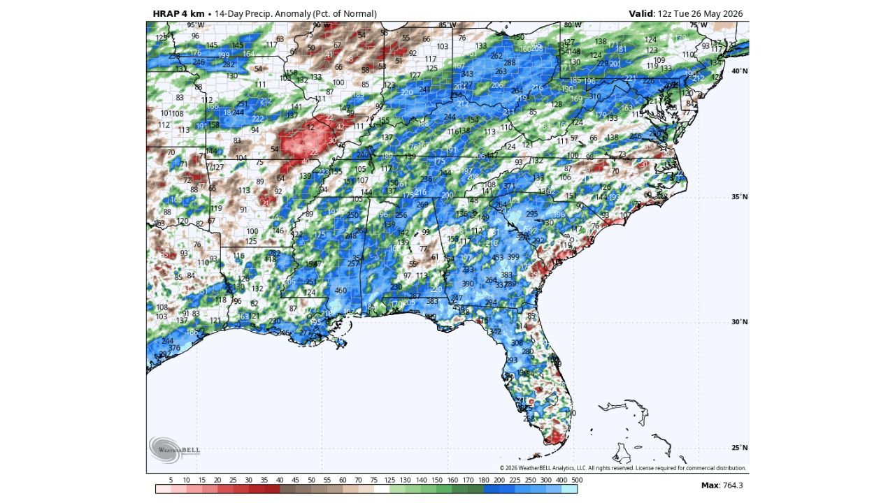
Beneficial Rain Making Dent in Drought Across the Southeast but 6 to 18 More Inches Needed as Wet Pattern Continues 10 to 15 Days
ATLANTA, GEORGIA — Most of the Southeast United States has received beneficial rainfall over the past couple of weeks, with the HRAP 4km 14-Day Precipitation Anomaly map valid at 12z Tuesday May 26, 2026 showing widespread above-normal precipitation percentages across…

Gordon Ramsay
Founder & Author
Hi there! I’m Gordon Ramsay, a journalist at heart and a storyteller by passion. Gordon Ramsay Club is my digital newsroom where I share breaking updates, sharp commentary, and stories that matter—covering trends, headlines, and conversations shaping today’s world.
Latest Posts
-
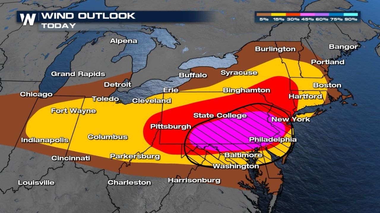
Interstate 95 Corridor Including Philadelphia, New York, Baltimore, and Washington DC Upgraded to Enhanced Risk with 75 MPH Severe Winds as Southern Pennsylvania and Eastern Ohio Report Wind Damage Today
-
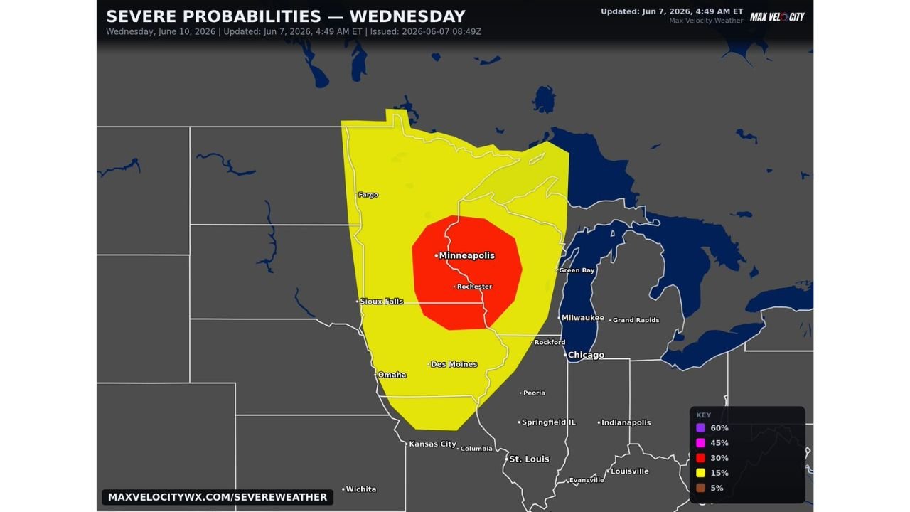
Minnesota, Iowa, Wisconsin, and North Dakota Including Minneapolis, Sioux Falls, and Des Moines Facing Growing Severe Weather Outbreak with Strong Tornadoes, Very Large Hail, and Widespread Damaging Winds Wednesday June 10
-
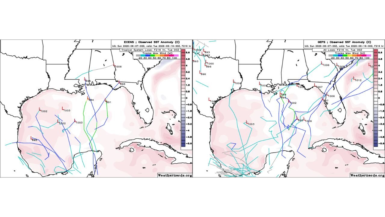
Gulf of Mexico and Gulf Coast States Seeing Further Decreased Tropical Development Chances as Euro, GFS, and AI Ensembles All Lose Interest Sunday June 7
-
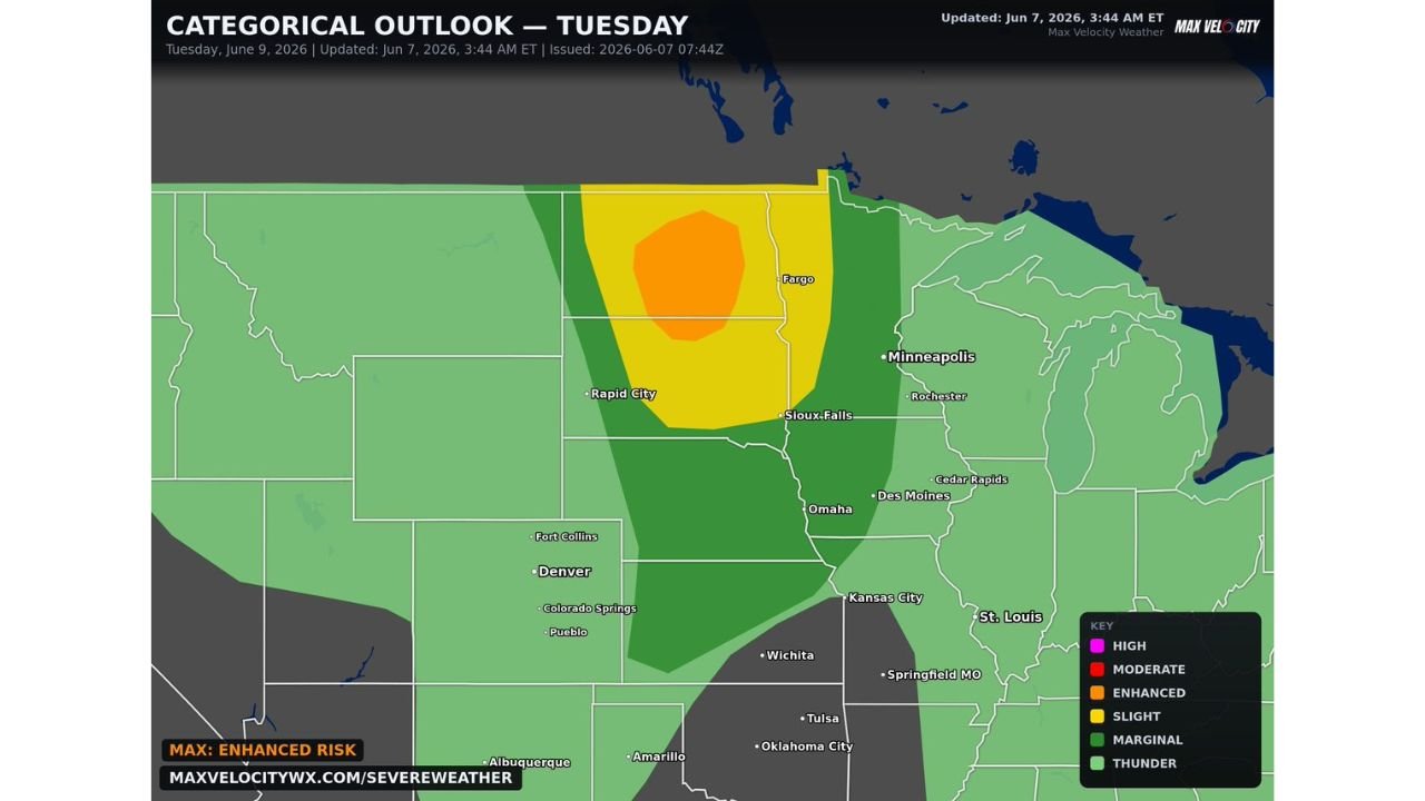
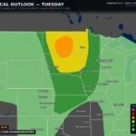
Dakotas and Western Minnesota Including Fargo and Sioux Falls Under Enhanced Risk with All Hazards and Significant Tornadoes Possible as Powerful Shortwave Targets Region Tuesday June 9
-
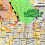
Saskatchewan, Manitoba, and Northern North Dakota Including Saskatoon, Regina, and Minot Under Active Ascent and Lift as Vorticity Loaded Upper Air Disturbance Drives Storm Development Sunday June 7