
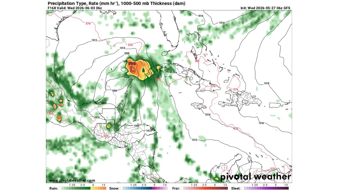
MIAMI, FLORIDA — The GFS model initialized at 06z Wednesday May 27, 2026 is depicting a low pressure system with a 999 mb central pressure in its F168 forecast frame valid at 06z Wednesday June 3, 2026, placing a potentially developing tropical or subtropical system near the Yucatan Peninsula and western Caribbean region one week from today — though forecasters are quick to note this solution remains an outlier that other models are not consistently supporting.
GFS Depicts 999 MB Low Near Yucatan With Heavy Precipitation Core in F168 Frame
The Pivotal Weather GFS output valid June 3, 2026 shows a closed low pressure center marked at 999 mb positioned near the Yucatan Peninsula and surrounding western Caribbean waters, with an intense orange and red precipitation core indicating heavy rainfall rates concentrated directly around the circulation center. The surrounding 1006 and 1008 mb isobars and tight pressure gradient visible on the map suggest at least some degree of organization around this system in the GFS solution one week out.
The heavy precipitation footprint extends broadly across the surrounding Gulf of Mexico and western Caribbean region in green shading, indicating widespread moisture and convective activity associated with the depicted system in this particular model run.
GFS Remains an Outlier as Other Models Do Not Support This Development
Despite the visually striking nature of the GFS depiction, forecasters are clear that this solution remains an outlier compared to the broader model consensus. Other global models are not consistently picking up on this development scenario, making the GFS output for this timeframe a notable but unreliable single-model signal rather than a consensus-supported tropical development threat.
Additionally, the GFS has been pushing the timing of this potential system further out with each successive model run, which forecasters note is never a positive sign for those hoping to see actual tropical development materialize in this region.
Tropical Development Uncertainty Remains High at the One Week Range
At the one week forecast range, tropical development signals carry inherently high uncertainty even under the best modeling conditions. The combination of GFS outlier status, lack of multi-model support, and the ongoing trend of the system being pushed further out in time all point toward treating this signal with significant caution.
Residents across the Gulf Coast and western Caribbean should monitor forecast updates over the coming days as the June 3 timeframe comes into better model focus.
Stay with GordonRamsayClub.com for the latest updates.

Leave a Reply