
CHARLESTON, WEST VIRGINIA — The SPC has issued a Level 2 of 5 Slight Risk for Thursday June 18 across Kentucky, West Virginia, and Pennsylvania, with damaging wind as the headline hazard as fast upper level winds push storms into clusters and lines riding east through the afternoon hours across the region.
Level 2 Slight Risk Core Covers Kentucky Through Pennsylvania
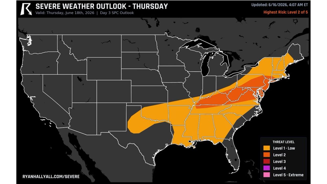
The Day 3 SPC severe weather outlook updated June 16 at 4:07 AM ET valid Thursday June 18 shows a Level 2 red Slight Risk centered over West Virginia, western Pennsylvania, and Kentucky. A Level 1 orange zone surrounds the core, extending the broader severe weather footprint from Arkansas and Mississippi northward through Tennessee, the Carolinas, Virginia, Maryland, and into New York and New England.
The geographic footprint of Thursday’s Level 1 zone is substantial, covering a large portion of the eastern United States from the Deep South through the mid-Atlantic and Northeast corridor.
Damaging Wind the Primary Story Thursday
Fast winds high up in the atmosphere will push storms into clusters and lines tracking east through the afternoon hours Thursday. This storm mode is most efficient at producing widespread damaging straight-line wind gusts rather than tornadoes, making damaging wind the primary hazard across Kentucky, West Virginia, and Pennsylvania on Thursday.
The storm system driving Wednesday’s outbreak will continue pushing eastward Thursday, maintaining severe weather potential across the Appalachian region and into the mid-Atlantic as it goes.
Morning Clouds Could Limit Fuel Across Northern Areas
The key swing factor for Thursday’s setup is morning clouds and rain potentially stealing the day’s atmospheric fuel before storms can get going across northern portions of the risk zone. If cloud cover persists through the morning hours across Pennsylvania and surrounding states, it could limit the afternoon heating needed for storm intensification and reduce the overall severe threat.
Forecasters note there is still time for this outlook to shift with two days remaining before Thursday arrives. Residents across Kentucky, West Virginia, and Pennsylvania should monitor updates closely.
Stay with GordonRamsayClub.com for the latest updates.

Leave a Reply