-
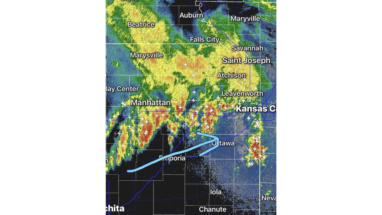
Eastern Kansas and Western Missouri Hit by Heavy Thunderstorms with Flooding Likely as 2 to 3 Inches of Rain Possible This Morning
KANSAS CITY, MISSOURI — Heavy thunderstorms are actively tracking across eastern Kansas into western Missouri this Sunday morning, bringing intense lightning, booming thunder, and very heavy rainfall that is already raising serious flooding concerns across the region. Six Lines of…
-
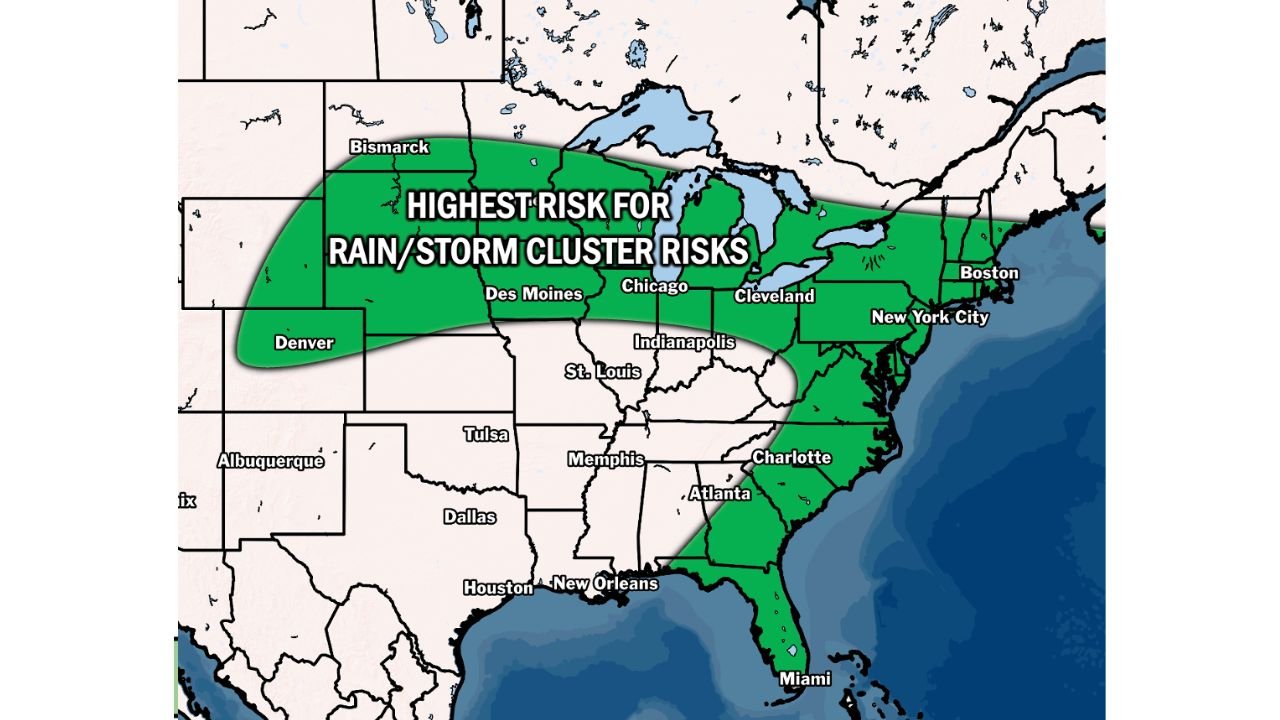
Plains to East Coast Bracing for More Active Storm Pattern with Rain and Storm Cluster Risks from June 6 to 11
CHICAGO, ILLINOIS — A significant shift in weather patterns is expected across a wide stretch of the United States next week, as BAM Weather targets June 6 through 11, 2026 for a more active storm setup stretching from the Plains…
-
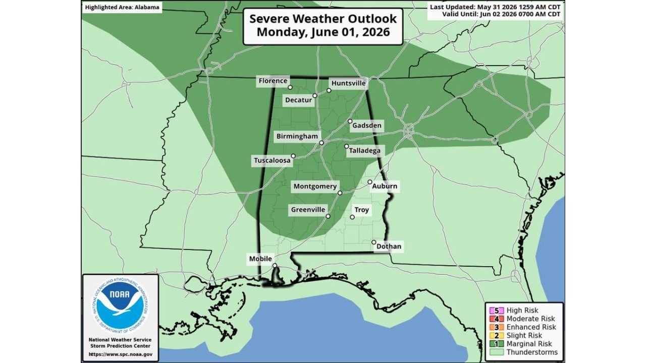
Alabama Faces Severe Storms and Damaging Straight Line Winds as SPC Issues Marginal Risk Monday
BIRMINGHAM, ALABAMA — A severe weather threat is building across Alabama as Monday, June 1, 2026 approaches, with the Storm Prediction Center issuing a Marginal Risk (Level 1 of 5) outlook covering roughly the northern three-quarters of the state. SPC…
-
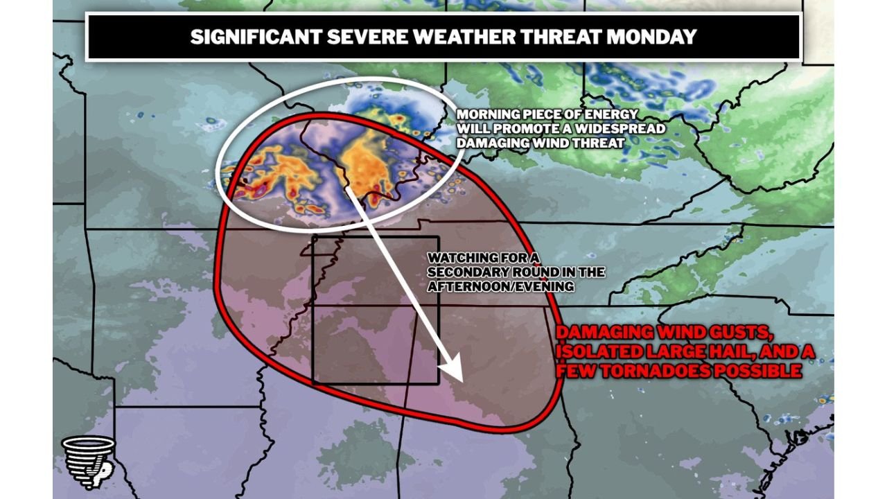
Mid South Facing Significant Severe Weather Monday With Damaging Winds Large Hail and Tornadoes in Two Separate Rounds
MEMPHIS, TENNESSEE — A significant and multi-round severe weather event appears likely across parts of the Mid South on Monday June 1, 2026, with a morning line of storms pushing south bringing widespread damaging winds followed by afternoon storm development…
-
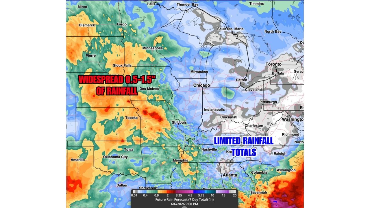
Central Plains From Sioux Falls to Oklahoma City Expecting Widespread 0.5 to 1.5 Inches of Rain Next Week Through June 6
TOPEKA, KANSAS — A more active rainfall pattern is setting up across the Central Plains for next week, with BAM Weather’s Future Rainfall Totals forecast through June 6, 2026 showing widespread accumulations of 0.5 to 1.5 inches across a broad…
-
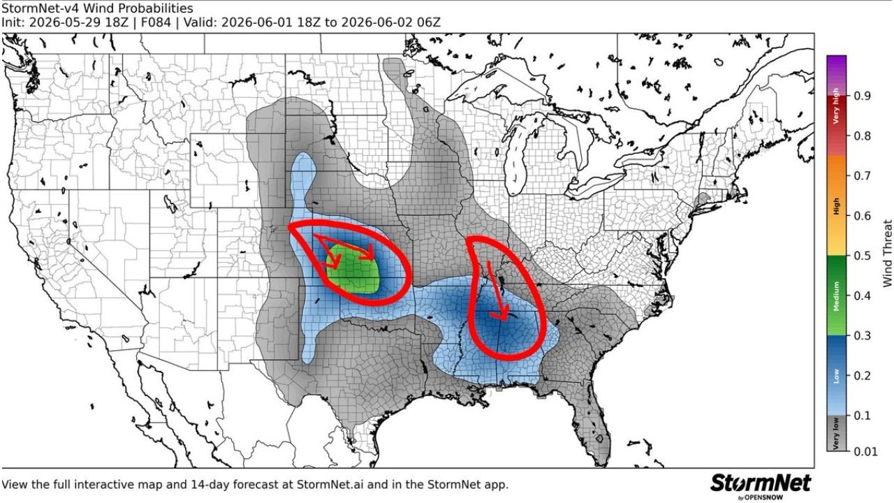
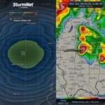
Central Plains and Deep South Bracing for Dual Intense MCS Events With Possible Derecho Criteria Monday June 1
KANSAS CITY, MISSOURI — A potentially significant and rare dual Mesoscale Convective System setup is taking shape for Monday June 1, 2026, with the StormNet-v4 Wind Probabilities model initialized at 18z May 29, 2026 and valid from 18z June 1…
-
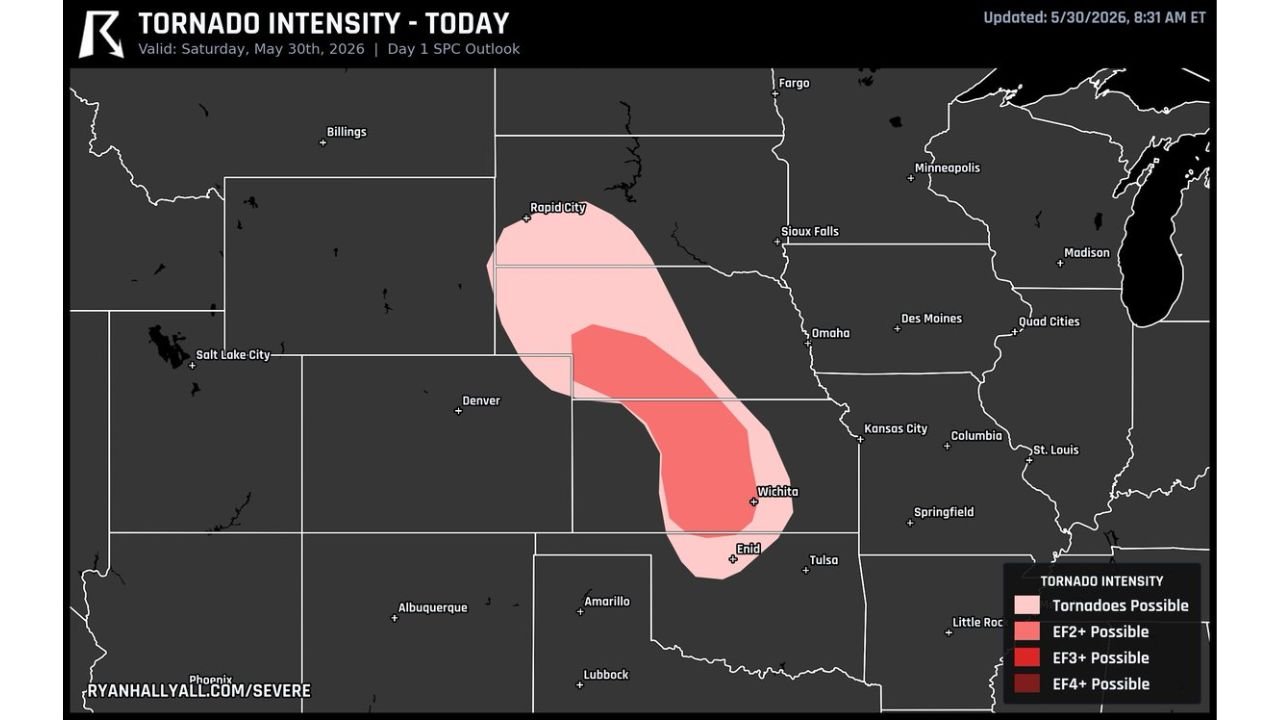
Central Kansas and Southern Nebraska Facing EF2 Plus Tornado Threat With Level 2 Intensity Risk Active Today May 30
WICHITA, KANSAS — Central Kansas and southern Nebraska are in for a busy and potentially dangerous afternoon on Saturday May 30, 2026, with the Ryan Hall Y’all Tornado Intensity outlook updated at 8:31 AM ET showing a Level 2 tornado…
-
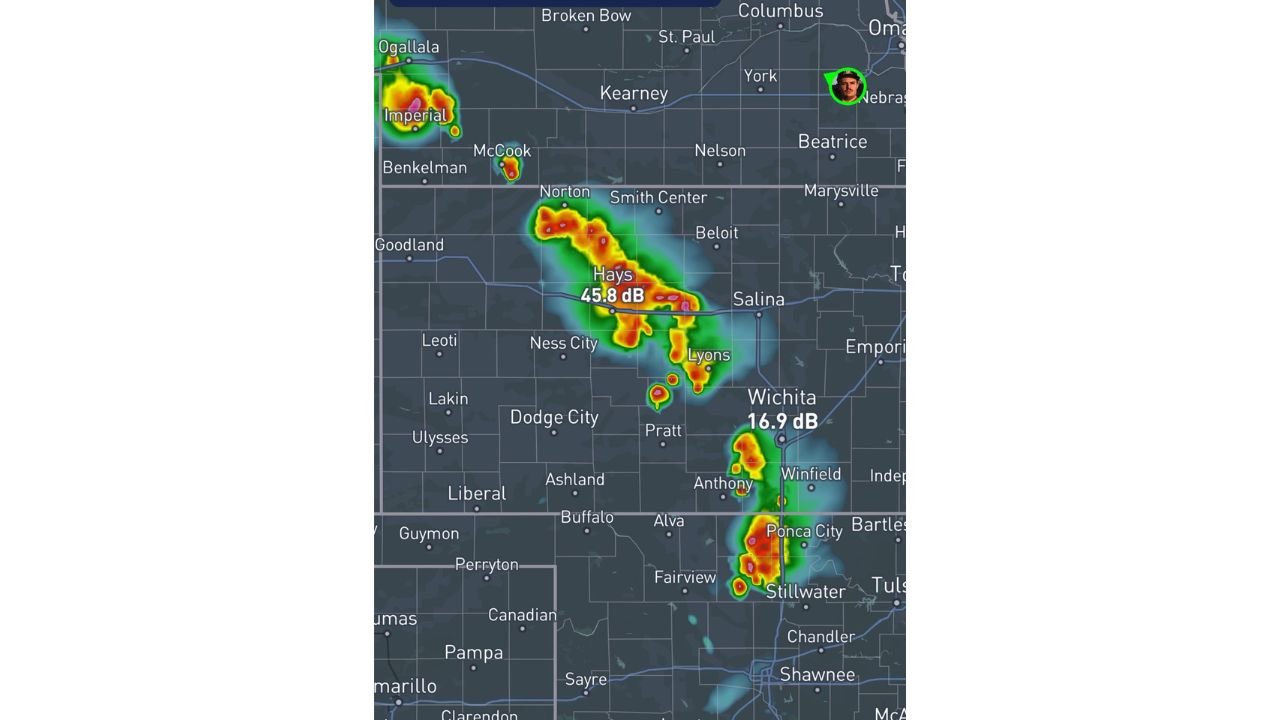
Kansas and Oklahoma Severe Storms Trending Toward Blobby Disorganized Cells Rather Than Tornadic Supercells This Afternoon
HAYS, KANSAS — The supercell tornado threat across Kansas and Oklahoma is trending significantly lower than initially anticipated this Saturday afternoon May 30, 2026, with meteorologists noting that barely any bulk shear or mid to upper level flow exists across…

Gordon Ramsay
Founder & Author
Hi there! I’m Gordon Ramsay, a journalist at heart and a storyteller by passion. Gordon Ramsay Club is my digital newsroom where I share breaking updates, sharp commentary, and stories that matter—covering trends, headlines, and conversations shaping today’s world.
Latest Posts
-
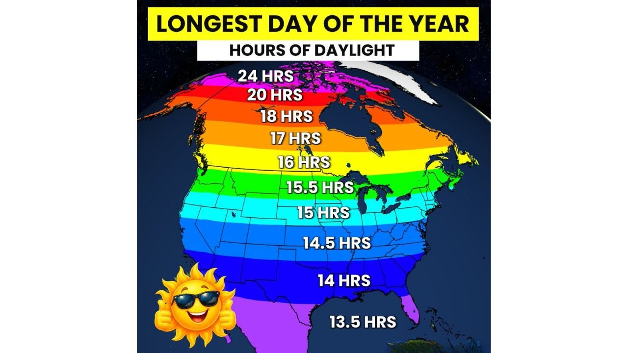
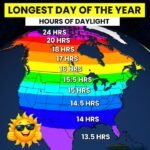
Northern States Alaska See Up to 24 Hours of Daylight Today on Summer Solstice as US Marks Longest Day of the Year
-
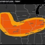
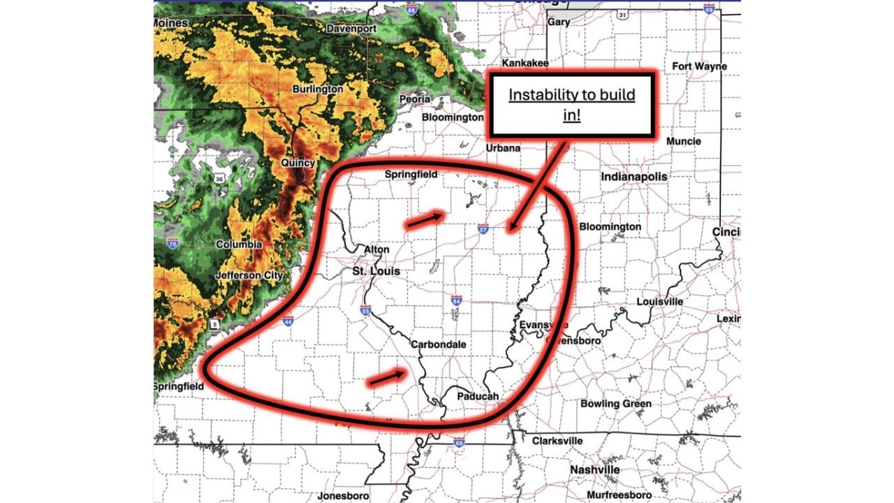
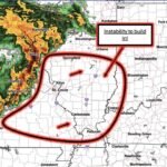
Illinois, Missouri, Indiana Brace for Strong to Severe Storms This Morning Into Afternoon With Damaging Winds, Hail, Isolated Tornado Risk as Instability Builds
-
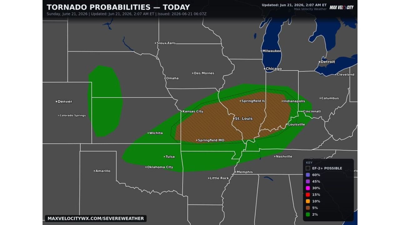
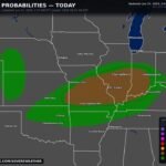
Missouri, Illinois, Indiana Face 5 Percent Tornado Risk Today With Strong Tornadoes Possible After Morning Storm Round, Kansas Nebraska Watch Hail and Wind
-
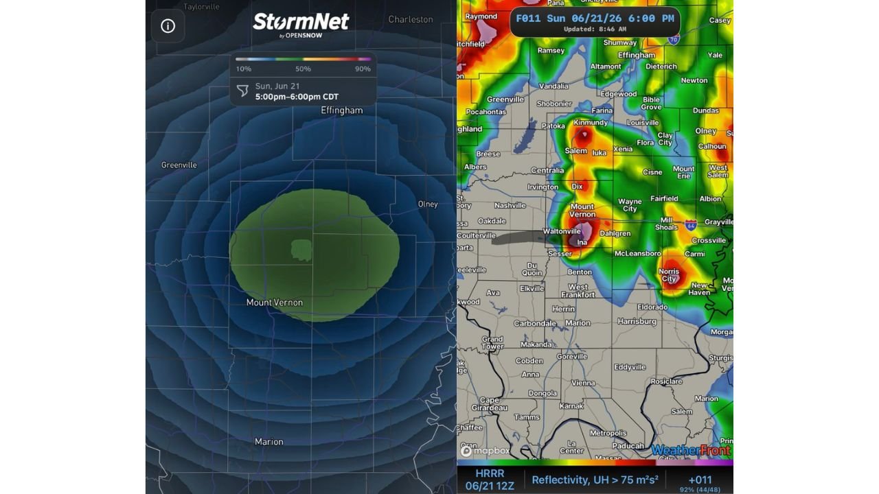
Mount Vernon Illinois, Olney Illinois Brace for Elevated Tornado Threat Tonight as Boundary Stalls Along I 64 Corridor Between 5 and 6 PM
-
Kansas, Oklahoma, Missouri Face Level 2 Severe Risk Today With Big Hail, Possible Tornado, 75 MPH Wind Gusts Tonight