
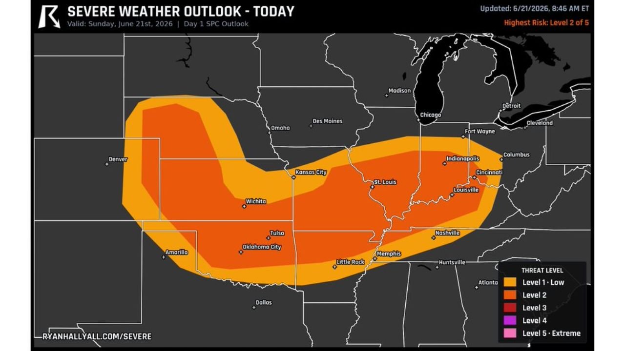
ST. LOUIS, MO. — A Level 2 of 5 severe risk runs across Kansas, Oklahoma, and Missouri today, Sunday, June 21, with a batch of storms already rolling east this morning and new storms expected to build along the front this afternoon as the air heats back up behind the initial round.
Big Hail the Early Story This Afternoon
Big hail is the early story as storms build along the front this afternoon. The threat covers a broad corridor stretching from eastern Colorado and Kansas through Missouri and into Indiana and Kentucky, with the highest concentration centered over Kansas, Oklahoma, and Missouri.
Eastern Missouri Storms Could Spin Up a Tornado
Forecasters say to watch eastern Missouri closely this afternoon. If storms there stay discrete rather than merging, a few could spin up a tornado, and a strong one is not off the table given the setup in place.
Storms Expected to Clump Into Line Tonight
Later tonight, the storms tend to clump into one line shoving east, bringing gusts up to 75 mph along with it. This transition from discrete storms to a consolidated line typically marks the shift from a hail and isolated tornado threat to a more widespread damaging wind threat.
Level 2 Risk Covers Wide Stretch From Plains to Ohio Valley
The Level 2 of 5 risk, the highest threat level in today’s outlook, stretches from Kansas and Oklahoma through Missouri and into Indiana, Kentucky, and Ohio. Cities including Wichita, Tulsa, Oklahoma City, St. Louis, Louisville, Indianapolis, and Cincinnati all fall within the highlighted threat area as the system tracks east today.
Stay with GordonRamsayClub.com for the latest updates.

Leave a Reply