-
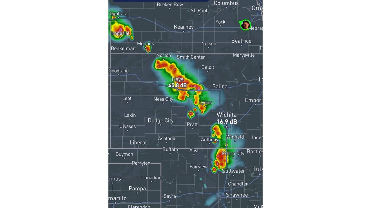
Kansas and Oklahoma Severe Storms Trending Toward Blobby Disorganized Cells Rather Than Tornadic Supercells This Afternoon
HAYS, KANSAS — The supercell tornado threat across Kansas and Oklahoma is trending significantly lower than initially anticipated this Saturday afternoon May 30, 2026, with meteorologists noting that barely any bulk shear or mid to upper level flow exists across…
-
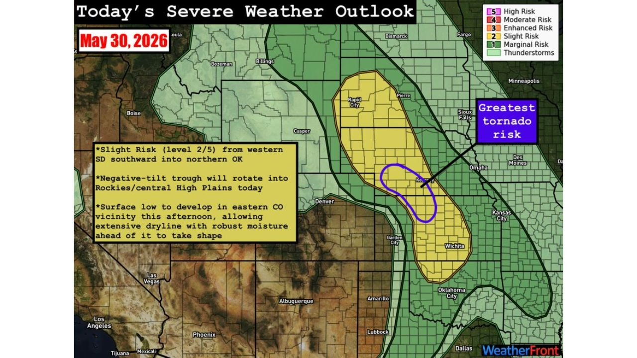
Western South Dakota Through Kansas and Northern Oklahoma Facing Slight Risk Severe Weather With Greatest Tornado Threat Near Kearney Today
WICHITA, KANSAS — The Storm Prediction Center has outlined a large Slight Risk Level 2 out of 5 severe weather zone stretching from western South Dakota southward through Kansas and into northern Oklahoma for Saturday May 30, 2026, with a…
-
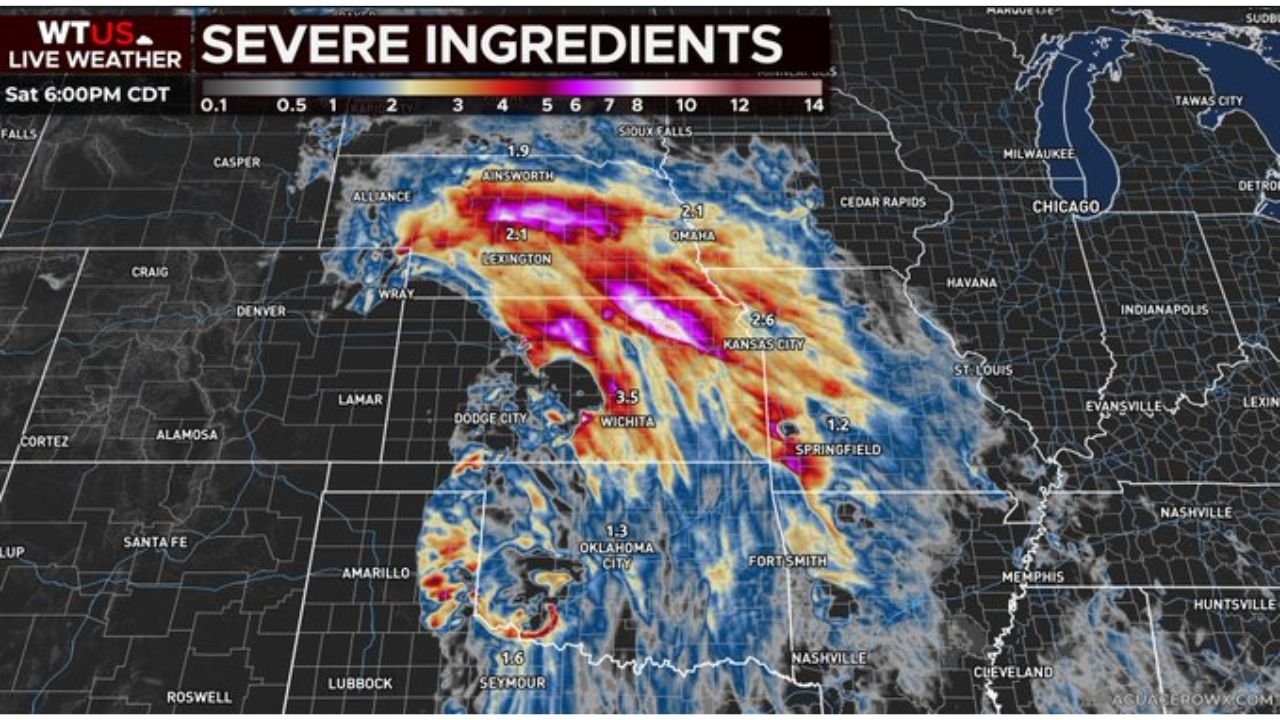
North Platte Nebraska and Hutchinson Kansas Facing Slight Risk of Damaging Winds Large Hail and Tornadoes Along Dryline This Afternoon
NORTH PLATTE, NEBRASKA — Scattered strong to severe storms are expected to fire this afternoon and evening across a significant stretch of the central plains, with the WTUS Live Weather Severe Outlook valid at 9:00 AM CDT Saturday May 30,…
-
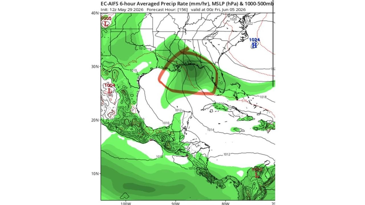
Gulf of Mexico and Florida Watching Small Chance of Subtropical or Tropical Storm Development With Heavy Rains Possible Next Week
MIAMI, FLORIDA — Tropical interests are being watched closely across the Gulf of Mexico and Florida this weekend, with the EC-AIFS model initialized at 12z May 29, 2026 showing a small but notable chance of subtropical or tropical storm development…
-
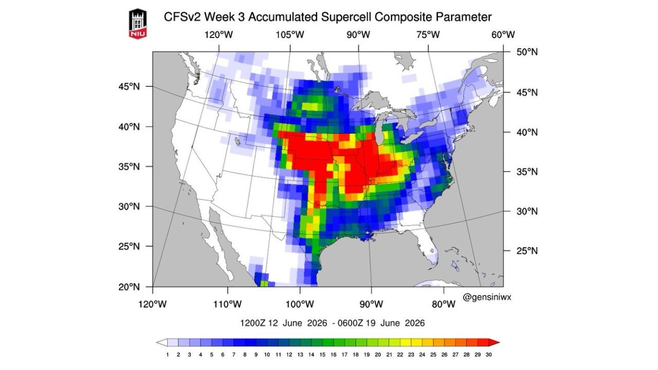
Central Plains and Southern States Facing Return of Organized Severe Weather and Supercell Threat Mid to Late June 2026
OKLAHOMA CITY, OKLAHOMA — A return to more organized and potentially significant severe weather activity across the Plains appears increasingly likely by mid to late June 2026, with the CFSv2 Week 3 Accumulated Supercell Composite Parameter showing a robust and…
-
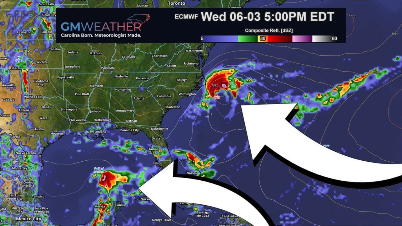
Carolina Coast Showing Tropical Spin Along Frontal Boundary as EURO and GFS Trap Gulf Energy on June 3
WILMINGTON, NORTH CAROLINA — A significant tropical update is emerging as both the EURO and GFS models have now joined together in mostly trapping Gulf energy rather than allowing it to develop into an organized system, but the ECMWF is…
-
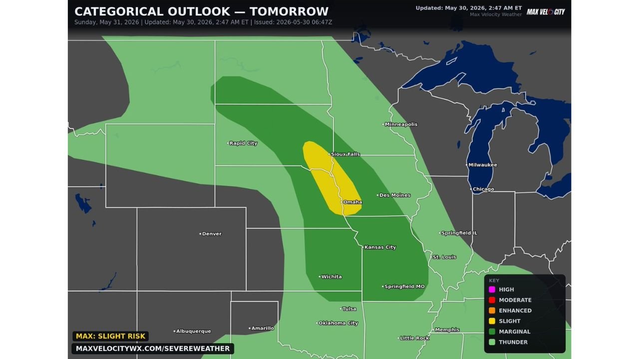
Omaha Nebraska and Sioux Falls South Dakota on High Alert for Supercells With Tornadoes and Large Hail Sunday May 31
OMAHA, NEBRASKA — Severe weather will continue across the Central and Northern Plains on Sunday May 31, 2026, with the Max Velocity Weather Categorical Outlook updated at 2:47 AM ET on May 30, 2026 placing a Slight Risk zone directly…
-
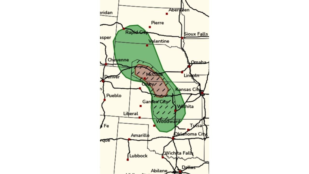
Northwest Kansas and Southwest Nebraska Severe Storm Initiation Uncertainty Grows as Models Trend Downward Today
COLBY, KANSAS — Forecaster confidence in severe storm initiation across the northwest Kansas and southwest Nebraska corridor is facing serious questions Saturday May 30, 2026, with multiple model solutions trending downward on storm initiation before 8 PM and the SPC…

Gordon Ramsay
Founder & Author
Hi there! I’m Gordon Ramsay, a journalist at heart and a storyteller by passion. Gordon Ramsay Club is my digital newsroom where I share breaking updates, sharp commentary, and stories that matter—covering trends, headlines, and conversations shaping today’s world.
Latest Posts
-
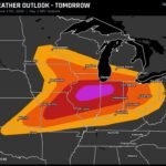
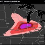
Springfield Illinois Peoria Illinois and Champaign Illinois Face Level 4 Tornado Risk Wednesday as EF-3 Plus Tornadoes Possible Across Central Illinois
-
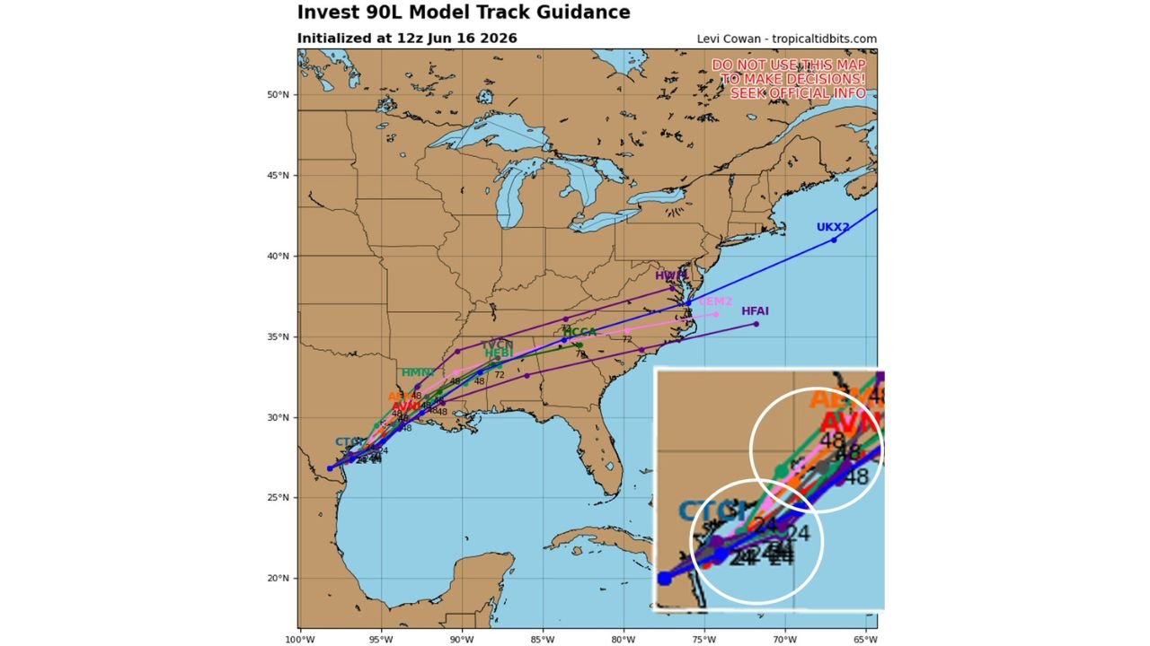
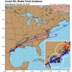
Texas and Gulf Coast Watching Invest 90L as Spaghetti Models Show Eastward Shift With Center Likely Remaining Over Water Through Wednesday
-
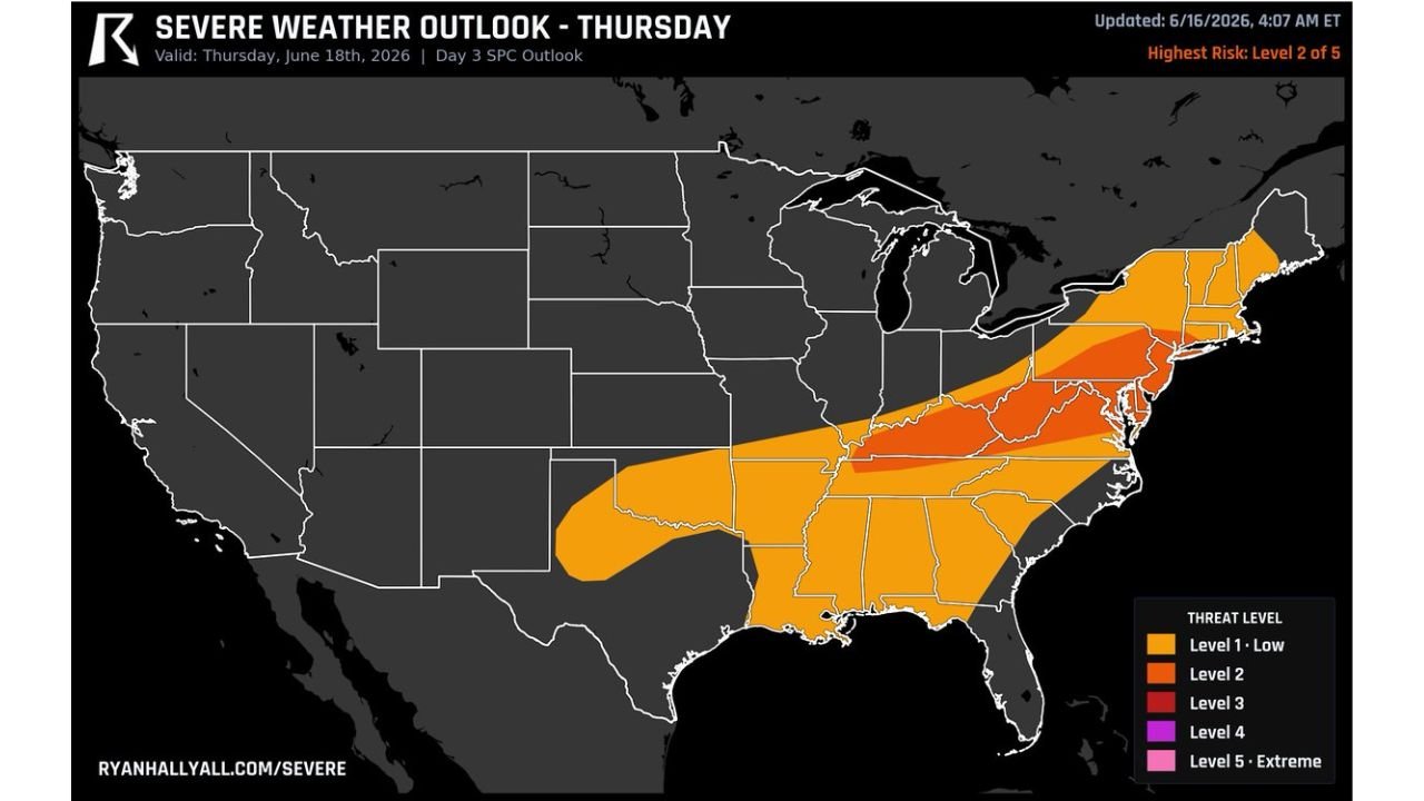
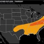
Kentucky West Virginia and Pennsylvania Face Level 2 Damaging Wind Threat Thursday as Fast Upper Level Winds Push Storm Lines East
-
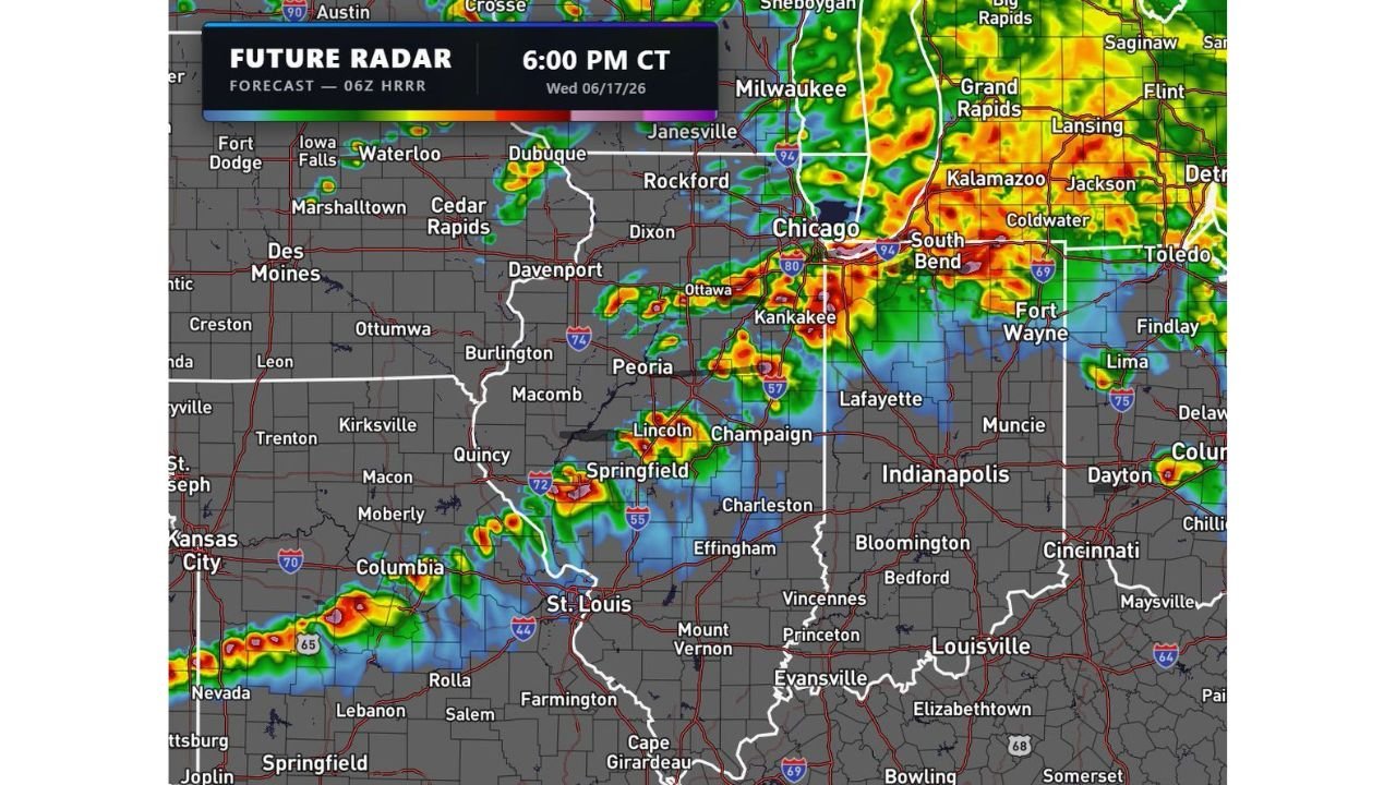
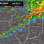
Chicago Illinois and Indianapolis Indiana Face Significant EF-3 Tornado Outbreak Risk Wednesday as HRRR Shows Multiple Discrete Supercells at 6PM
-
Central Illinois and Northwest Indiana Upgraded to Level 4 of 5 Outbreak Wednesday Bringing Strong Tornadoes 80 MPH Winds and Tennis Ball Hail