
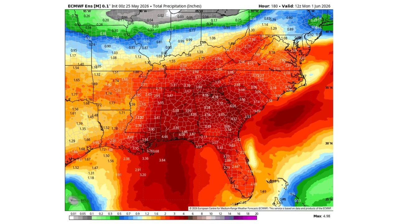
NEW ORLEANS, LOUISIANA — A strong and persistent rainfall pattern is locked in across the southern United States and shows no signs of breaking down, with the ECMWF Ensemble model initialized at 00z May 25, 2026 maintaining a loud rain signal valid through 12z Monday June 1, 2026 across a massive stretch of the country.
ECMWF Model Projects 3 to 4 Inch Totals Blanketing the Deep South Through Next Week
The European model output shows widespread totals in the 3 to 4 inch range covering the majority of the Deep South from Louisiana and Mississippi eastward through Alabama, Tennessee, Georgia, and into the Carolinas. Values of 3.31, 3.47, 3.67, 3.88, and 4.06 inches are visible across multiple counties throughout this corridor, with deep red shading dominating the entire southern tier of the map.
The pattern is described as one that will wiggle around some in terms of exact placement but will stay mainly in place in some form or fashion through the end of the week, keeping the rain threat alive and ongoing for tens of millions of residents.
Gulf Coast and Arkansas Seeing Some of the Highest Totals on the Map
Along the Gulf Coast and into Arkansas, some of the highest projected totals on the current model run are visible. Values of 3.94, 4.09, 4.46, and 3.76 inches are clustered across parts of Arkansas and the central Gulf Coast zone, with the deep red core of the model output centered firmly across this region.
Louisiana is also sitting within the heavier end of the projected totals, with values in the 3.35 to 3.68 inch range visible across multiple parishes, keeping flooding concerns elevated for areas that may already be dealing with saturated ground conditions.
Northern Plains and Upper Midwest Stay Mostly Dry by Comparison
The contrast across the map is significant. While the South braces for another week of heavy and persistent rainfall, the northern tier of the country including the Northern Plains, upper Midwest, and Great Lakes region is sitting in the 0.20 to 1.00 inch range through the same period.
Residents across the South and Gulf Coast should plan for a wet week ahead and monitor local flood watches and warnings as the pattern continues through June 1.
Stay with GordonRamsayClub.com for the latest updates.

Leave a Reply