
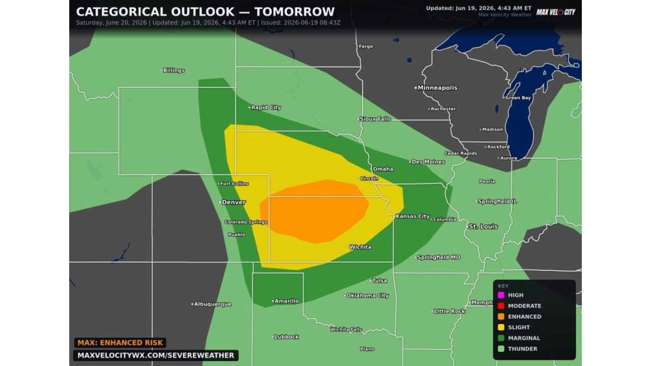
WICHITA, KAN. — Saturday’s setup is concerning across the central Plains, with an Enhanced Risk of severe thunderstorms covering parts of Kansas, Nebraska, and Colorado.
Severe Storms to Fire Saturday Afternoon Into Evening
Severe storms are expected to fire up from Saturday afternoon into the evening, bringing large to very large hail, severe winds over 75 mph, and tornadoes. The threat covers a broad swath of the central Plains, with the highest risk centered near the Kansas, Nebraska, and Colorado border region.
Lee Cyclone and Upslope Flow Trigger Early Supercells
As a mid level ridge de amplifies and a lee cyclone deepens across eastern Colorado, moisture transport will escalate across Kansas, northeast Colorado, and southwest Nebraska. By mid afternoon, upslope flow will likely trigger supercells capable of producing large hail across eastern Wyoming and the Nebraska Panhandle.
Dryline and Frontal Storms Expected Later in the Day
Later in the day, storm development is expected along the dryline in eastern Colorado and western Kansas, as well as along a frontal zone in Nebraska. These initial supercells could evolve into mesoscale convective systems by evening, intensifying the wind threat as they track into central Kansas.
Long Severe Weather Day Ahead for the Plains
With multiple rounds of severe weather possible from the afternoon through the overnight hours, Saturday is shaping up to be a long day for residents across the outlook area. Communities from Denver and Colorado Springs to Wichita, Kansas City, and Omaha should stay weather aware as the threat evolves through the day.
Stay with GordonRamsayClub.com for the latest updates.

Leave a Reply