
ST. LOUIS, MO. — Severe storms are on the table Sunday from the central High Plains to parts of the Mid Mississippi Valley, where a frontal zone will spark storms capable of large hail, severe winds, and even tornadoes.
Morning MCS Across Kansas and Missouri to Kick Things Off
The action will likely kick off with a morning mesoscale convective system across Kansas and western Missouri. As it moves east, areas from northeast Oklahoma to St. Louis could see further storm development in its wake.
Surface Low Could Raise Tornado Threat
The potential for severe weather hinges on the setup of a surface low in eastern Missouri into central and southern Illinois. Forecast model guidance is hinting at a higher tornado threat if the system deepens as expected.
Central High Plains Watching Shortwave Trough
Out in the central High Plains, scattered storms in the post frontal airmass will be driven by a shortwave trough, bringing threats of large hail and damaging winds as supercells organize. Specifics remain uncertain this far out, but forecasters say it is an early signal worth watching closely.
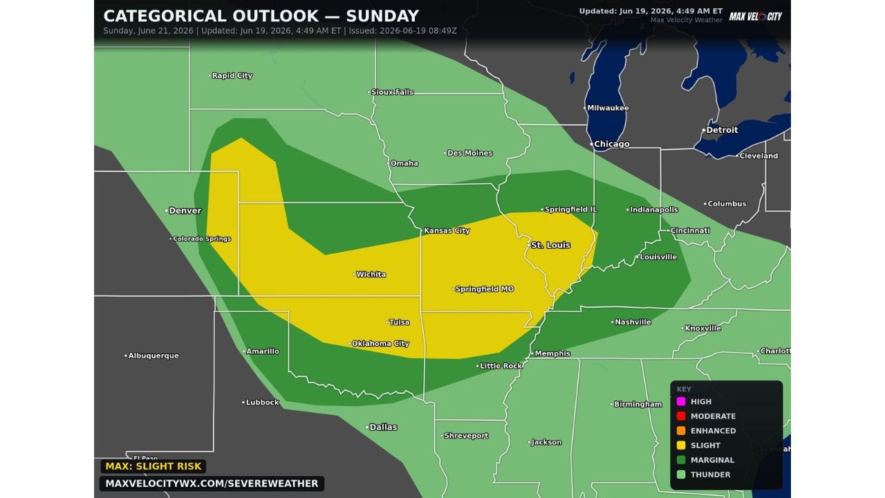
Slight Risk Covers Wide Stretch of the Plains and Midwest
A Slight Risk has been outlined from Colorado and Kansas through Missouri, Illinois, and into parts of Oklahoma and Arkansas. Cities including Wichita, Kansas City, St. Louis, Springfield, Tulsa, and Oklahoma City all fall within the outlook area as Sunday’s setup continues to come into focus.
Stay with GordonRamsayClub.com for the latest updates.

Leave a Reply