
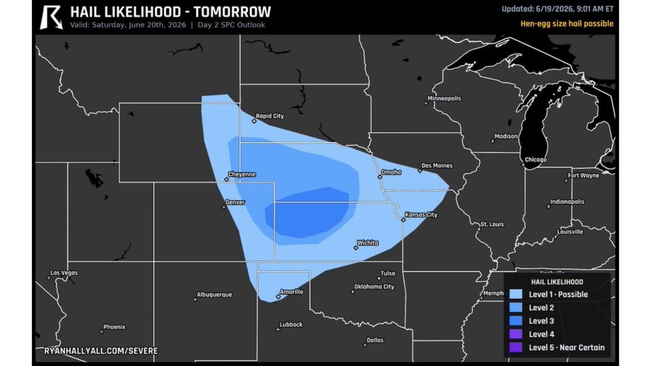
RAPID CITY, S.D. — The most likely spot for hen egg size hail Saturday is around Rapid City, South Dakota, Cheyenne, Wyoming, and Akron, Colorado, with stones expected to reach 2 inches and up.
Hail Could Dent Cars and Crack Windshields
Hail of that size is large enough to dent cars and crack windshields in a hurry. Forecasters say residents with vehicles parked outside in the highlighted areas should plan to find cover for them ahead of Saturday’s storms, as damage from hail this large can total a vehicle in a matter of seconds.
Storms Build Off High Ground in the Afternoon
Storms are expected to build off the high ground during the afternoon hours as daytime heating destabilizes the atmosphere across the higher terrain of Wyoming, South Dakota, and Colorado. The air aloft where these storms are growing is cold enough to support hail growth up to hen egg size and potentially larger, as strong updrafts repeatedly carry hailstones through the coldest part of the storm before they fall.
The combination of steep terrain, daytime heating, and cold air aloft creates an environment uniquely suited for oversized hail production, and forecasters note this pattern tends to repeat itself across this corridor during the late spring and early summer months.
Broader Hail Threat Stretches Across the Plains
Beyond the highest risk zone, a broader area of hail potential stretches from South Dakota and Wyoming through Colorado, Nebraska, and into Kansas, including areas near Denver, Omaha, Kansas City, and Wichita. Hail likelihood within this corridor ranges from possible up through higher level threats closer to the core risk area centered near Cheyenne and Akron.
While the most likely zone for the largest hail sits closer to the higher terrain, any storm that organizes within this broader corridor will carry at least some risk of large hail given the supportive upper level conditions in place Saturday.
Residents Urged to Prepare Ahead of Storms
Residents across the region are urged to monitor the forecast Saturday afternoon and take steps to protect vehicles and property as storms develop. Moving cars into garages or covered parking, and securing any loose outdoor items, can help reduce the risk of costly damage.
Forecasters say the threat window will likely run from the afternoon into the early evening hours as storms fire off the high ground and track east across the open Plains, weakening somewhat as they move away from the terrain that helps fuel them.
Stay with GordonRamsayClub.com for the latest updates.

Leave a Reply