
RALEIGH, N.C. — A trough of low pressure associated with the remnants of Arthur is producing showers and thunderstorms over the southeastern United States, with forecasters watching for a slight chance of tropical or subtropical development as the system moves offshore.
System Set to Emerge Off the East Coast
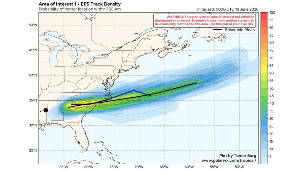
The disturbance is expected to push offshore the East Coast by Friday afternoon. Once over open water, environmental conditions are forecast to become marginally conducive for some subtropical or tropical development tonight or Saturday.
Northeastward Track Across the Atlantic
The system is forecast to move northeastward at around 20 mph across the western Atlantic Ocean. Sea surface temperatures along its path range from the mid 20s to upper 20s Celsius, generally supportive of slow development if other conditions align.
Development Chances Remain Low
The National Hurricane Center has placed the chance of development at just 10 percent through both the 2 day and 7 day windows. Ensemble track guidance shows the system’s probable center remaining well offshore as it accelerates northeastward, with the highest probability area stretching from off the Carolina coast out toward the open Atlantic.
Rest of Atlantic Basin Stays Quiet
Aside from this area of interest, the rest of the Atlantic basin remains quiet with no other systems being tracked. Coastal residents from North Carolina northward should monitor updates as the system tracks offshore, though direct impacts are not currently expected given the system’s forecast path away from land.
Stay with GordonRamsayClub.com for the latest updates.

Leave a Reply