
DENVER, COLORADO — Two distinct areas of heightened severe weather potential are active today Friday June 12, with supercells capable of producing tornadoes and large hail developing across southeast Colorado and northeast New Mexico while separate clusters of damaging wind-producing storms threaten the East Coast from the Great Lakes through the mid-Atlantic this afternoon and evening.
Southeast Colorado and Northeast New Mexico Supercell Threat
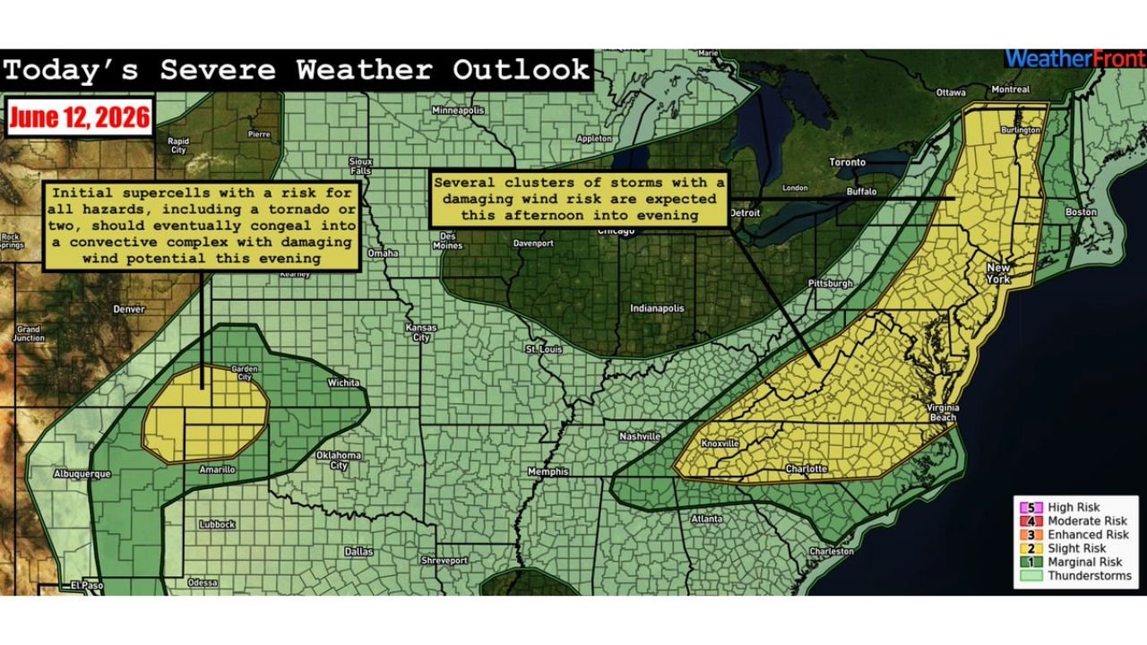
The Southern High Plains setup centers on southeast Colorado and northeast New Mexico where initial supercells are expected to develop this afternoon carrying the potential for large hail, damaging winds, and a tornado or two. The WeatherFront severe weather outlook valid June 12 shows a Slight Risk zone covering this corridor with the supercells forecast to eventually congeal into an eastward-moving convective complex carrying continued damaging wind potential through the evening hours.
The transition from discrete supercells to a convective complex shifts the primary hazard from tornadoes toward widespread damaging winds as the evening progresses across the southern plains.
East Coast Damaging Wind Clusters Expected This Afternoon
The second threat area covers a broad East Coast corridor stretching from Chicago and Des Moines eastward through Indianapolis, Detroit, Pittsburgh, and into the mid-Atlantic and New England region. Several clusters of strong to severe storms are expected to develop this afternoon despite relatively weak deep-layer shear, posing a risk for mainly damaging winds and isolated large hail across the populated corridor.
A Marginal Risk zone covers the entire East Coast footprint from the Great Lakes through Virginia Beach and Boston, with the afternoon into evening hours representing the primary storm window.
Residents in Both Threat Zones Should Remain Weather Aware Today
The dual-threat nature of today’s severe weather pattern means communities from southeast Colorado all the way to the East Coast need to remain weather-aware through the afternoon and evening. The southern plains setup carries the higher end tornado and hail potential while the East Coast threat focuses primarily on damaging winds from storm clusters.
Anyone in either threat zone should monitor local watches and warnings closely through Friday evening.
Stay with GordonRamsayClub.com for the latest updates.

Leave a Reply