
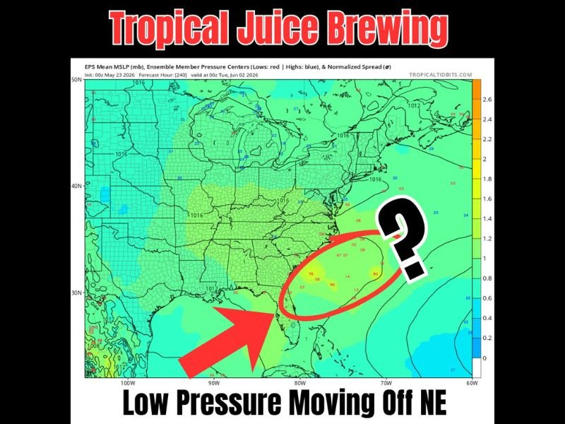
FLORIDA — Tropical juice is brewing across the Gulf and Caribbean heading into next week, with lowering pressures expected across the region through the week increasing rain chances for many while the EURO ensemble model initialized at 00Z May 23 and valid at 00Z June 2, 2026 shows a developing low pressure system moving off the northeast coast with multiple ensemble members clustering in the area east of Florida and the Carolinas suggesting possible tropical development in early June.
Both the main EURO and the GFS models are showing signals for something potentially trying to form on the Atlantic side as the system exits, with the timing aligning with historically favored early season tropical development patterns.
Lowering Pressures Across Gulf and Caribbean Next Week Boosting Rain Chances Statewide
Pressures are expected to lower across the Gulf of Mexico and Caribbean through next week, a pattern that typically increases moisture and storm activity across the Florida peninsula and surrounding Gulf states regardless of whether any formal tropical development occurs.
If the core of the low pressure system cuts through the middle of Florida, forecasters note it could bring enhanced rainfall and storms directly to the Florida peninsula during the week ahead, adding to an already active and wet pattern across the state heading out of Memorial Day weekend.
Euro and GFS Models Both Signaling Possible Atlantic Development Around Early June
The EPS ensemble pressure map valid June 2 shows a notable cluster of low pressure ensemble members circled off the Southeast coast between Florida and the Carolinas, with the question mark highlighted by forecasters reflecting the genuine uncertainty around whether formal tropical development will occur as the system moves off the northeast coast.
Both the EURO and GFS models showing this signal gives the potential development scenario more credibility than if only one model were picking it up, though significant uncertainty remains at this forecast range.
The timing around early June aligns with historically favored early tropical season development, making this a system worth monitoring closely through next week as models continue refining the potential track and development chances. Stay with GordonRamsayClub.com for the latest updates.

Leave a Reply