-
Florida East Coast Seeing Most Active Storm Coverage as Frontal Line Fires Storms with Marginal Risk Across the Peninsula Tuesday
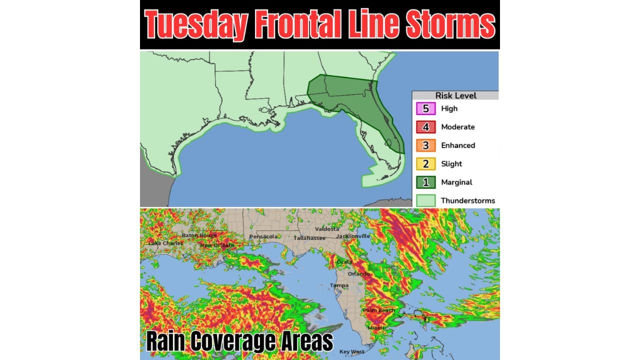
ORLANDO, FLORIDA — A frontal line is helping trigger storm development across Florida and the broader Gulf South region on Tuesday June 2, 2026, with the SPC placing Florida under a Marginal Risk Level 1 of 5 and the Florida…
-
Eastern Grain Belt Including Illinois, Indiana, and Ohio Facing Concerning Ridge Pattern Matching Historic Drought Years 1988, 2012, and 2023
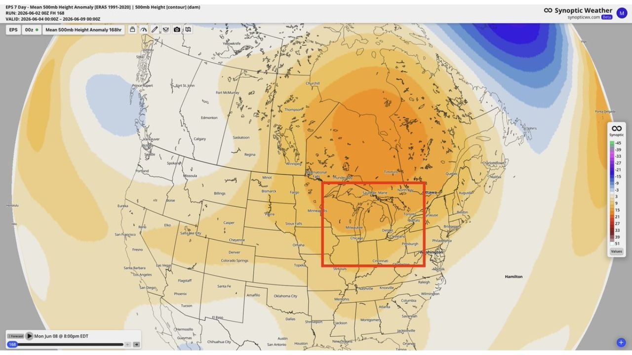
CHICAGO, ILLINOIS — A growing concern is emerging for the eastern grain belt over the next 6 to 10 days as EPS 500mb height anomaly data valid June 4 through June 9, 2026 shows a significant ridge building across the…
-
Western Tennessee, Kentucky, and Southern Illinois Hit by Organizing MCS as Greatest Severe Risk Sits West of I-65 This Morning
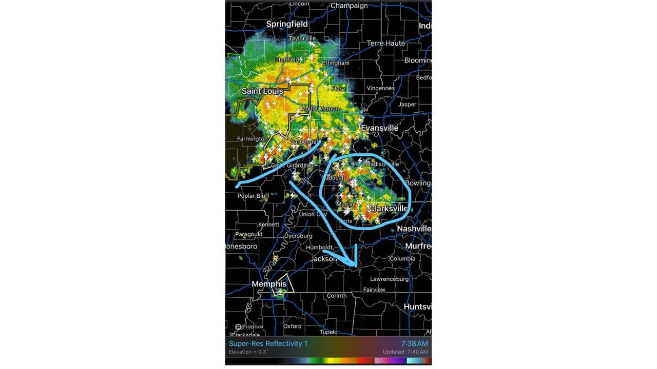
NASHVILLE, TENNESSEE — An organizing Mesoscale Convective System is currently tracking across western Tennessee, southern Illinois, and western Kentucky this morning, with radar at 7:40 AM showing intense lightning activity and heavy storm cores concentrated across the Paducah, Murray, Clarksville,…
-
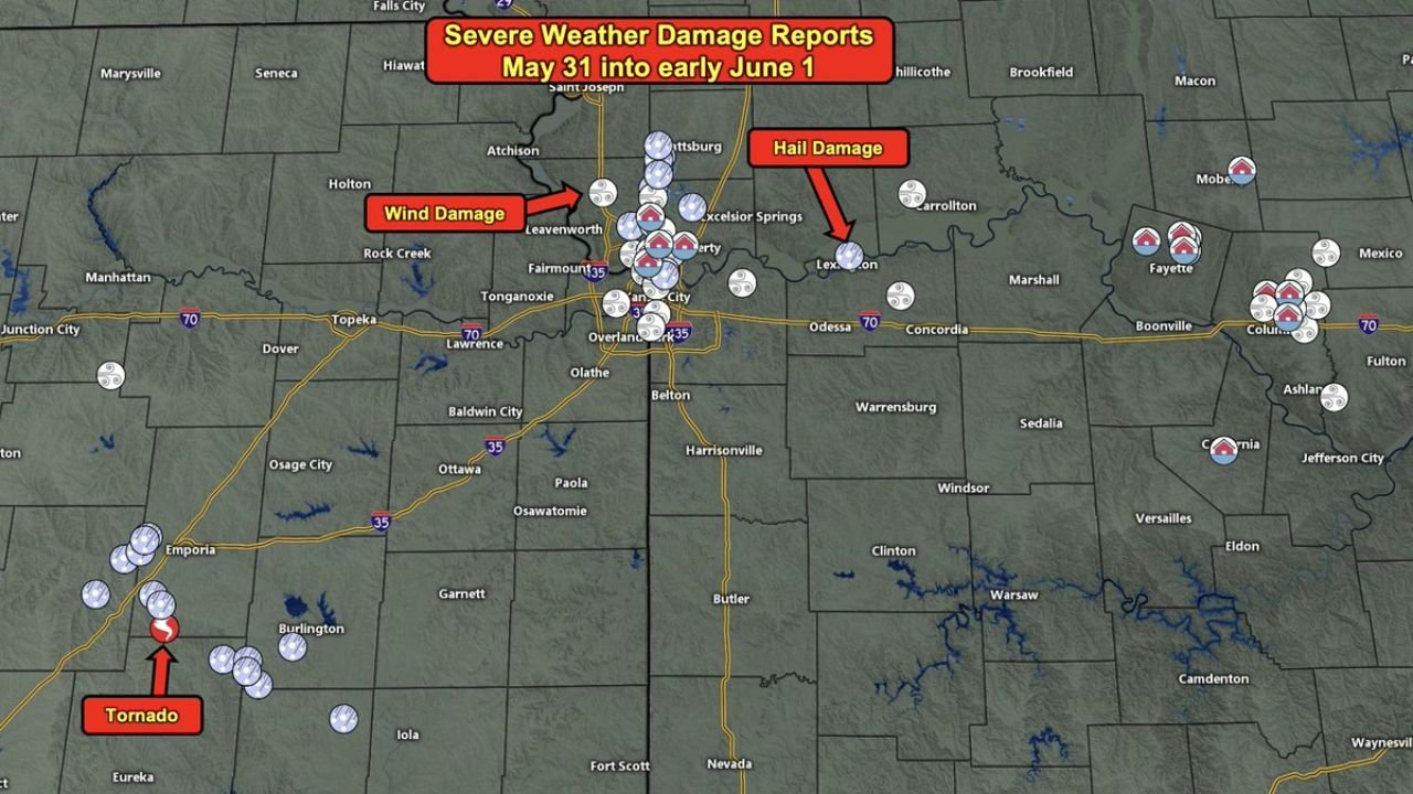
Kansas City and Eastern Kansas Hit by Tornado, Large Hail, Wind Damage, and Flooding as Damage Reports Confirmed from May 31 into June 1
KANSAS CITY, MISSOURI — Severe weather swept through the Kansas City metro and eastern Kansas overnight from May 31 into early June 1, 2026, producing a confirmed tornado near Emporia, widespread large hail damage, wind damage near Leavenworth, and multiple…
-
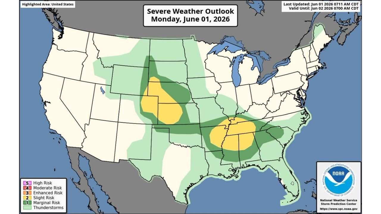
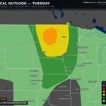
Central Plains and Southeast Hit by Large Hail and Severe Wind Gusts as SPC Issues Slight Risk Across Two Separate Zones Monday
KANSAS CITY, MISSOURI — A dual-zone severe weather outbreak is unfolding across the United States on Monday June 1, 2026, as the Storm Prediction Center’s Severe Weather Outlook valid until June 2, 2026 at 7:00 AM CDT shows two separate…
-

Tennessee Mississippi and Alabama Facing Imminent Severe Thunderstorm Watch with 55 to 70 MPH Winds as SPC Sets Watch Probability at 80 Percent
HUNTSVILLE, ALABAMA — The Storm Prediction Center has issued Mesoscale Discussion 934 signaling a severe thunderstorm watch is forthcoming for parts of Tennessee, Mississippi, and Alabama, with an 80 percent watch probability and damaging wind gusts of 55 to 70…
-

Northern Alabama, Including Florence, Huntsville, and Birmingham, Under Slight Risk as Strong Straight Line Winds Threaten from Noon to 8 PM Today
HUNTSVILLE, ALABAMA — Strong to severe thunderstorms are expected to move southward across Alabama this afternoon and early tonight, with the SPC Severe Weather Outlook valid until June 2, 2026 at 7:00 AM CDT placing northern Alabama under a Slight…
-
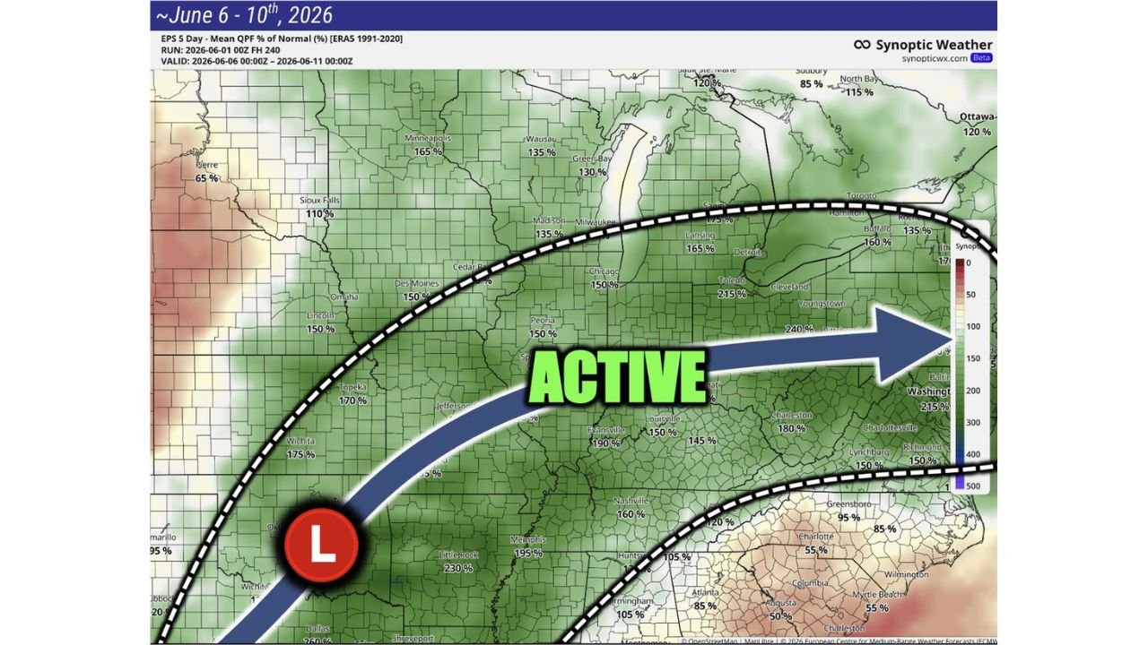
Illinois, Indiana, Ohio, Tennessee, and Mid-Atlantic States Facing Return of Active Storm Pattern with Above Normal Rainfall Expected June 6 to 10
CHICAGO, ILLINOIS — After a generally drier and calmer weather pattern through mid to late this week, a significant and widespread return of rain and storm activity is targeting the Midwest through the East Coast for the June 6 to…

Gordon Ramsay
Founder & Author
Hi there! I’m Gordon Ramsay, a journalist at heart and a storyteller by passion. Gordon Ramsay Club is my digital newsroom where I share breaking updates, sharp commentary, and stories that matter—covering trends, headlines, and conversations shaping today’s world.
Latest Posts
-
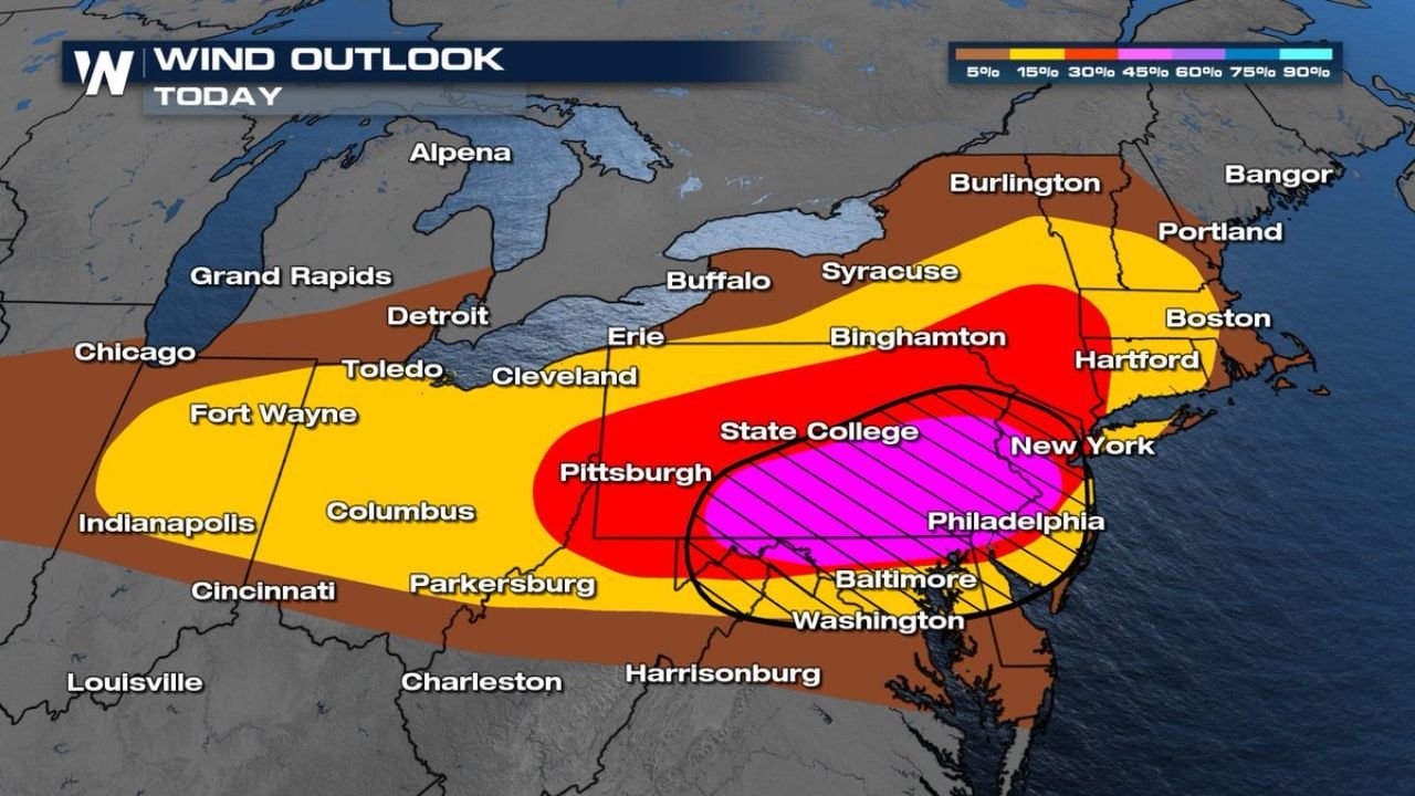
Interstate 95 Corridor Including Philadelphia, New York, Baltimore, and Washington DC Upgraded to Enhanced Risk with 75 MPH Severe Winds as Southern Pennsylvania and Eastern Ohio Report Wind Damage Today
-
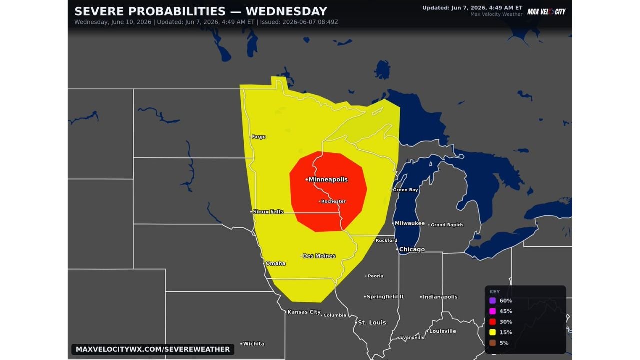
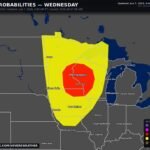
Minnesota, Iowa, Wisconsin, and North Dakota Including Minneapolis, Sioux Falls, and Des Moines Facing Growing Severe Weather Outbreak with Strong Tornadoes, Very Large Hail, and Widespread Damaging Winds Wednesday June 10
-
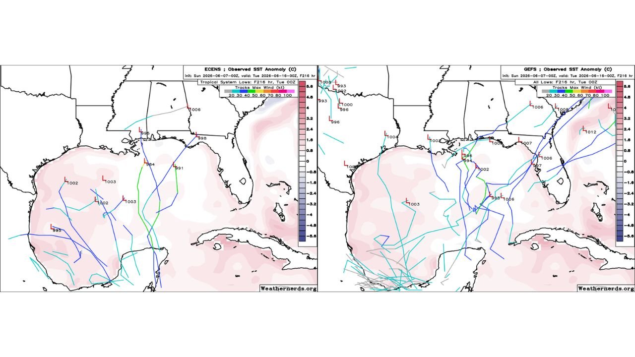
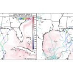
Gulf of Mexico and Gulf Coast States Seeing Further Decreased Tropical Development Chances as Euro, GFS, and AI Ensembles All Lose Interest Sunday June 7
-
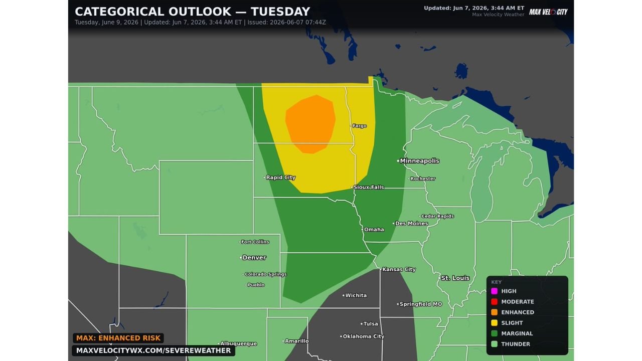
Dakotas and Western Minnesota Including Fargo and Sioux Falls Under Enhanced Risk with All Hazards and Significant Tornadoes Possible as Powerful Shortwave Targets Region Tuesday June 9
-
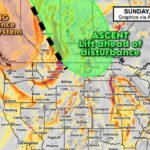
Saskatchewan, Manitoba, and Northern North Dakota Including Saskatoon, Regina, and Minot Under Active Ascent and Lift as Vorticity Loaded Upper Air Disturbance Drives Storm Development Sunday June 7