
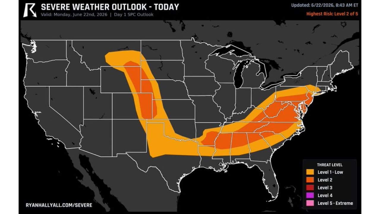
RALEIGH, N.C. — A Level 2 of 5 severe risk covers two very different setups today, Monday, June 22, with northeast Colorado facing very large hail and a tornado or two from afternoon High Plains storms, while Virginia and North Carolina brace for damaging winds as storms roll off the mountains toward the coast, and the DC and Baltimore corridor remains in play for a couple of quick tornadoes near the warm front.
Northeast Colorado Watching Very Large Hail and Tornadoes
Out on the High Plains in northeast Colorado, storms are expected to fire off the high ground this afternoon on their own. That isolated storm mode is exactly what supports very large hail production, and a tornado or two cannot be ruled out as these storms tap into strong instability across the open Plains.
Virginia and North Carolina Face Damaging Wind Threat
The bigger severe weather area today runs across Virginia and North Carolina, where storms will roll off the mountains this afternoon and push toward the coast. Damaging wind is the main worry with this setup as the storms accelerate eastward off the terrain.
DC and Baltimore Still Watching for Quick Tornadoes
Near the warm front up around Washington DC and Baltimore, a couple of quick tornadoes remain possible today. Forecasters flagged this corridor yesterday and say the threat has not gone away as the front lingers across the region through the afternoon hours.
Level 2 Risk Stretches Across Two Separate Corridors
The Level 2 of 5 risk is split across two distinct corridors, one running through the High Plains of Colorado and another stretching from Virginia and North Carolina through the Mid Atlantic. Both corridors carry legitimate severe weather threats but with very different primary hazards on each end.
Stay with GordonRamsayClub.com for the latest updates.

Leave a Reply