
LINCOLN, NEBRASKA — A Level 2 of 5 Slight Risk has been issued for Saturday June 20 across Nebraska, northeast Colorado, and western Kansas, with scattered severe storms expected from potential supercells carrying an all-hazards threat before possible growth into lines or clusters of storms through the afternoon and evening hours.
Slight Risk Core Covers Lincoln Omaha Denver and Wichita Corridor
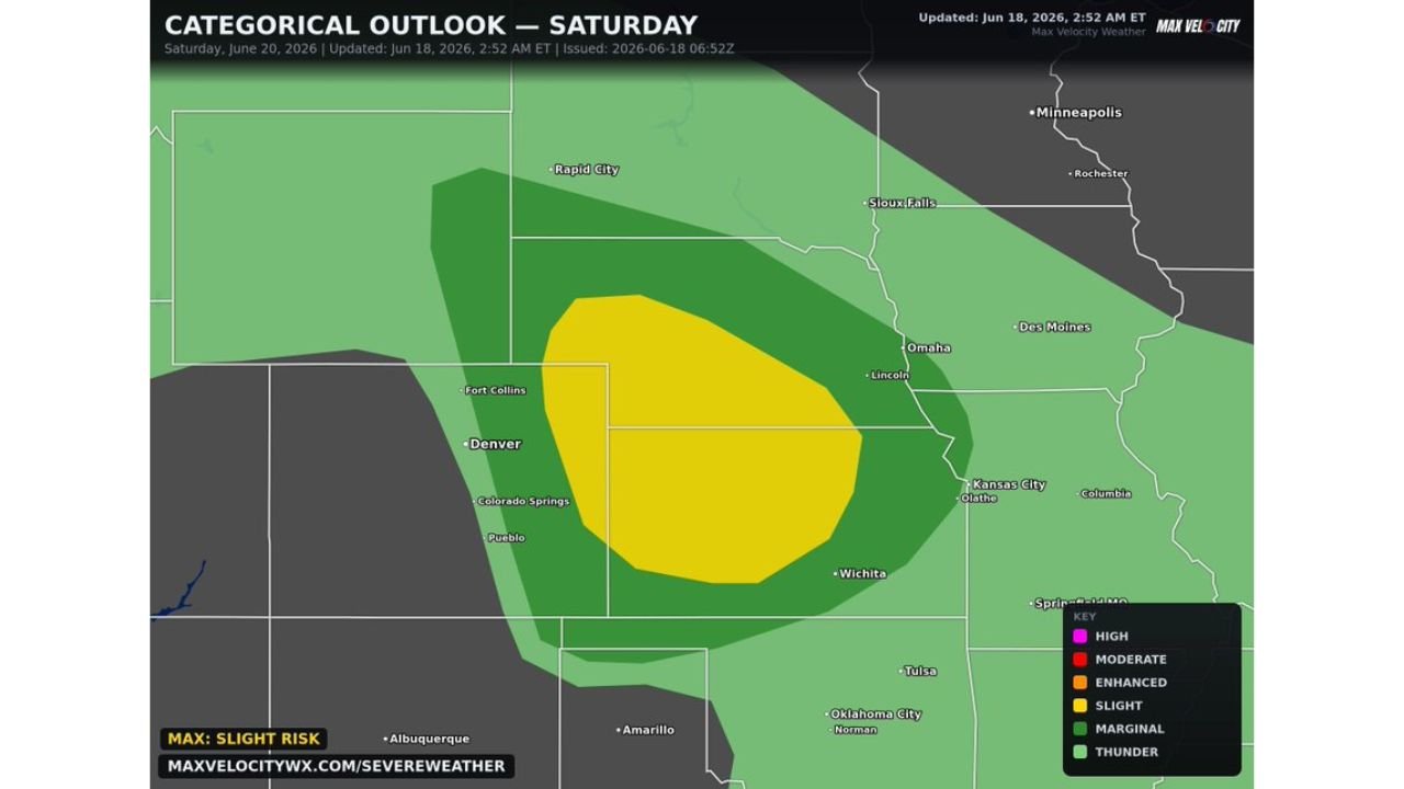
The Max Velocity categorical outlook updated June 18 at 2:52 AM ET valid Saturday June 20 shows a Slight Risk in yellow centered over a broad zone covering Lincoln, Omaha, Fort Collins, Denver, Colorado Springs, Pueblo, and extending southward toward Wichita. The Slight Risk zone encompasses a large footprint across the central plains covering both the Nebraska and northeast Colorado corridors identified in the forecast.
A Marginal Risk in dark green surrounds the Slight core, extending coverage from Rapid City and Sioux Falls southward through Kansas City and toward Tulsa and Oklahoma City.
All Hazards Possible From Supercells Before Possible Line Growth
Potential supercells Saturday carry an all-hazards threat including large hail, damaging winds, and tornadoes across the Slight Risk zone. Some growth into lines or clusters of storms is also possible as the event evolves, which would shift the primary hazard toward widespread damaging winds across a broader corridor.
The all-hazards nature of Saturday’s supercell potential means residents across Nebraska, northeast Colorado, and western Kansas need to be prepared for multiple simultaneous severe weather threats during the afternoon storm window.
Further Details to Come as Saturday Approaches
Forecasters note that additional details on Saturday’s setup will be issued as the event gets closer and model guidance refines the timing and placement of storm development. The Slight Risk designation at this range reflects solid early confidence in a meaningful severe weather day across the central plains.
Residents across Lincoln, Omaha, Denver, and Wichita should monitor updated forecasts through Friday as Saturday’s setup continues to evolve.
Stay with GordonRamsayClub.com for the latest updates.

Leave a Reply