
ST. LOUIS, MO. — Multiple rounds of severe storms are in the forecast for Sunday, with damaging winds, large hail, and a few strong tornadoes possible across the central United States.
Active Day of Storms Expected for Major Cities
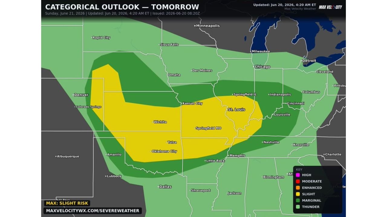
Residents living in St. Louis, Springfield, Oklahoma City, or Wichita are urged to prepare now for an active day of storms. Some storms are expected to turn severe, with multiple rounds capable of producing damaging winds and large hail through the day.
Highest Tornado Threat Centered Near St. Louis
The highest tornado threat within Sunday’s outlook is centered near St. Louis, where forecasters say a few strong tornadoes will be possible. The setup raises concern for a more significant tornado risk in this corridor compared to surrounding areas.
Slight Risk Covers Broad Stretch From Plains to Midwest
A Slight Risk has been outlined stretching from Colorado and Kansas through Missouri, Oklahoma, and Illinois, with an enhanced corridor of concern running from Wichita and Kansas City through Springfield, Missouri, and into St. Louis. Cities including Tulsa, Oklahoma City, and Springfield, Illinois also fall within the broader outlook area.
Damaging Winds and Large Hail Also Expected
Beyond the tornado threat, damaging winds and large hail are expected to accompany storms across the outlook area throughout the day. Multiple rounds of storms raise the potential for repeated impacts in some communities as the system moves through.
Residents across Missouri, Oklahoma, Kansas, and surrounding states are encouraged to have a way to receive warnings and monitor the forecast closely as Sunday approaches, given the potential for an active and possibly dangerous severe weather day.
Stay with GordonRamsayClub.com for the latest updates.

Leave a Reply