
KANSAS CITY, MISSOURI — Significant severe thunderstorms are likely Wednesday June 17 across Missouri, Illinois, and Indiana, where the highest confidence in an all-hazards severe threat exists with very high-end wind shear in place that may help organize supercells capable of severe hail, severe wind, and tornadoes.
Enhanced Risk Core Covers Kansas City Through Indianapolis
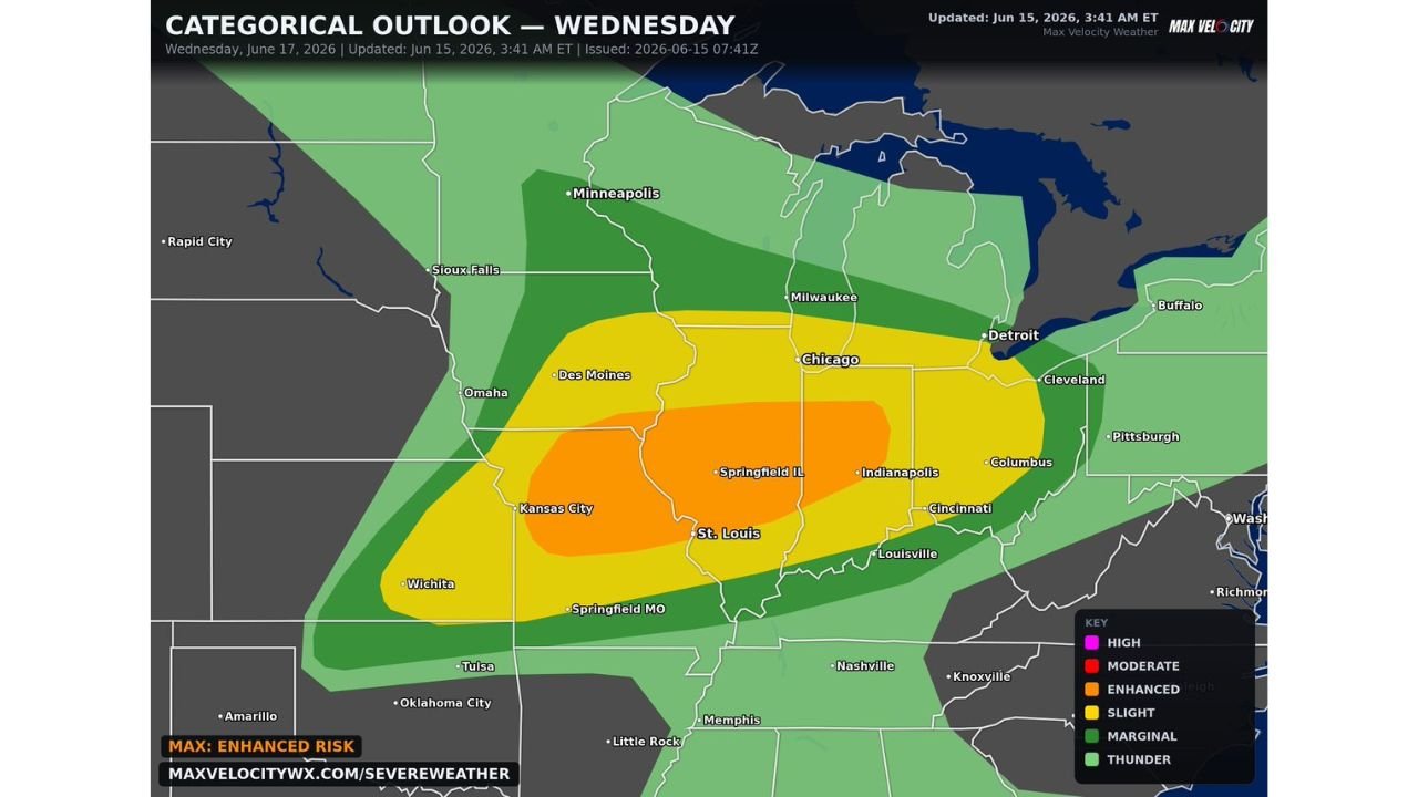
The Max Velocity categorical outlook updated June 15 at 3:41 AM ET valid Wednesday June 17 shows an Enhanced Risk in orange centered over Kansas City, Springfield Illinois, St. Louis, and Indianapolis. A Slight Risk in yellow surrounds the core, extending coverage from Des Moines and Wichita through Chicago, Detroit, Columbus, and Cleveland. Marginal Risk shading pushes the broader severe footprint further outward toward Minneapolis, Milwaukee, Buffalo, and Pittsburgh.
The Enhanced designation reflects the highest confidence area for an all-hazards severe weather event across the central and eastern Midwest on Wednesday.
Very High End Wind Shear Could Organize Supercells
Forecasters are highlighting very high-end wind shear as the key ingredient that may help organize discrete supercells across the Enhanced Risk zone. Supercells capable of producing severe hail, severe wind, and tornadoes are the primary concern wherever this organized storm mode can develop across Missouri, Illinois, and Indiana.
The combination of strong shear and instability across this corridor creates the potential for a high-end severe weather event if storms can take full advantage of the available ingredients.
Storms Could Congeal Into Line With Significant Damaging Winds
There is potential for Wednesday’s storms to congeal into one organized line as the event progresses. If that scenario unfolds, significant damaging winds would become likely across the corridor as the line tracks through Missouri, Illinois, and Indiana.
Forecasters are describing this as yet another complicated forecast with updates expected as Wednesday approaches. Residents across Kansas City, Springfield Illinois, St. Louis, and Indianapolis should stay tuned to the latest outlooks through Tuesday and into Wednesday.
Stay with GordonRamsayClub.com for the latest updates.

Leave a Reply