
DENVER, COLO. — More severe storms are likely across the Great Plains tomorrow, Tuesday, June 23, with the main threat centered from Denver to just north of Oklahoma City, where significant severe wind and large hail are expected from afternoon supercells before storms congeal into messy segments capable of widespread damaging winds.
Supercells to Fire Across Colorado and Kansas This Afternoon
Afternoon storms are expected to fire across the High Plains from Colorado through Kansas as daytime heating builds instability across the corridor. These initial supercells will carry the potential for significant severe hail and damaging winds before eventually consolidating into less discrete storm modes later in the day.
Tornado Potential Concentrated Near Cheyenne and Denver
The tornado potential within Tuesday’s setup is concentrated near Cheyenne, Wyoming and Denver, Colorado, where a small 2 percent tornado probability has been issued. Supercells in this zone carry the best chance at producing a brief tornado before the storm mode becomes more linear and wind dominated.
Storms Expected to Congeal Into Wind Threat Later
As the afternoon progresses into the evening, the initial supercells are expected to congeal into messy segments capable of significant damaging winds across a broader area. This upscale growth shifts the primary threat from hail and tornadoes to widespread severe wind gusts as the line organizes and pushes east.
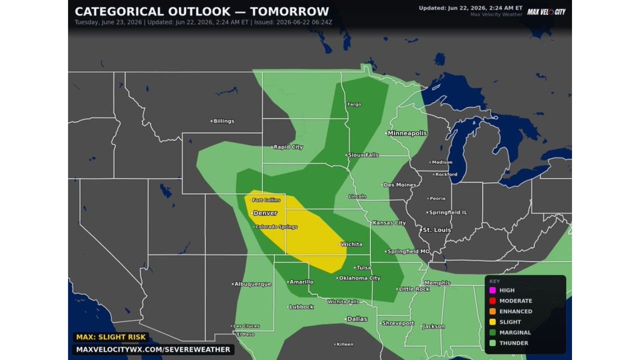
Slight Risk Covers Denver Through Oklahoma City Corridor
A Slight Risk has been outlined stretching from Fort Collins and Denver through Colorado Springs, Wichita, Tulsa, and just north of Oklahoma City. A broader Marginal and Thunder risk extends across the Plains from the Dakotas through Nebraska and into Missouri and Kansas City as the active pattern continues into Tuesday.
Stay with GordonRamsayClub.com for the latest updates.

Leave a Reply