
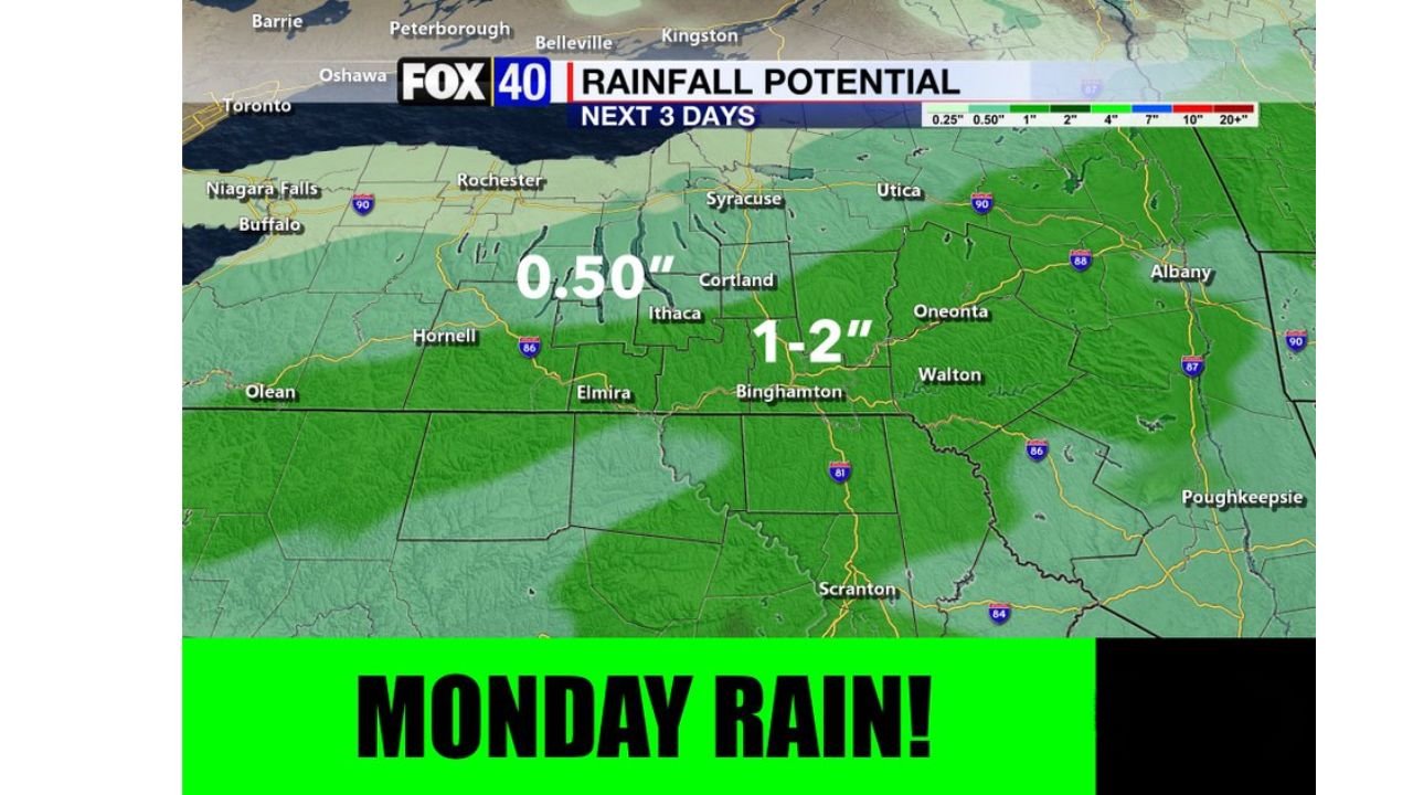
BINGHAMTON, N.Y. — Rain may be heavy at times Monday across the Southern Tier of New York and northeast Pennsylvania, with rainfall potential reaching 1 to 2 inches in Binghamton, Oneonta, Walton, and Scranton, while areas farther west near Ithaca and Cortland see closer to a half inch over the same three day period.
Heaviest Rain Targets Southern Tier and Binghamton Area
The highest rainfall totals of 1 to 2 inches are expected across the Southern Tier of New York, including Binghamton, Oneonta, and Walton, with the heavier band extending south into northeast Pennsylvania near Scranton. This corridor stands out as the focal point for Monday’s heaviest rainfall.
Lighter Totals Expected to the West
Areas farther west, including Hornell, Olean, and parts of the Finger Lakes region near Ithaca and Cortland, are expected to see lighter totals around half an inch. Rainfall amounts taper off noticeably moving away from the Southern Tier corridor toward western New York.
Three Day Rainfall Outlook Covers Broad Stretch
The three day rainfall outlook covers a wide swath of central and southern New York into northeast Pennsylvania, with totals generally ranging from a quarter inch up to 2 inches depending on location. Cities including Rochester, Syracuse, Utica, and Albany sit mostly outside the heaviest rain corridor but could still see lighter accumulations.
Monday Identified as Main Rain Day
Monday has been identified as the primary day for rain across the region, with the potential for heavy downpours at times. Residents across the Southern Tier of New York and northeast Pennsylvania are encouraged to plan for wet conditions heading into the start of the week.
Stay with GordonRamsayClub.com for the latest updates.

Leave a Reply