
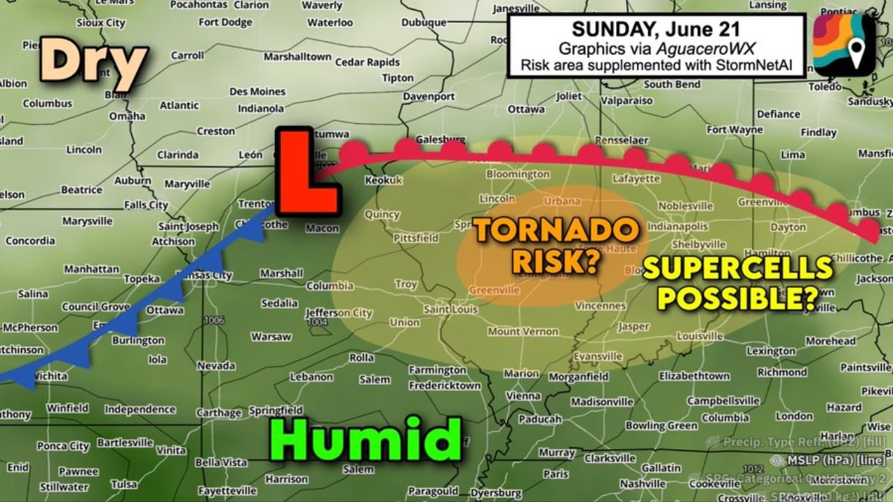
SPRINGFIELD, ILL. — Sunday, June 21 will unfortunately feature another tornado risk in the same hard hit parts of Illinois that have already dealt with back to back tornado outbreaks.
Strengthening Surface Low to Bring Warm Front North
Machine learning guidance, along with both the NAM and ECMWF models, is hinting at the strengthening of a surface low in northern Missouri. That low will lift a warm front north into central Illinois and Indiana, reintroducing a warm, moisture rich air mass and ample thunderstorm fuel.
Added Helicity and Vorticity Raise Tornado Chances
Additional helicity along the warm front, combined with extra vorticity from the approaching surface low, means a couple of tornadoes will be possible Sunday. Forecasters say it is too early to determine exact strength, but are currently leaning toward lower end tornadoes in the EF0 to EF1 range, not as significant as earlier in the week.
Hail Not Expected to Be a Major Concern
Hail is not expected to be a big concern with this system. If hail does occur, it will likely top out around half dollar size, with nothing larger anticipated from any of the storms.
Morning Storms Could Limit Afternoon Risk
One wildcard remains the potential for morning storms to use up some of the available instability, which could reduce the afternoon severe threat. That outcome is still uncertain.
Forecasters say the tornado risk is increasing heading into Sunday, which also happens to be Father’s Day, and are urging residents across central Illinois and Indiana to stay weather aware.
Stay with GordonRamsayClub.com for the latest updates.

Leave a Reply