
ST. LOUIS, MISSOURI — A significant tornado and severe weather outbreak is possible Wednesday June 17 across northern Missouri into central Illinois, with the Euro model showing an incredibly strong polar jet stream for this time of year as a crazy trough ejection is forecast to unleash across the Corn Belt during the same valid period flagged in earlier outlooks.
Euro 500mb Winds Show Extreme Polar Jet Stream for Mid-June
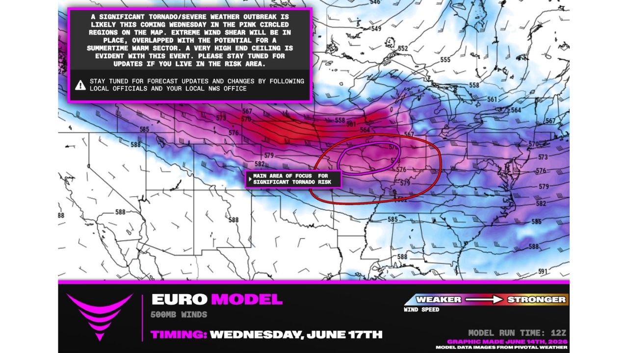
The Euro model 500mb winds analysis for Wednesday June 17 shows an extraordinarily strong polar jet stream pushing across the central United States, with the strongest wind speeds shown in red and magenta indicating values well above what’s typical for mid-June. The main area of focus for significant tornado risk is circled in red, centered over northern Missouri and extending into central Illinois.
A purple inner circle within the main focus area highlights the zone of greatest concern, where extreme wind shear overlaps with the potential for a summertime warm sector to develop ahead of the ejecting trough.
Extreme Wind Shear Overlapping With Summertime Warm Sector
Forecasters are highlighting the combination of extreme wind shear with the potential for a summertime warm sector as the key concern driving Wednesday’s significant tornado outbreak potential. This overlap creates a very high-end ceiling for severe weather outcomes, a combination not commonly seen this late in the season.
The incredibly strong polar jet stream positioned across the northern tier of the country is the driving force behind the trough ejection forecast to unleash across the Corn Belt on Wednesday.
Same Areas From Northern Missouri Into Central Illinois Remain in Focus
This outlook continues to identify the same general areas flagged in previous days, with northern Missouri into central Illinois remaining the main focus for significant tornado risk Wednesday. Forecasters describe themselves as watching this setup extremely closely given the rare nature of the ingredients coming together for mid-June.
Residents across northern Missouri and central Illinois should follow updates from local officials and the National Weather Service closely as Wednesday approaches and this forecast continues to evolve.
Stay with GordonRamsayClub.com for the latest updates.

Leave a Reply