
BALTIMORE, MARYLAND — The atmosphere over Maryland is primed for explosive storm development over the next several days, with the RRFS Experimental 3km model showing substantial surface-based CAPE values valid at 18z Thursday June 11 across the region and strong storm potential in play each afternoon from today through Friday.
RRFS Model Shows High CAPE Values Across Maryland
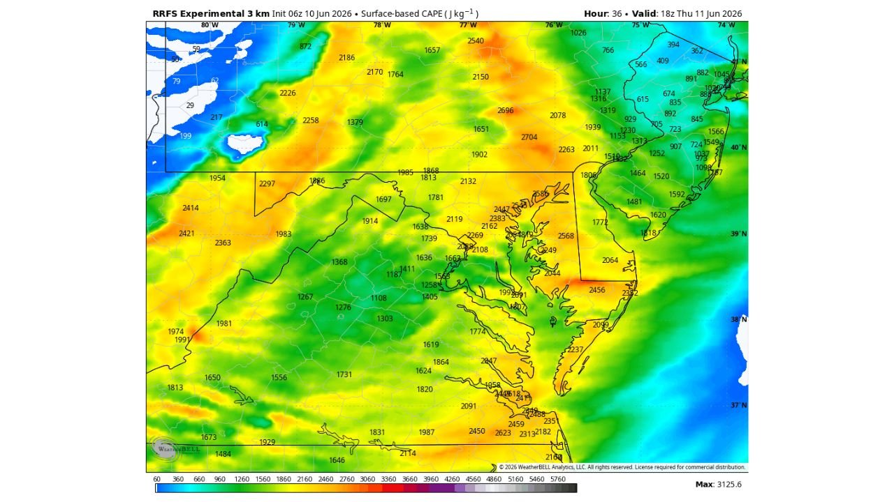
The RRFS 3km surface-based CAPE analysis initialized at 06z June 10 shows values ranging broadly from 1,500 to 2,500-plus J/kg across central and eastern Maryland valid Thursday afternoon. The highest values on the map approach 2,568 J/kg near the eastern shore corridor, with the western portions of the state running in the 1,200 to 1,900 J/kg range.
CAPE in this range is more than sufficient to support strong to severe thunderstorm development on any afternoon where sunshine can destabilize the boundary layer and a triggering mechanism is present.
Three Day Window of Storm Potential Wednesday Through Friday
Forecasters are highlighting Wednesday, Thursday, and Friday afternoons as each carrying individual storm potential across Maryland. The key ingredients needed are sunshine to act as fuel and a lifting mechanism to get air rising within the unstable atmosphere.
While no outcome is guaranteed, the atmospheric setup across the state is described as primed for big storm development on any of the three days when those ingredients come together.
Eastern Shore Carries Highest Instability Values
The RRFS data places the most intense CAPE values across the eastern shore of Maryland and into coastal Delaware, where readings push toward and above 2,500 J/kg. These elevated instability values along the coast could support particularly intense storm activity if storms develop in that corridor during peak afternoon heating Thursday.
Residents across all of Maryland should remain weather-aware through Friday and monitor updated forecasts each morning before outdoor afternoon plans.
Stay with GordonRamsayClub.com for the latest updates.

Leave a Reply