
CONCORDIA, KANSAS — An increasing and focused tornado threat is developing across northeast Kansas today Thursday June 4, 2026, as a mesoscale convective vortex positioned near Smith Center is tracking eastward and enhancing low-level spin across the Concordia to Marysville corridor, creating the potential for brief EF0 to EF1 tornadoes during the afternoon hours.
MCV Tracking Toward Northeast Kansas Enhancing Low Level Spin Near Concordia and Marysville
Thursday June 4 at 11:00 AM observations show a well-defined mesoscale convective vortex positioned near Smith Center in north-central Kansas and tracking northeast toward the Concordia and Marysville corridor. The MCV is generating a concentrated area of vorticity and low-level spin clearly visible on AguaceroWX graphics, with the rotating circulation centered directly over the Smith Center area and moving toward the northeast into the primary tornado threat zone. This remnant swirl from overnight convective activity is the key driver behind the increasing tornado potential across northeast Kansas today.
EF0 to EF1 Tornado Possible as MCV Interacts with Instability Field
The MCV is moving into a zone of rich instability across north-central and northeast Kansas, where storm fuel values are clearly elevated on AguaceroWX instability graphics for Thursday June 4. The combination of the MCV-enhanced low-level spin interacting with the available instability creates a favorable environment for brief tornado development, with EF0 to EF1 intensity the most probable range if tornadoes do occur. The Concordia to Marysville corridor sits directly in the path of the approaching MCV circulation and represents the highest risk zone for brief tornado activity during the afternoon hours.
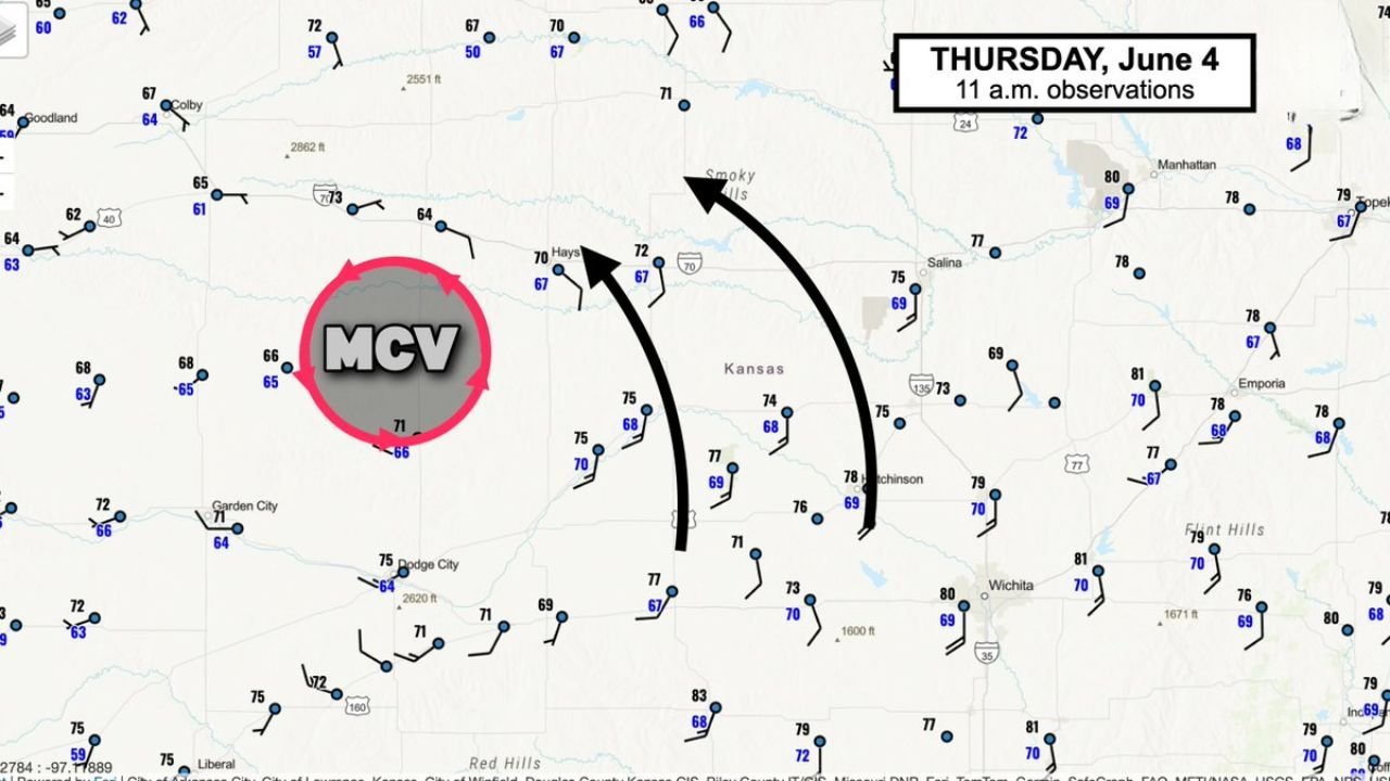
11AM Observations Show MCV Circulation Clearly Defined West of Hays Tracking Northeast
Surface observations at 11:00 AM Thursday June 4 show the MCV positioned west of Hays with a clear cyclonic circulation pattern visible on the observation map. Wind flow across the region is converging into the MCV center, with the circulation tracking northeast toward the Smoky Hills region and directly into the northeast Kansas corridor. The well-organized nature of the MCV at the 11:00 AM observation time increases confidence in the tornado threat materializing across the Concordia to Marysville zone during the afternoon hours.
Northeast Kansas Residents From Concordia to Marysville Should Be Alert This Afternoon
With an increasing EF0 to EF1 tornado threat specifically highlighted for the Concordia to Marysville corridor, residents across northeast Kansas should remain closely connected to local NWS Hastings and Topeka forecast updates throughout Thursday afternoon and have shelter plans ready to execute immediately if tornado warnings are issued in their area.
Stay with GordonRamsayClub.com for the latest updates.

Leave a Reply