
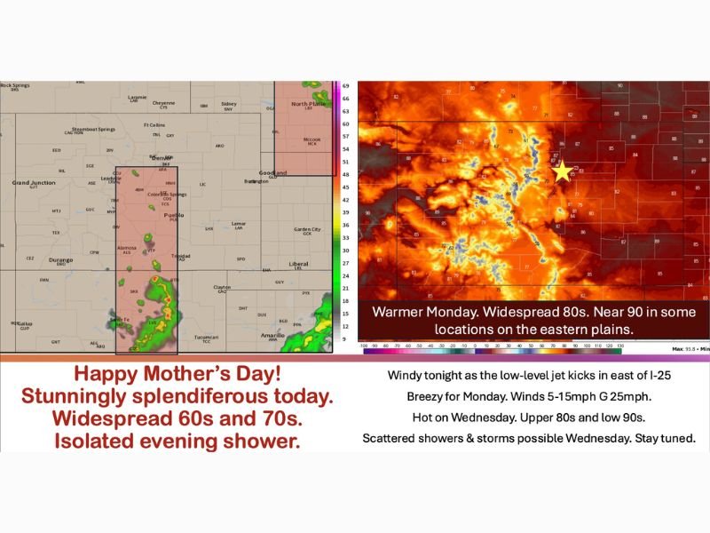
DENVER AND FRONT RANGE, COLORADO — Mother’s Day is shaping up to be a spectacular and largely pleasant day across Denver and the Front Range, with widespread temperatures in the 60s and 70s and light variable winds making for comfortable outdoor conditions statewide. Low 80s are expected on the Western Slope today. Only a small risk of isolated afternoon and evening showers exists after 4 PM west of Interstate 25, focused over the southern foothills, the rim of the San Juans, Sangre de Cristos, the Wet Mountains, and the Rampart Range, while most of the region will see no rain at all today.
Today’s Mother’s Day Weather
The vast majority of Colorado residents will enjoy a quiet and pleasant Mother’s Day with no rain and comfortable temperatures ranging from the 60s and 70s across the Denver metro and Front Range corridor. Low 80s are expected across the Western Slope, making for ideal outdoor conditions across most of the state throughout the day.
The only rain risk today is a small and isolated shower chance after 4 PM, confined primarily west of Interstate 25 over the southern mountain terrain including the foothills, San Juan rim, Sangre de Cristos, Wet Mountains, and Rampart Range. A small cluster of showers is also possible up in portions of Nebraska around North Platte, but that activity will have minimal impact on Colorado residents.
Significant Warmup Coming Monday
High pressure building into the region starting Monday will crank temperatures significantly higher across Colorado and the eastern plains. Widespread 80s are expected Monday across the region with a few low 90s possible across the eastern plains. Winds will also be breezy Monday with speeds of 5 to 15 mph and gusts reaching up to 25 mph throughout the day.
The eastern plains near Burlington and surrounding communities are highlighted as the hottest spots for Monday with temperatures approaching 90 degrees as the heat builds in behind the high pressure system.
Tuesday Through Wednesday Outlook
Tuesday brings a slight cooldown across the northern half of the region with upper 70s and low 80s, while far southern Colorado and Kansas hold onto upper 80s and low 90s. Wednesday sees the heat crank back up into the upper 80s and low 90s again, but a risk of scattered showers and thunderstorms capable of gusty winds and lightning also develops Wednesday, though significant rainfall is not expected with those storms at this stage.
Beyond Wednesday Remains Uncertain
Long range forecast models are showing significant disagreement beyond Wednesday, with some guidance keeping showers and thunderstorms around heading into next weekend while other models attempt to dry conditions out. Residents across the Denver and Front Range area are advised to monitor updated forecasts through the week as the pattern becomes clearer heading into the following weekend. Stay with GordonRamsayClub.com for the latest updates.

Leave a Reply