
LOUISVILLE, KY. — A significant forecast change is underway this afternoon as the atmosphere over parts of Kentucky, Indiana, and Illinois is becoming noticeably more unstable than models expected, with real time CAPE measurements surging well beyond what the 12z HRRR run indicated, raising the potential for a stronger and more impactful storm line punching through the Missouri and Ohio Valleys tonight and into the overnight hours.
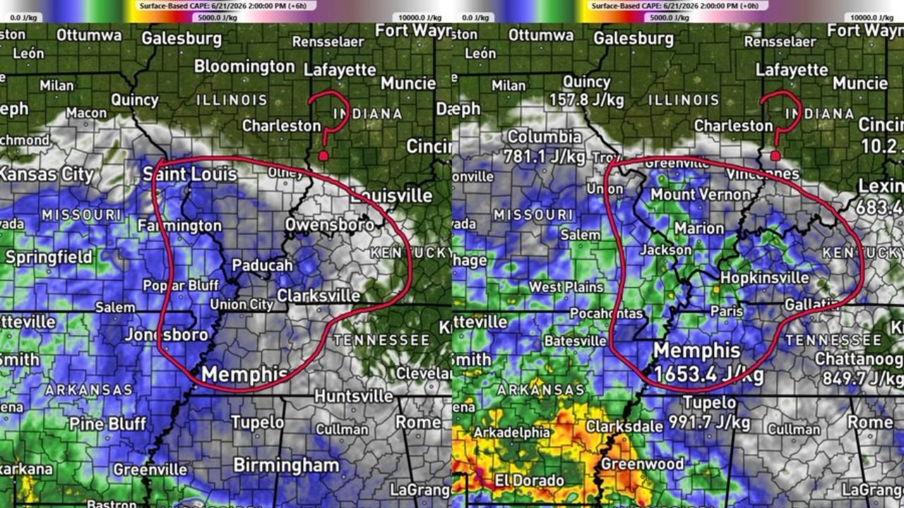
HRRR Underestimating Instability Across the Region
Comparing the 12z HRRR run to the newest model run at hour zero reveals the environment is significantly more unstable than forecast data indicated earlier today. Real time surface based CAPE measurements are running well above model guidance across the highlighted corridor, a critical development that could enhance tonight’s storm potential considerably.
CAPE Values Surging Well Above Model Guidance
Real time CAPE measurements are showing dramatically higher values than models anticipated, with Columbia, Missouri reading 781.1 J/kg, Mount Vernon, Illinois at 683.4 J/kg, and Memphis, Tennessee surging to 1,653.4 J/kg. Values near Chattanooga are also running at 849.7 J/kg, indicating a broad zone of elevated instability across the region heading into the evening hours.
Increased Storm Fuel Could Power Tonight’s Line
This increased storm fuel could help the developing storm line pack a more significant punch as it moves through the Missouri and Ohio Valleys this evening into the overnight hours. Forecasters say the excess instability beyond what models expected raises the ceiling on storm intensity for tonight’s round.
Missouri and Ohio Valleys Urged to Stay Alert Tonight
Residents across the Missouri and Ohio Valleys, including communities near St. Louis, Louisville, Paducah, Memphis, and surrounding areas, are urged to stay weather aware heading into tonight as this evolving instability picture continues to be monitored in real time.
Stay with GordonRamsayClub.com for the latest updates.

Leave a Reply