
SALINA, KANSAS — Initial supercells are expected to fire across Kansas and Nebraska between 3 and 6 PM Saturday June 13, with the AguaceroWX graphic showing a focused supercell development zone centered near Salina, Great Bend, Lincoln, and Topeka before storms merge into one or more windy lines and clusters sagging southeast through the overnight hours.
Supercells Expected to Fire Between 3 and 6 PM Across Kansas and Nebraska
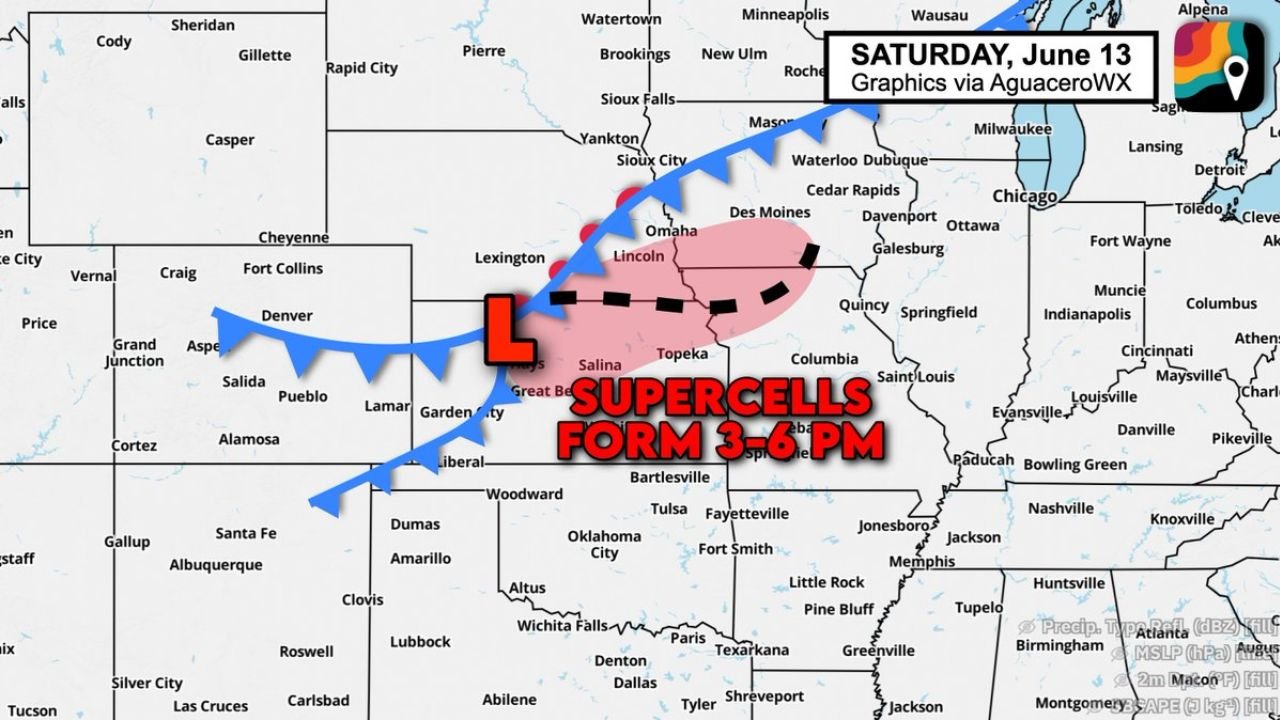
The AguaceroWX Saturday June 13 graphic places the initial supercell formation zone in pink across central Kansas and southern Nebraska, centered near Salina, Great Bend, Topeka, and Lincoln. The 3 to 6 PM timeframe represents the primary discrete supercell window when tornado and hail risk will be at their highest before storm mode begins to transition.
A surface low pressure system is positioned across the central Kansas corridor, providing the lift and wind shear convergence needed to initiate and organize supercell development during the afternoon heating hours.
Tornado and Hail Risk Highest During Discrete Supercell Phase
The initial supercell phase between 3 and 6 PM carries the most significant tornado and hail potential of Saturday’s event across Kansas and Nebraska. Discrete supercells operating ahead of the developing line can produce large hail and tornadoes more efficiently than the linear storm mode expected to take over later tonight.
Communities across Salina, Topeka, Lincoln, Omaha, and the surrounding central plains corridor should treat the 3 to 6 PM window as the peak life-safety period for Saturday’s severe weather.
Storms Merge Into Windy Lines and Clusters Tonight Sagging Southeast
As the afternoon progresses into Saturday evening, individual supercells are expected to merge into one or more organized windy lines and storm clusters that will sag southeast through the overnight hours. This transition shifts the primary hazard from tornadoes and hail toward widespread damaging straight-line winds across a broader corridor including Missouri, Iowa, and Illinois.
Residents across the entire zone from Kansas City through Des Moines and into St. Louis should remain weather-aware well into Saturday night as the storm complex continues its southeast push.
Stay with GordonRamsayClub.com for the latest updates.

Leave a Reply