
CEDAR RAPIDS, IOWA — An MCS moving rapidly eastward through Iowa Thursday morning is setting the stage for an intense and very dangerous tornado threat across eastern Iowa and northern Illinois this afternoon, with the greatest tornado risk now focused on the Cedar Rapids corridor and points east toward Rockford and Chicago as the storm system continues its eastward track.
MCS Tracking Eastward With Little Northward Progress
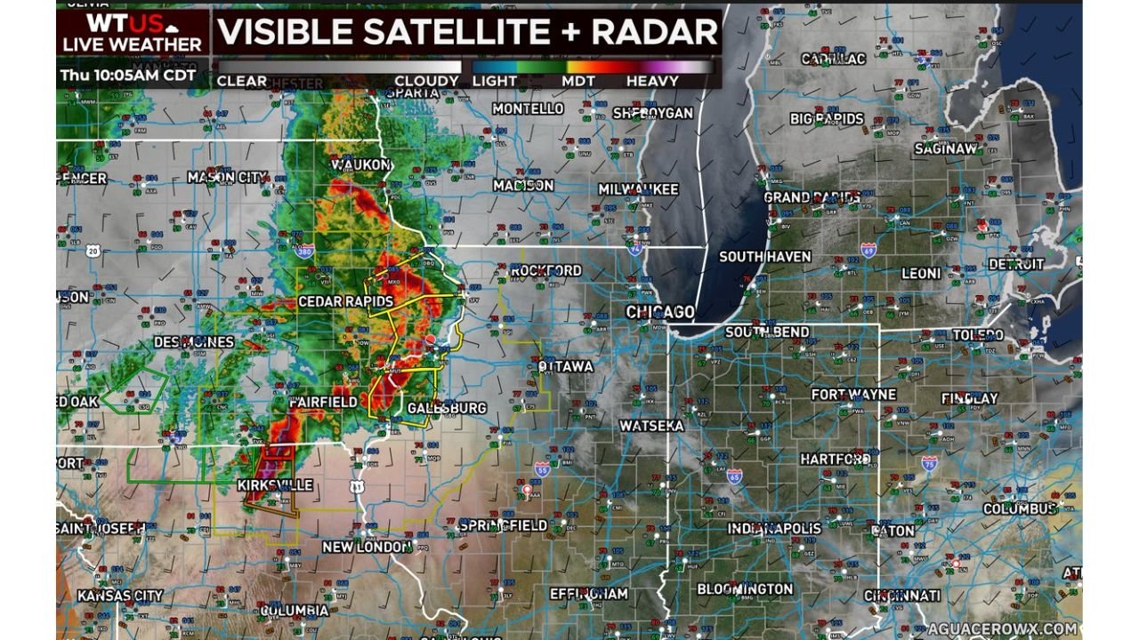
The WTUS Live Weather visible satellite and radar image valid Thursday 10:05 AM CDT shows the MCS concentrated across eastern Iowa with heavy precipitation returns centered near Cedar Rapids, Fairfield, and Galesburg. The storm system has been moving at a quick pace but has made very little northward progress, keeping the most intense activity focused along an east-southeast track.
That eastward motion is shifting the greatest tornado threat away from northern areas where more stable conditions are becoming established, and concentrating it across eastern Iowa and northern Illinois into the afternoon hours.
Greatest Tornado Threat Focused on Eastern Iowa and Northern Illinois
Forecasters are now pinpointing eastern Iowa and northern Illinois as the primary corridor for intense and very dangerous tornado development this afternoon. The stabilization of northern areas due to the MCS track means the tornado threat is becoming more geographically focused rather than spread across the broader risk zone.
Wind and hail hazards remain the dominant concern for northern portions of the risk area where stability is increasing, but the tornado threat across the eastern Iowa and northern Illinois corridor remains high-end and life-threatening.
Residents Must Be Ready for Rapid Tornado Development This Afternoon
The combination of the eastward-tracking MCS clearing the atmosphere and afternoon reheating behind it creates the window for intense tornado-capable supercells to develop across eastern Iowa and northern Illinois during the afternoon hours. Conditions can change rapidly in this type of setup.
Residents across Cedar Rapids, Rockford, Galesburg, and the Chicago metro should maintain active weather alerts and be prepared to shelter immediately as the afternoon storm window opens.
Stay with GordonRamsayClub.com for the latest updates.

Leave a Reply