
KANSAS CITY, MISSOURI — A multi-day severe weather and flooding outbreak is unfolding across the central United States through this weekend, as SPC Day 1, Day 2, and Day 3 Categorical Outlooks all issued June 5, 2026 show consecutive Slight Risk zones targeting the central Plains, Midwest, and Mid-Mississippi Valley corridor with large hail, damaging winds, isolated tornadoes, and flooding all possible through the weekend period.
Day 1 Friday Slight Risk Targets Nebraska and Iowa Corridor with All Hazards Possible
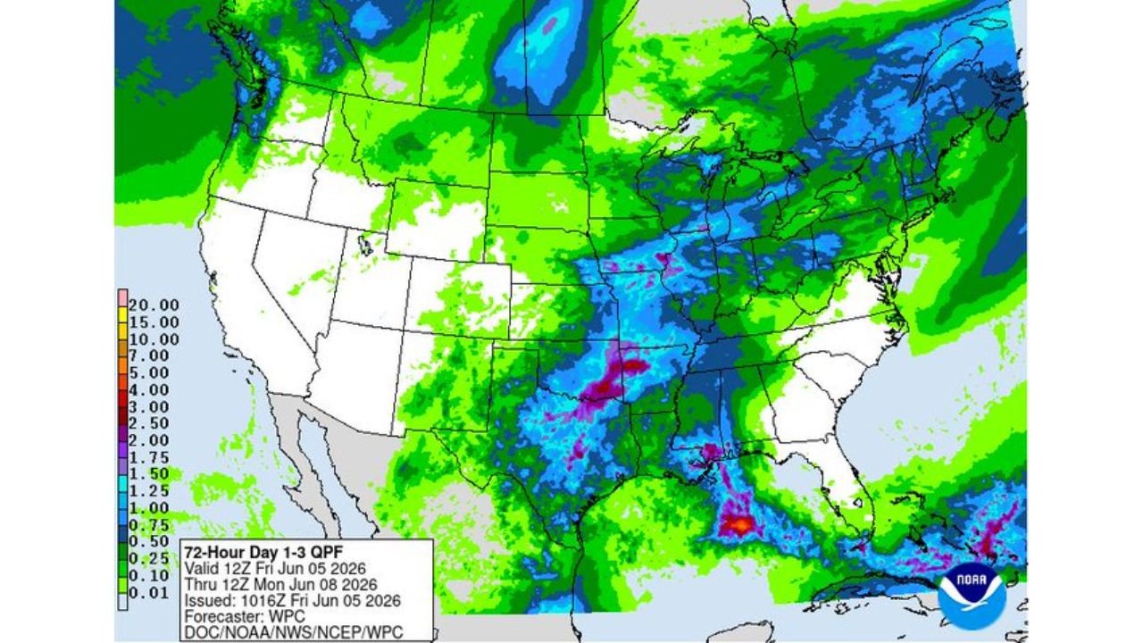
The SPC Day 1 Categorical Outlook issued 1200Z June 5, 2026 shows a Slight Risk zone concentrated across Nebraska and Iowa, with a broader Enhanced and Marginal Risk area surrounding the core threat zone. Large hail, damaging winds, and isolated tornadoes are all possible across the Day 1 threat corridor as numerous to widespread thunderstorms erupt during Friday afternoon and evening. The 72-hour QPF map shows heavy precipitation values stretching from the central Plains through Texas and into the Mid-Mississippi Valley, with the most intense rainfall totals concentrated in pink and blue colors across portions of Texas and the Gulf Coast region.
Day 2 Saturday Slight Risk Shifts East Toward Mid-Mississippi Valley and Ohio Valley
The SPC Day 2 Categorical Outlook issued 0536Z June 5, 2026 shows the Slight Risk zone shifting eastward toward the Mid-Mississippi Valley and Ohio Valley corridor for Saturday, with a broad Enhanced and Marginal Risk area accompanying the primary threat zone. The eastward progression of the severe weather setup indicates the storm system will continue tracking across the central and eastern United States through Saturday, maintaining large hail, damaging wind gusts, and isolated tornado potential as the primary hazards into the weekend.
Day 3 Sunday Slight Risk Consolidates Over Central Region as Flooding Threat Grows
The SPC Day 3 Categorical Outlook issued 0735Z June 5, 2026 shows a Slight Risk zone consolidating over the central region for Sunday, with a separate Marginal Risk area noted across the Southeast Gulf Coast states. Separately, thunderstorms with heavy to excessive rainfall moving from Texas northward into the Mid-Mississippi Valley through the weekend are expected to produce areas of flooding across the region, adding a significant flash flooding concern on top of the ongoing severe weather threat through Sunday.
Residents Across Central US Should Remain Weather Alert All Weekend Long
With three consecutive days of Slight Risk severe weather outlooks covering the central Plains, Midwest, and Mid-Mississippi Valley from Friday through Sunday June 5 to 7, 2026, residents across Nebraska, Iowa, Kansas, Missouri, and surrounding states face an extended period of dangerous weather requiring sustained alertness and preparedness throughout the entire weekend.
Stay with GordonRamsayClub.com for the latest updates.

Leave a Reply