
NORTH PLATTE, NEBRASKA — Scattered strong to severe storms are expected to fire this afternoon and evening across a significant stretch of the central plains, with the WTUS Live Weather Severe Outlook valid at 9:00 AM CDT Saturday May 30, 2026 placing a Level 2 Slight Risk zone covering a corridor from Rapid City, South Dakota through North Platte, Nebraska and down to Hutchinson, Kansas as storms develop along the dryline from West Texas to South Dakota by mid-afternoon.
Slight Risk Zone Covers Rapid City Through North Platte and Hutchinson Along the Dryline
The WTUS AguaceroWX Severe Outlook shows a yellow Level 2 Slight Risk zone concentrated across the central plains corridor stretching from Rapid City and Mitchell in South Dakota through North Platte in Nebraska and southward to Hutchinson, Kansas. This is the highest risk designation on today’s national outlook and places the greatest concentration of severe weather potential directly along and just east of the developing dryline boundary where storms are expected to fire by mid-afternoon.
A broader Marginal Risk zone surrounds the Slight Risk core and extends from Billings, Montana southward through Denver, Amarillo, and Oklahoma City, covering a wide multi-state area within the overall severe weather awareness footprint for today’s event.
Damaging Winds and Large Hail Are Primary Hazards With a Few Tornadoes Possible
Forecasters identify damaging winds and large hail as the two primary hazards expected from today’s severe storm complex across the Slight Risk zone. However a few tornadoes cannot be ruled out within the most organized supercell cells that develop along the dryline through the afternoon and evening hours, keeping the full spectrum of severe weather hazards active across the North Platte and Hutchinson corridor today.
The WTUS Future Radar valid at 6:00 PM CDT Saturday shows intense red and orange radar returns developing near Garden City, Kansas and extending toward Oklahoma City, with a separate area of activity firing near Lexington and the Omaha corridor, confirming that storm initiation is expected across multiple points along the dryline simultaneously during the peak afternoon heating window.
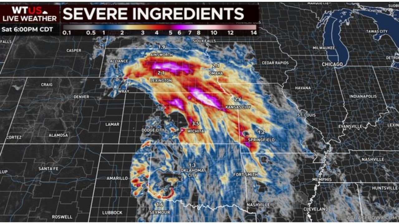
Severe Ingredients Map Shows 3.5 Composite Value Near Wichita at 6 PM
The WTUS Severe Ingredients map valid at 6:00 PM CDT Saturday shows the highest composite severe weather ingredient values concentrated near Wichita, Kansas where a value of 3.5 is depicted in deep pink shading. Additional elevated values of 2.6 near Kansas City, 2.1 near Omaha and Lexington, and 2.1 near Alliance confirm that the atmospheric ingredients necessary for organized severe convection are loaded across a broad stretch of the central plains during the primary storm window this afternoon and evening.
Residents across North Platte, Hutchinson, Wichita, Rapid City, and surrounding communities should have shelter plans ready and monitor local severe thunderstorm and tornado warnings closely through the Saturday evening hours.
Stay with GordonRamsayClub.com for the latest updates.

Leave a Reply