
SALT LAKE CITY, UTAH — A cool and closed upper-level low pressure system is tracking toward Utah late tonight into Friday, bringing a remarkable late May snowfall threat to the highest elevations of the Wasatch Range and Uinta Mountains, with some models suggesting pockets of up to a foot of snow possible across the high Uintas — an extraordinary accumulation for the final days of May.
High Uinta Mountains Could See Up to 12 Inches in Pockets According to Some Models
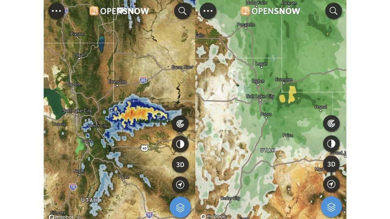
The most significant snowfall potential from this closed low event is concentrated across the high elevations of the Uinta Mountains, where some models are projecting pockets of snowfall accumulation reaching up to one full foot in the most elevated terrain. The OpenSnow radar imagery shows an intense precipitation core displayed in orange and red shading directly over the Ashley National Forest and high Uinta terrain, with blue shading extending outward across a broader zone of the Uinta Basin and surrounding mountain terrain.
This level of snowfall accumulation in late May is highly unusual even for Utah’s highest mountain ranges and represents a significant backcountry hazard for anyone venturing into the high Uinta wilderness area tonight through Friday.
Wasatch Range Including Areas Near Salt Lake City and Heber City Also in Snow Footprint
Beyond the high Uintas, the broader OpenSnow precipitation map shows green shading covering a wide area of northern and central Utah including the Wasatch Front corridor near Salt Lake City, Ogden, Logan, Heber City, and Provo. The yellow shading concentrated near the Evanston and high Uinta zone on the snowfall accumulation map confirms the heaviest totals will remain focused on the highest terrain east of Salt Lake City.
Several inches of snow are possible across the upper Wasatch elevations, with lower elevation areas around Salt Lake City and the populated Wasatch Front corridor likely seeing the event primarily as rain or a rain and snow mix rather than accumulating snowfall.
Closed Low Bringing Rare Late May Mountain Snow Event to Utah Backcountry
The closed low pressure system responsible for this late May snow event is the key atmospheric driver, as closed lows trap cold air effectively and can produce significant precipitation totals even during the late spring period when snowfall at elevation is uncommon but not unprecedented across the Wasatch and Uintas.
Anyone planning backcountry hiking, camping, or recreation in the high Uinta Mountains or upper Wasatch elevations tonight through Friday should be fully prepared for winter-like conditions including heavy wet snow, reduced visibility, and potentially hazardous trail conditions.
Stay with GordonRamsayClub.com for the latest updates.

Leave a Reply