
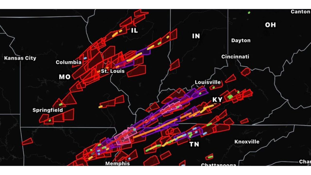
ST. LOUIS, MISSOURI — A newly developed and highly anticipated weather tool has gone live, with Stupercell releasing the Refined NWS Damage Assessment Toolkit, an independently created platform that is already drawing significant attention from the meteorological and storm chasing community for its detailed visualization of storm damage tracks across multiple states.
Refined NWS DAT Launches as a Non-Official but Powerful Storm Track Visualization Tool
The Refined NWS Damage Assessment Toolkit, developed by Stupercell and noted as not an official government product, has officially launched and is now accessible to the public. The tool pulls from NWS damage assessment data and presents it in a visually refined and more user-friendly format than existing official platforms, making it easier for researchers, storm chasers, meteorologists, and weather enthusiasts to analyze storm track data across the country.
The launch has been described by its creator as a highly anticipated release that the weather community has been requesting for some time, with the developer noting they had been posting about it for a while before finally making it available to all users.
Storm Track Visualization Shows Dense Damage Paths Across Missouri, Illinois, Kentucky and Tennessee
The map visible in the post showcases the toolkit’s capabilities in striking fashion, displaying a dense web of storm damage tracks rendered in red, orange, yellow, purple, and green across a multi-state corridor covering Missouri, Illinois, Indiana, Kentucky, and Tennessee. The visualization shows numerous storm paths cutting across the St. Louis, Louisville, Memphis, and Springfield areas with remarkable geographic detail.
The color-coded tracks allow users to distinguish between different storm events, intensities, and damage corridor widths at a glance, providing a level of visual clarity that makes historical storm pattern analysis significantly more accessible than raw NWS data alone.
Tool Fills an Important Gap in Publicly Available Storm Damage Visualization
The Refined NWS DAT fills a meaningful gap in the publicly available suite of weather tools by presenting official NWS damage assessment data in a cleaner and more interpretable visual format. While it carries a clear disclaimer that it is not an official government product, its foundation in real NWS assessment data gives it credibility and practical value for anyone studying severe weather impacts across the United States.
Stay with GordonRamsayClub.com for the latest updates.

Leave a Reply