
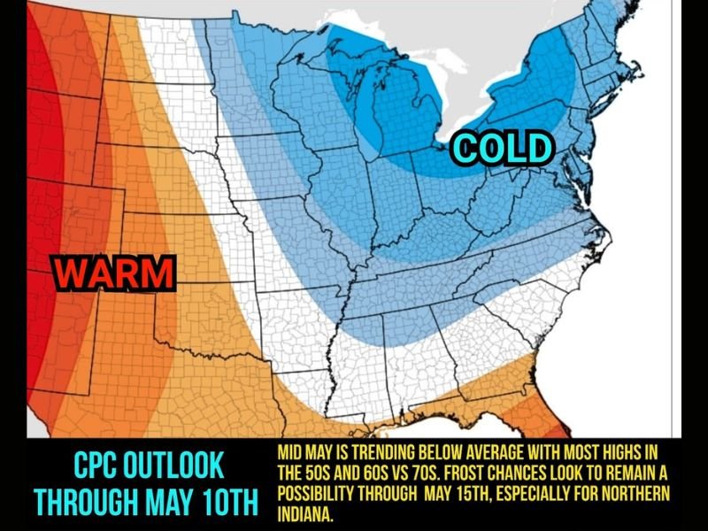
INDIANA AND MIDWEST — Below average temperatures are locked in across Indiana and the broader Midwest region for the next 10 plus days, with meteorologists confirming that 50s and 60s will be far more common than 70s across much of Indiana through mid May. The CPC Outlook through May 10th shows a large cold dome firmly established over the Great Lakes and Midwest region, and frost chances are expected to remain a real possibility through May 15th, especially across Northern Indiana.
How Cold Will It Get
Temperatures across Indiana and surrounding Midwest states are expected to stay well below average through the mid May period, with most daily highs landing in the 50s and 60s rather than the seasonably appropriate 70s that would normally be expected for this time of year. The persistent cold pattern shows little sign of breaking before mid May, keeping residents and farmers alike dealing with below normal conditions for an extended stretch.
Frost Risk Not Over Yet
Despite being well into May, frost remains a genuine threat across the region. Meteorologists confirmed that additional frost risks are possible into next week, with Northern Indiana carrying the highest exposure to freezing temperatures during the overnight and early morning hours. The frost risk is expected to linger as a concern through approximately May 15th before the pattern eventually begins to shift.
Residents with gardens, landscaping, or sensitive outdoor plants should take precautions to protect vegetation from potential frost damage during this extended cold stretch through mid May.
Agricultural Impacts Are a Real Concern
The prolonged cold pattern carries meaningful consequences for Indiana’s agricultural sector. Frost events during this period can directly damage emerging crops, while persistently cold soils are expected to slow germination rates across farmland throughout the state. Farmers across Northern Indiana in particular are being urged to monitor conditions closely as additional frost events remain possible into next week.
The combination of frost risk and cold soil temperatures creates a challenging environment for spring planting operations that are typically well underway by this point in the season.
When Will Warmer Weather Return
Relief from the below average temperature pattern is not expected until around mid May, when a pattern flip is anticipated to allow warmer air to build back into the Midwest. Until that shift occurs, Indiana and surrounding states should plan for continued cool and potentially frosty conditions through the next 10 plus days. Stay with GordonRamsayClub.com for the latest updates.
Leave a Reply