
INDIANAPOLIS, IND. — With an active severe weather pattern in full swing and showing little signs of letting up, forecasters say Monday evening, June 22, through Wednesday evening, June 24, is shaping up to be a mostly dry break across the Ohio Valley, with only a bit of drizzle expected Wednesday.
Dry Window Offers Break From Active Pattern
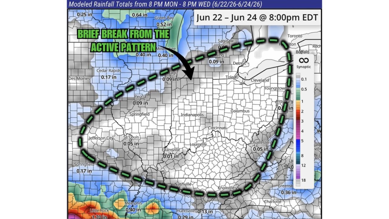
The dry stretch marks a brief break from the active pattern that has brought repeated rounds of severe weather to the region in recent days. Modeled rainfall totals from 8 p.m. Monday through 8 p.m. Wednesday show most of the Ohio Valley staying under a quarter inch of rain, with many areas seeing well under a tenth of an inch.
Indianapolis, Cincinnati, Louisville Among Driest Spots
Cities including Indianapolis, Cincinnati, Columbus, and Louisville are expected to see some of the lightest rainfall totals during this window, generally staying dry through the period. Areas farther north, including Chicago, Milwaukee, and Detroit, are also expected to stay mostly dry, with only light totals around a tenth of an inch.
Good Window for Outdoor Work or Spraying
Forecasters say residents needing to get outdoor work done or planning to spray fields now have their chance during this stretch. The dry gap is expected to hold across most of the Ohio Valley before the active pattern looks to return afterward.
Heavier Rain Stays South of the Region
While the Ohio Valley stays mostly dry, heavier rainfall totals are expected to remain south of the region, with areas including Little Rock and Memphis seeing totals over an inch and a half during the same period. Forecasters say they will continue tracking this dry gap closely as the pattern evolves heading into next week.
Stay with GordonRamsayClub.com for the latest updates.

Leave a Reply