
CHICAGO, ILLINOIS — A volatile assemblage of severe weather ingredients is in place across the upper Midwest and Ohio Valley Thursday afternoon June 11, with robust wind shear through multiple atmospheric layers creating favorable conditions for significant tornado and severe storm development despite some limiting factors in the mid-levels.
Multi-Layer Wind Shear Profile Highly Favorable for Tornadoes
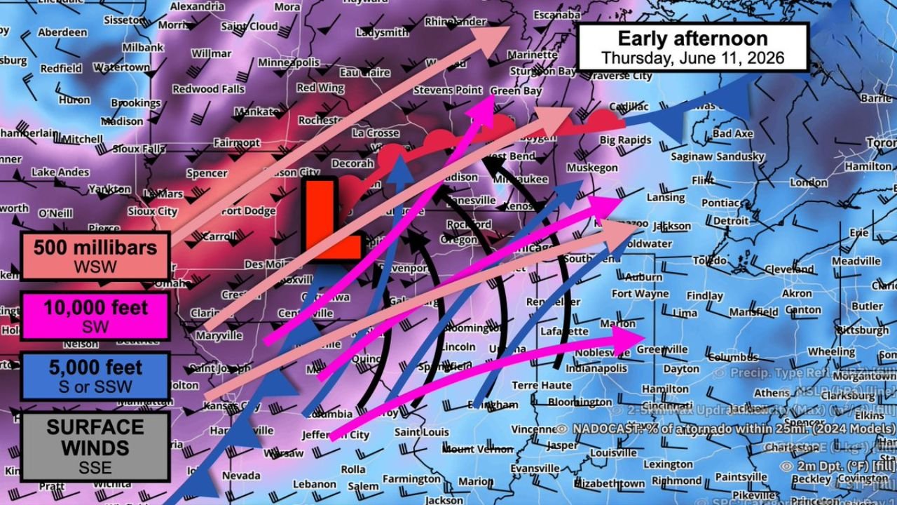
The NADOCAST wind profile graphic valid early afternoon Thursday June 11 shows a classic tornado-favorable shear setup across northern Illinois, Iowa, and Indiana. Surface winds are tracking from the south-southeast, backing to southerly and south-southwest at 5,000 feet, then shifting to southwest at 10,000 feet, and veering further to west-southwest at 500 millibars.
This type of directional wind shear with height is one of the primary ingredients forecasters look for when assessing tornado potential. The robust change in both wind speed and direction through the atmospheric column is providing plentiful rotational fuel for any storms that can organize into supercell mode this afternoon.
Warm Humid Mid-Levels Remain the Key Limiting Factor
Despite the favorable shear profile, forecasters are flagging warm and humid mid-levels as a potential limiting factor for Thursday’s setup. Those warm mid-levels could slow updraft development and push convection toward a blobbier, messier high-precipitation storm structure rather than discrete organized supercells.
If storm mode trends toward a squall line or disorganized convection, the tornado threat would decrease while the damaging wind threat increases across the same corridor.
Tornado Probabilities Elevated Across the Chicago and Rockford Corridor
The underlying NADOCAST tornado probability shading shows elevated values concentrated across northern Illinois and into southern Wisconsin, with the Chicago, Rockford, Janesville, and Madison corridor sitting within the highest probability zone on the afternoon update.
Residents across northern Illinois and the surrounding region should remain weather-alert through the afternoon and evening hours as this volatile parameter space continues to evolve Thursday.
Stay with GordonRamsayClub.com for the latest updates.

Leave a Reply