
CEDAR RAPIDS, IOWA — A Level 3 tornado setup is taking shape for Wednesday across eastern Iowa, with forecasters identifying Cedar Rapids, Charles City, and Decorah as the single best corridor for tornado development during the afternoon and evening hours.
Supercell Window Opens Wednesday Afternoon
Storms are expected to fire as discrete supercells during the afternoon hours, driven by 50 to 60 knots of wind shear combining with a strengthening low-level jet aimed directly at eastern Iowa. That combination creates favorable conditions for organized, rotating thunderstorms capable of producing significant tornadoes before the convective mode transitions.
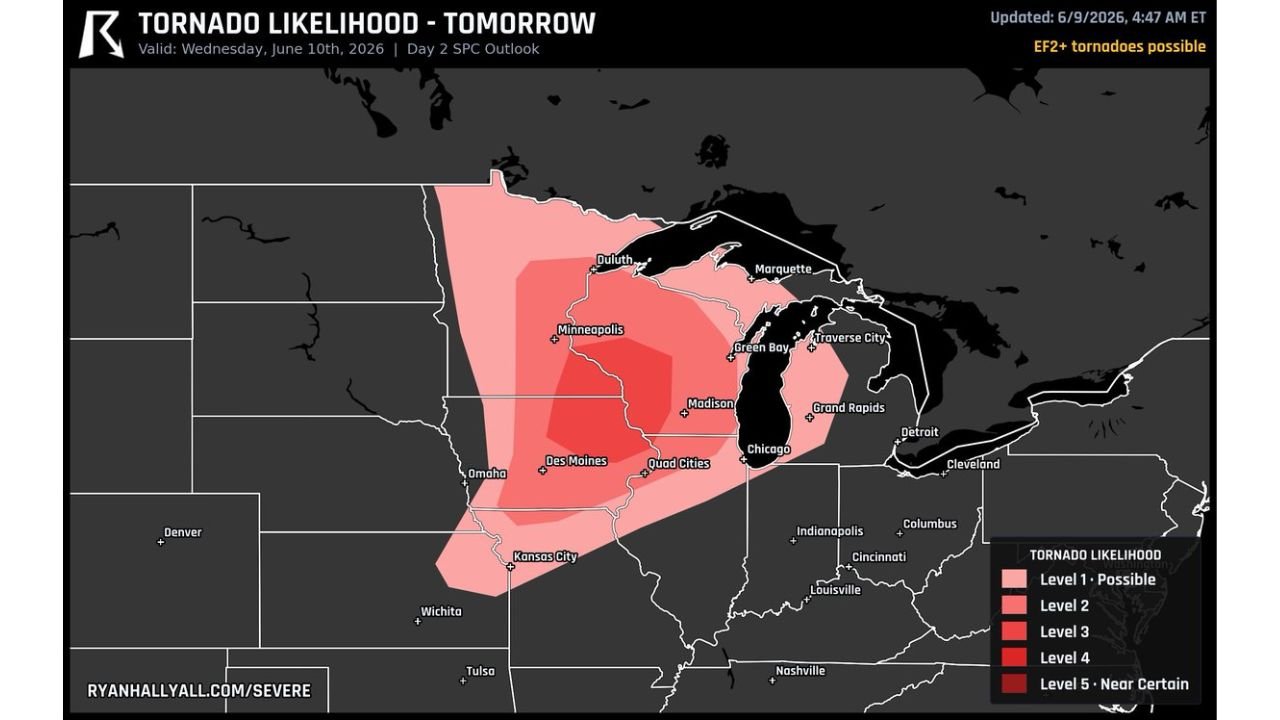
The Day 2 SPC Outlook valid Wednesday June 10 carries a Level 3 tornado likelihood across the region, with EF2-plus tornadoes explicitly possible within the highest-risk corridor centered on eastern Iowa.
EF2 Tornadoes Possible Before Line Takes Over
The critical window comes during the discrete supercell phase in the afternoon. The 50 to 60 knot shear profile paired with the low-level jet feeding into eastern Iowa gives individual storms the rotational potential needed to produce a few strong EF2-plus tornadoes.
Once the convective line consolidates and takes over, the threat shifts toward very large hail and damaging straight-line winds exceeding 75 mph across a broader swath of the region. Both phases of this event carry significant impact potential for communities across the corridor.
Broader Tornado Likelihood Zone Covers Upper Midwest
The tornado likelihood map shows Level 3 shading extending well beyond eastern Iowa, covering a broad zone that includes the Minneapolis metro, Des Moines, the Quad Cities, Madison, Wisconsin, and areas extending toward Chicago and Green Bay. Level 1 and Level 2 shading reaches from Omaha and Kansas City northward through the upper Midwest.
Residents across the entire highlighted zone should have a severe weather plan in place ahead of Wednesday. Those in the Cedar Rapids, Charles City, and Decorah corridor specifically should treat this as a high-end severe weather day and monitor watches and warnings closely through the afternoon.
Stay with GordonRamsayClub.com for the latest updates.

Leave a Reply