
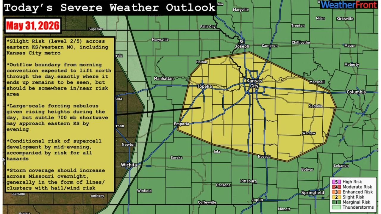
KANSAS CITY, MISSOURI — The Storm Prediction Center has outlined a Slight Risk (Level 2 of 5) across eastern Kansas and western Missouri today, May 31, 2026, with the Kansas City metro sitting directly within the primary risk zone as a conditional but dangerous severe weather setup takes shape for this evening.
SPC Issues Slight Risk Level 2 of 5 for Kansas City Metro and Surrounding Region
The WeatherFront severe weather outlook for May 31, 2026 places a concentrated Slight Risk zone covering a broad area from Topeka and Manhattan in the west through the Kansas City metro and eastward toward Sedalia and Columbia in Missouri. Communities including Saint Joseph, Holton, Emporia, Iola, Nevada, and Warsaw all fall within the outlined risk area. The surrounding region from Marysville to Springfield remains under a general Marginal Risk and thunderstorm threat throughout the day.
Outflow Boundary and Subtle Shortwave Creating Conditional Supercell Threat
A remnant outflow boundary from morning convection is expected to lift northward from the Kansas-Oklahoma border region throughout the day, with its exact position by evening remaining uncertain. A subtle 700 millibar shortwave may approach eastern Kansas by evening, potentially coinciding with this lifting boundary. Should supercells develop along this boundary by mid-evening, all severe hazards would be possible including large hail, damaging winds, and tornadoes.
Large Scale Forcing Remains Nebulous but Evening Timing Is Key
Large-scale height rises during the day are keeping the overall forcing environment nebulous and uncertain through the afternoon hours. However, forecasters note the conditional risk of supercell development increases significantly by mid-evening. Storm coverage is also expected to increase across Missouri overnight, generally organizing into lines and clusters carrying hail and wind risks as the system progresses eastward.
Residents in Kansas City Metro Should Stay Weather Aware Through Tonight
Given the conditional but potentially dangerous nature of this setup, residents across eastern Kansas and western Missouri should remain closely connected to local forecasts throughout the afternoon and evening. The situation could evolve rapidly once the shortwave approaches and the outflow boundary interacts with the evening environment.
Stay with GordonRamsayClub.com for the latest updates.

Leave a Reply