
WILMINGTON, OHIO — Multiple rounds of showers and thunderstorms are expected to develop across Ohio today, with the environment remaining favorable for locally heavy rainfall that could trigger isolated flooding issues, particularly south and east of the Interstate 71 corridor.
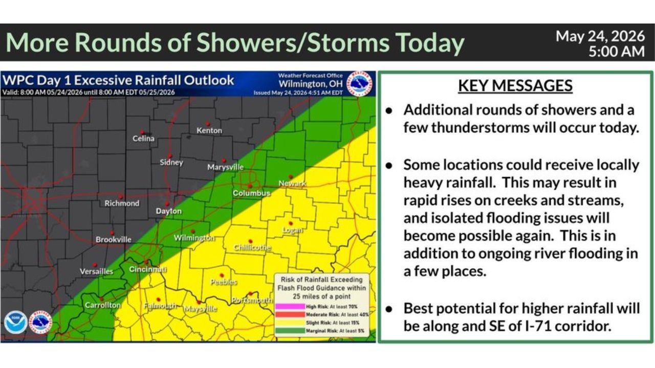
WPC Day 1 Excessive Rainfall Outlook Flags Slight to Marginal Risk Across Central and Southern Ohio
The Weather Prediction Center Day 1 Excessive Rainfall Outlook, valid from 8:00 AM EDT May 24, 2026 through 8:00 AM EDT May 25, 2026, has placed a Slight Risk zone across a broad swath of central and southern Ohio covering Columbus, Chillicothe, Logan, Newark, and areas stretching southeast toward Portsmouth and Maysville.
A Marginal Risk zone extends further west and southwest, encompassing Dayton, Cincinnati, Wilmington, and Peebles. The yellow Slight Risk shading on the map indicates at least a 15 percent probability of rainfall exceeding flash flood guidance within 25 miles of any given point in that zone.
Locally Heavy Rain Could Trigger Rapid Creek and Stream Rises Across the Region
The National Weather Service office in Wilmington, Ohio issued this outlook at 4:51 AM EDT, noting that some locations within the impacted area could receive locally heavy rainfall capable of producing rapid rises on creeks and streams.
Isolated flooding issues are expected to become possible again through the day, and forecasters note this comes on top of ongoing river flooding already affecting a few locations across the region. The combination of fresh heavy rain falling on already saturated or elevated waterways raises the flood concern further.
Southeast of I-71 Corridor Carries the Highest Rainfall Potential Today
Forecasters are pointing to the area along and southeast of the I-71 corridor as carrying the best potential for the highest rainfall totals today. Cities including Columbus, Chillicothe, Logan, and areas pushing toward the Ohio River valley sit within this zone of greatest concern.
Residents in these areas should avoid low-lying roads, monitor local creek and stream levels closely, and stay weather-aware throughout the day as additional rounds of storms continue developing.
Stay with GordonRamsayClub.com for the latest updates.

Leave a Reply